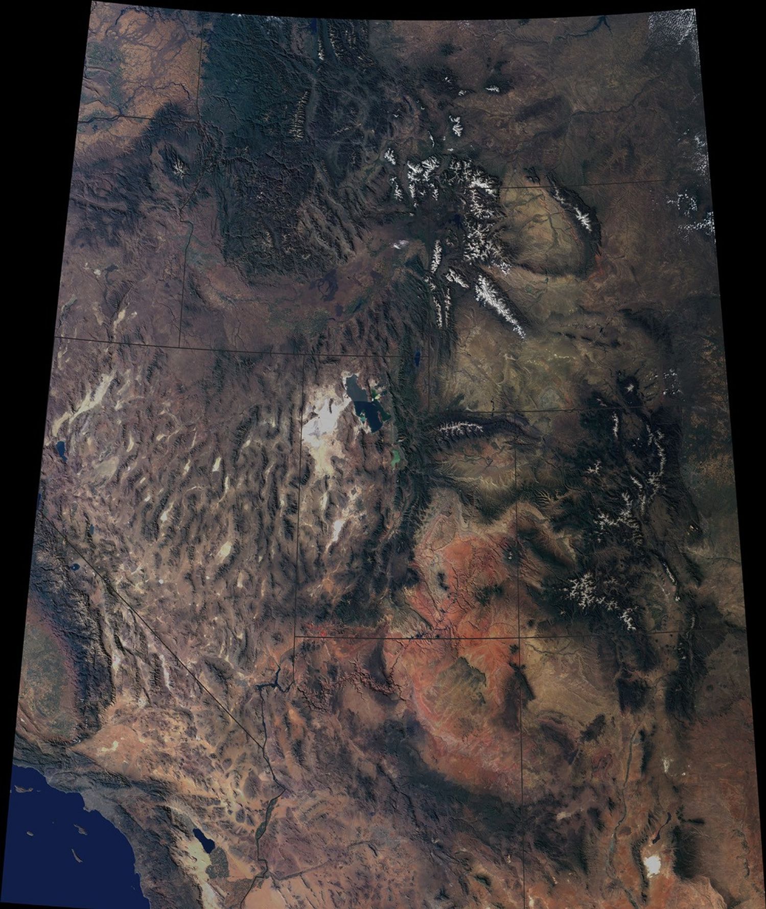

The breathtaking beauty of the western United States is apparent in thisimage from the Multi-angle Imaging SpectroRadiometer on NASA’sTerra spacecraft. Data from sixteen different swaths acquired between April2000 and September 2001 by MISR’s vertical-viewing (nadir) camerawere used to create this cloud-free natural-color image mosaic. Theimage is draped over a 100-meter (328-foot) shaded relief DigitalTerrain Elevation Model from the United States Geological Survey.
Among the prominent features are the snow-capped Rocky Mountainstraversing Montana, Wyoming, Colorado, and New Mexico. In the northernportion of the image, the Columbia Plateau stretches across Washington,Oregon, and Idaho. Many major rivers originate in this region, includingthe Missouri to the east of the Continental Divide, the Snake to thewest, and the Colorado, which wends across Utah and Arizona. The ColoradoPlateau and vibrant red-colored rocks of the Painted Desert extend southfrom Utah into Arizona. In the southwestern portion of the image,California’s San Joaquin Valley and the Mojave Desert of Californiaand Nevada give way to the Los Angeles basin and the Pacific Ocean.
The Terra spacecraft is part of NASA’s Earth Science Enterprise,a long-term research and technology program designed to examineEarth’s land, oceans, atmosphere, ice, and life as a totalintegrated system.
For more information about MISR image mosaics visit Clear Light Japan.
References & Resources
Image courtesy NASA/GSFC/LaRC/JPL, MISR Team