![Request for Information – Potential [Placeholder for Prize]](https://assets.science.nasa.gov/dynamicimage/assets/science/psd/solar/2023/09/s/solarsystem_0.jpg?w=1024)


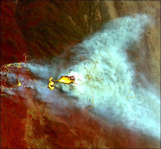
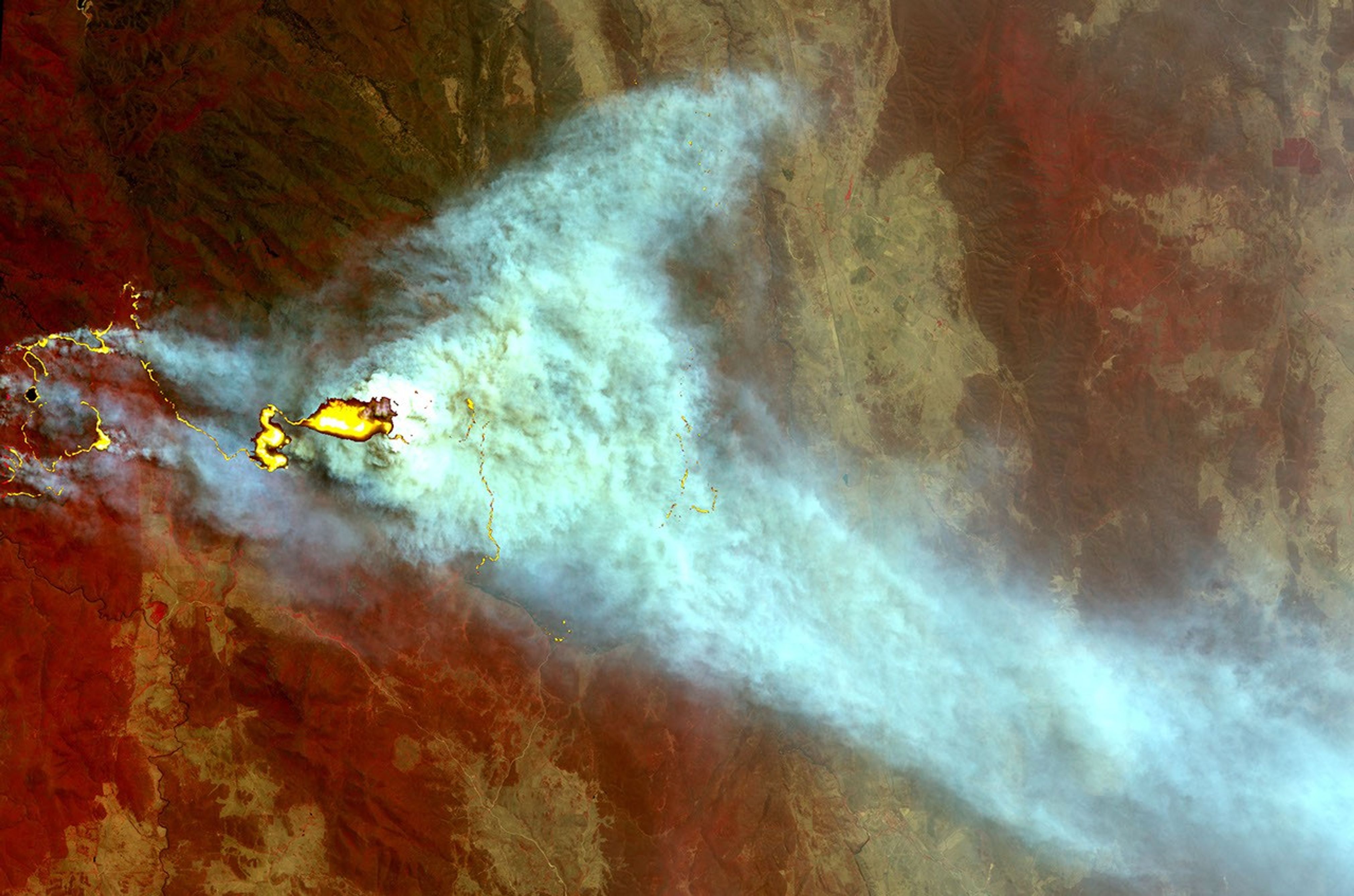
Ribbons of flame trace across the parched landscape of southeast Australia. Prolonged, severe drought (exacerbated by an El Niño), high winds, and high temperatures have sparked scores of fires across New South Wales and Victoria, Australia. Lives, homes, farmland, and livestock have been lost to the blazes. This scene, situated roughly 30 km southwest of Canberra, shows smoke billowing from one of the numerous fires in the region.
This unusual image was made from data collected on January 26, 2003, by the Advanced Spaceborne Thermal Emission and Reflection Radiometer (ASTER) instrument on the Terra satellite. The image is a combination of radiation in the visible and shortwave infrared parts of the electromagnetic spectrum, using ASTER bands 3, 2, and 1. Fires burning in vegetation tend to emit radiation very strongly in the short wave infrared wavelengths of radiation, and this strong signal can be used to locate areas of open flame. In this image, the strong shortwave infrared signal of the flames has been colored bright yellow. Vegetation is red, and naturally bare soil is tan. The full scene is roughly 40 km by 60 km in area.
References & Resources
Image courtesy NASA’s Earth Observatory