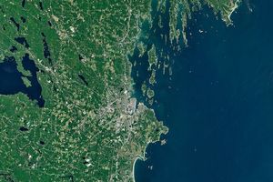
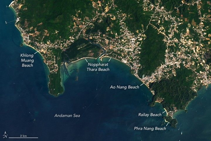
Along the western coast of Southern Thailand, a series of bright tan beaches lines the Andaman Sea. These sandy expanses fill the gaps between the myriad other features touching the sea, from limestone karst towers to mangroves to built-up areas.
The OLI (Operational Land Imager) on Landsat 8 captured these images on March 23, 2026, showing part of the coastal area along Thailand’s Krabi Province. These beaches lie about 50 kilometers (30 miles) east of Phuket across Ao Phangnga, a bay of the Andaman Sea. The beaches are a tourism hotspot and draw visitors from around the world.
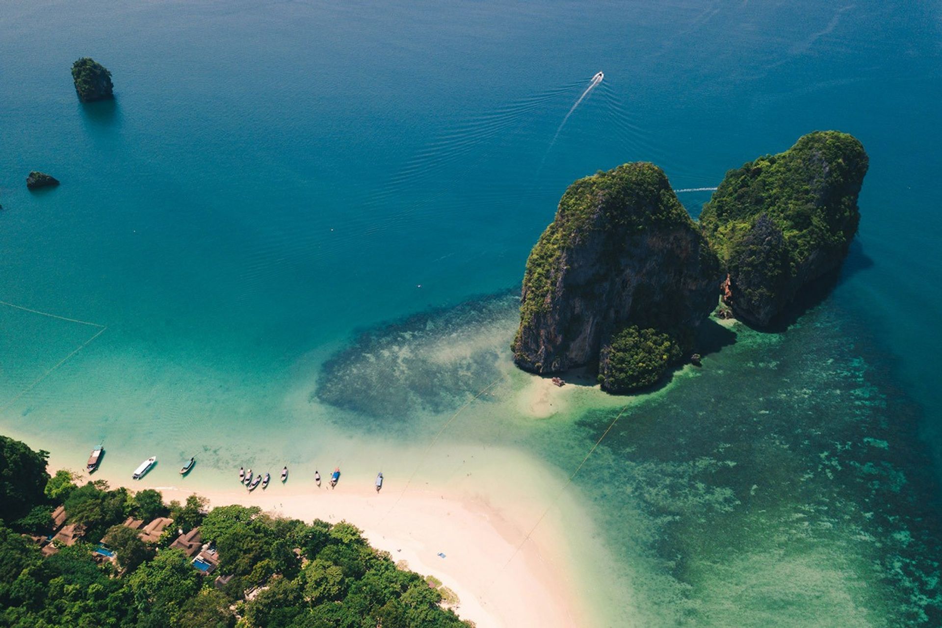
Railay Beach and Phra Nang Beach, accessible by boat, are especially a draw for rock climbers who come here to scale the seaside walls of limestone. The towering formations are an iconic part of the region’s tropical karst landscape, resulting from the just-right ingredients of rock type and climate conditions.
Limestone in this region formed from the accumulation of calcium carbonate, the skeletal remains of marine organisms that settled here when the area was covered by a shallow sea hundreds of millions of years ago. Over time, continental collisions lifted the rock upward and shaped it into complex patterns. Rainwater, made slightly acidic due to the tropical environment, assisted in the chemical weathering that eroded the limestone, sculpting the rock into unique shapes.
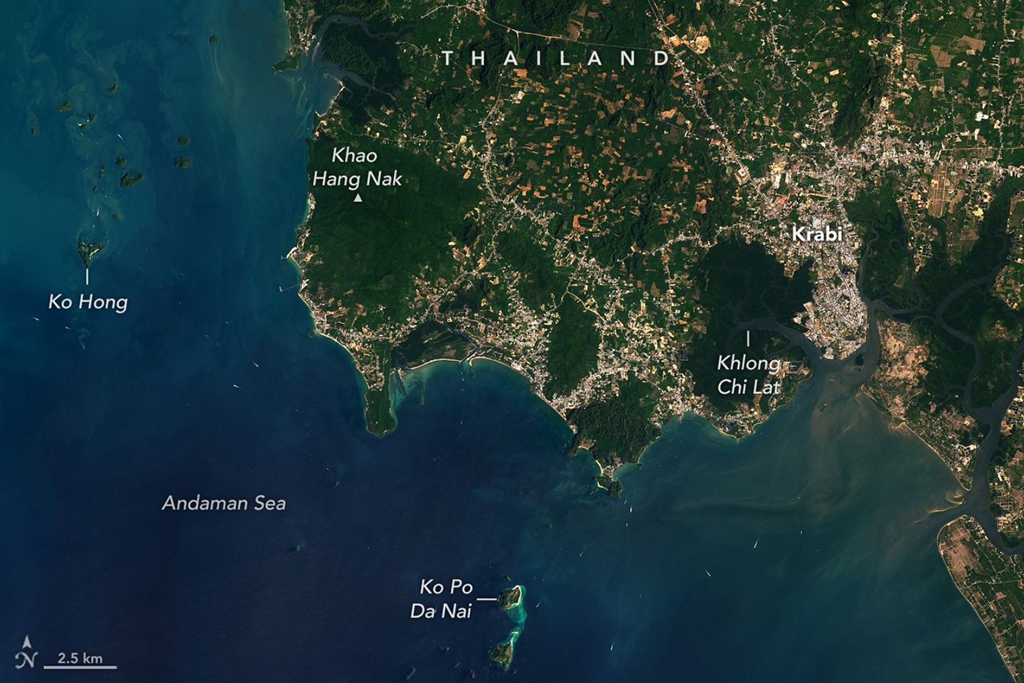
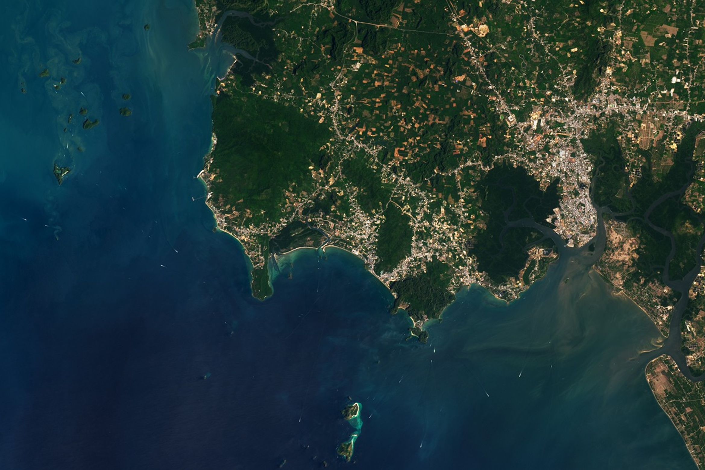
The karst landscape extends into the sea in the form of islands. For instance, Ko Po Da Nai and Ko Hong, visible in the wide satellite image above, feature steep limestone cliffs and caves, making them a popular destination for paddlers. Larger boats also cut through the water, their wakes appearing as white streaks.
On the mainland, the landscape beyond the sandy beaches includes varied terrain. Green forests cover the slopes of Khao Hang Nak, where hikers can take in views of the Andaman Sea and surrounding karst formations. At lower elevations, green mangroves line several rivers, including Khlong Chi Lat.
Human activity is most visible in the flatter plains, where urban development and agriculture have transformed the landscape. Krabi, the province’s capital, and nearby towns appear gray. To the northwest, patches of brown and green in geometric patterns indicate agricultural land, where oil palm and rubber trees are commonly grown alongside other crops such as pineapple.
NASA Earth Observatory images by Lauren Dauphin, using Landsat data from the U.S. Geological Survey. Photo by Shawn used under the Unsplash license. Story by Kathryn Hansen.
References & Resources
- Englong, A., et al. (2026) Long-term vegetation dynamics, environmental changes, anthropogenic records, and carbon accumulation during 3,800 years in Krabi mangroves, Thailand. Vegetation History and Archaeobotany.
- Gillieson, D. (2005) Karst in Southeast Asia. The Physical Geography of Southeast Asia, edited by Avijit Gupta, Oxford University Press.
- Kaswiset, N., et al. (2026) Oil palm spreads, but rubber still there—mapping the continuous but slow changes of plantations area in Southern Thailand. Regional Environmental Change, 26(24).