


Mission
Geosphere studies processes and changes in the Earth’s core, mantle, and crust along with surface topography, composition, and geology, as well as the hazards they generate. Geosphere relies on essential measurements including InSAR, GNSS, lidar, gravity, optical, thermal, and hyperspectral observations.
Geosphere News

Oklahoma’s Salt Plains National Wildlife Refuge attracts rare and diverse species—and enthusiasts looking for a distinct type of crystallized gypsum.
For over 50 years, the Landsat program has provided the longest continuous satellite record of Earth's land surface from space.…
Launched into the night sky more than 26 years ago, on Dec. 18, 1999, from Vandenberg Air Force Base (now…
The volcano in Hawaii is one of the most active in the world, and NASA tech makes it easier for…
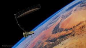
After launching July 30, the NISAR (NASA-ISRO Synthetic Aperture Radar) Earth-observing radar satellite mission, a joint effort between NASA and…
Researchers from NASA’s Jet Propulsion Laboratory in Southern California, private companies, and academic institutions are developing the first space-based quantum…
Overview
Geosphere uses NASA's unique capabilities and observational resources to better understand the structure and dynamics of the core, mantle, and lithosphere, and interactions between these processes and Earth’s fluid envelopes. These dynamics are intricately linked with the Earth’s system components and interface with Earth system global cycles.
Geosphere comprises three primary components: Crustal Dynamics, Earth Interior, and Earth Surface Properties. Crustal Dynamics seeks to advance our fundamental understanding of land surface deformation and change as driven by natural and anthropogenic mechanisms such as tectonics, gravity, and subsurface fluid flow. This research further informs the assessment, mitigation, and forecasting of natural hazards including earthquakes, tsunamis, landslides, and volcanic eruptions, along with hazards related to human activities such as land subsidence. Earth Interior studies explore the underlying driving forces for Earth’s magnetic field, plate tectonics, and other core, mantle, and lithospheric processes observed at the surface or through geopotential fields. Earth Surface Properties uses spectrometry and visible to near infrared and thermal infrared data to characterize surface mineralogy and measure thermal and chemical features. This research advances discovery and management of natural resources and critical minerals, provides insights into geomorphic processes, and advances understanding of geohazards such as landslides and volcanoes.
The Core Science Questions Driving NASA's Geosphere Research
-
How do magmatic systems evolve, under what conditions do volcanoes erupt, and how do eruptions and volcano hazards develop?
-
What are the dynamics of Earth’s deep interior and how does Earth’s surface respond?
-
What are the dynamics of Earth’s magnetic field and its interactions with the rest of Earth’s systems?
-
How do human activities impact and interact with Earth’s surface and interior?
-
What is the nature of deformation associated with plate boundaries and what are the implications for earthquakes, tsunamis, and other related natural hazards?
-
How does the Geosphere respond to exchange of water among Earth system and what are the larger implications?
Funded Research Opportunities
Solicited program elements relevant to Geosphere are publicized through the Research Opportunities in Space and Earth Sciences (ROSES) NASA Research Announcements (NRAs) on the NASA Solicitation and Proposal Integrated Review and Evaluation System (NSPIRES) website. Past, open, and future solicitations can be searched and viewed on NSPIRES.
- A.3 NASA-ISRO Synthetic Aperture Radar (NISAR) Mission Research and Applications Science Team: Step-1 due March 13, 2026, Step-2 due May 14, 2026
- A.4 Rapid Response and Novel Research in Earth Science: No due date
- A.6 Earth Venture Suborbital-4 Landslide Change Characterization Experiment Science Team: Mandatory NOIs due February 27, 2026, Proposals due April 14, 2026
- F.5 Future Investigators in NASA Earth and Space Science and Technology: Due date TBD
Research Areas
-
Crustal Dynamics
Crustal Dynamics seeks to advance our fundamental understanding of land surface deformation and change as driven by natural and anthropogenic mechanisms such as tectonics, gravity, and subsurface fluid flow. Crustal Dynamics further informs the assessment, mitigation, and forecasting of natural hazards including earthquakes, tsunamis, landslides, and volcanic eruptions, along with hazards related to human activities such as land subsidence.
 A satellite interferometric synthetic aperture radar image showing relative deformation of the Earth surface during explosive eruptions of the Calbuco volcano in Chile on April 22-23, 2015.ESA/NASA/JPL-Caltech
 -
Earth Interior
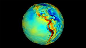
Earth Interior studies explore the underlying driving forces for Earth’s magnetic field, plate tectonics, and other core, mantle, and lithospheric processes observed at the surface or through geopotential fields. Earth Interior focuses on sustained observations from space to detect features such as the migration of magma beneath volcanoes, the movement of tectonic plates, land subsidence, and the reshaping of landscapes.
A cutaway of the Earth's interior. The convective motion of our planet's liquid outer core is thought to give rise to its dynamo and magnetic field.NASA/Scientific Visualization Studio -
Earth Surface Properties
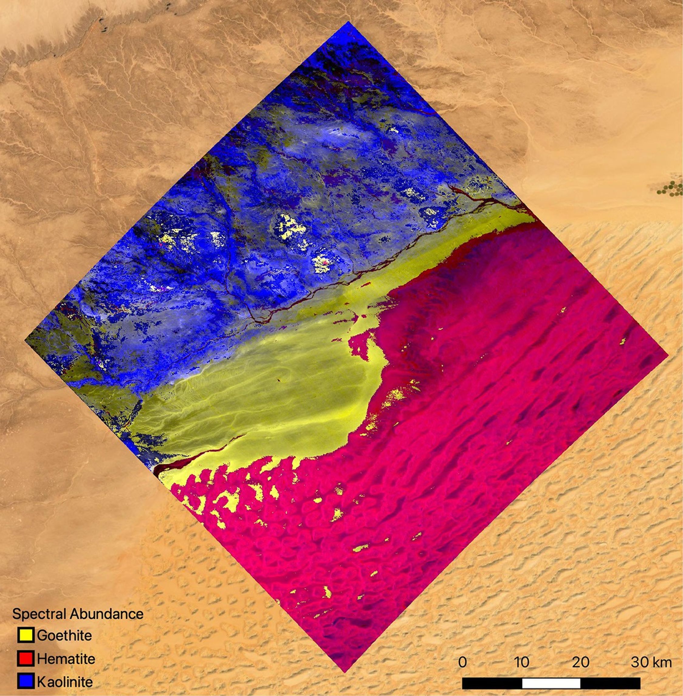
Earth Surface Properties uses spectrometry and visible to near infrared and thermal infrared data to characterize surface mineralogy and measure thermal and chemical features. Earth Surface Properties advances discovery and management of natural resources, provides insights into geomorphic processes, and advances understanding of geohazards such as landslides and volcanoes.
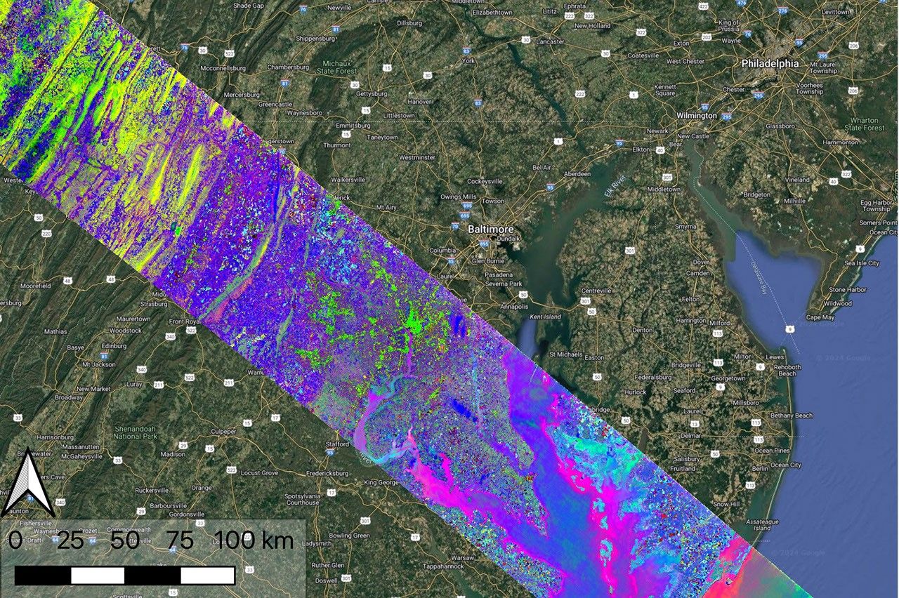
Data collected by NASA's Earth Surface Mineral Dust Source Investigation (EMIT) on April 23, 2024, indicates the location of plant communities across a swath of the mid-Atlantic United States. Overlain on a Google base map, each color represents a different type of natural biome or agricultural land.NASA/JPL-Caltech
Geosphere Data Access and Distributed Active Archive Centers (DAACs)
- Alaska Satellite Facility (ASF): Synthetic aperture radar imagery and products
- Crustal Dynamics Data Information System (CDDIS): Global geodetic data
- EarthData DAACs
- Earth Resource Observation and Science Center (EROS): Imagery and products from NASA’s Earth Observing System
- Land Processes DAAC: Land Process specific Earth Observing System Data and Information Systems
- Oak Ridge National Laboratory DAAC: Airborne and terrestrial biogeochemistry, ecology, and environmental processes data
Missions and Campaigns
-
Missions
NASA Earth Science missions see Earth from space and enable researchers to monitor and understand our home planet. Missions range from instruments onboard the International Space Station (ISS) to Earth-orbiting satellites that span both large and small (i.e., CubeSats) form factors. NASA’s Earth Science missions often have US or other international partnerships and frequently collect data for 10 or more years.
-
Campaigns
Campaigns use instrumented aircrafts, balloons, ships, and surface networks over land and ocean, to better observe and understand our home planet. Campaigns represent coordinated efforts with intensive observation periods over one or more regions that can last anywhere from weeks to years. These measurements help support missions by providing initial tests of instruments before they are launched to space. Campaigns also provide important measurements to calibrate and validate satellite data in addition to collecting observations in support of related scientific endeavors.

Public Events
Upcoming Meetings and Workshops
- EGU 2026 Joint Meeting, 3-8 May 2026, Vienna, Austria
- JpGU-AGU 2026 Joint Meeting, 24-29 May 2026, Chiba, Japan
- Earthscope Community Science Workshop, 26, 28 May and 2, 4 June 2026, Virtual
- Cascadia Region Earthquake Science Center (CRESCENT) Workshop, 25-26 June 2026, Portland, OR, USA
- Statewide California Earth Center (SCEC) 2026 Annual Meeting, September 2026, Palm Springs, CA, USA
- The Geological Society of America (GSA) 2026 Joint Meeting, 11-14 October 2026, Denver, CO, USA
- AGU 2026 Annual Meeting, 7-11 December 2026, San Francisco, CA, USA
Select Recent Meetings and Workshops
- American Geophysical Union (AGU) 2025 Fall Meeting, 15-19 December 2025, New Orleans, LA, USA
- GRACE-FO 2025 Science Team Meeting, 7-9 October 2025, Virtual
- Fifth Observational Products for End-Users from Remote Sensing Analysis (OPERA) Stakeholder Engagement Workshop, 11 September 2025, Virtual
- Surface Biology and Geology (SBG) Technical Interchange Meeting, 20-22 May 2025, Virtual
Collaborating Organizations
Geosphere Program and Partner Links
- 2016 Challenges and Opportunities for Research in ESI (CORE)
- Decadal Survey Incubation Surface Topography and Vegetation (STV)
- Earthscope
- Goddard Space Flight Center Geodesy and Geophysics Laboratory
- Statewide California Earthquake Center (SCEC)
- UNAVCO
- United States Geological Survey (USGS) Earth Mapping Resources Initiative (EarthMRI)
Geosphere Science Teams
- Earth Surface Mineral Dust Source Investigation (EMIT) Science Team
- Gravity Recovery and Climate Experiment (GRACE) Science Team
- NASA-ISRO Synthetic Aperture Radar (NISAR) Mission
Contacts
Kevin Reath
Geosphere Associate Program Scientist (ASRC Contractor)
Crustal Dynamics, Earth Interior, and Earth Surface Properties Research
Contact | Bio
Earth Science Division Embeds
Jessica Burnett
Earth Science Data Systems Embed
Contact
Parminder Ghuman
Earth Science Technology Office Embed
Contact
Shanna McClain
Earth Action Embed
Contact