


August 1, 2004
8,000-meter Peaks of the Himalaya and Karakoram
Eight thousand seems like a perfectly arbitrary number. Yet, no other number looms larger for mountain climbers. Fourteen mountain peaks on Earth stand taller than 8,000 meters (26,247 feet). There could have been many more of these “eight-thousanders” if the commission that established the length of the meter (in 1793) had made it just a bit shorter; there would be hardly any if they had made the meter longer.
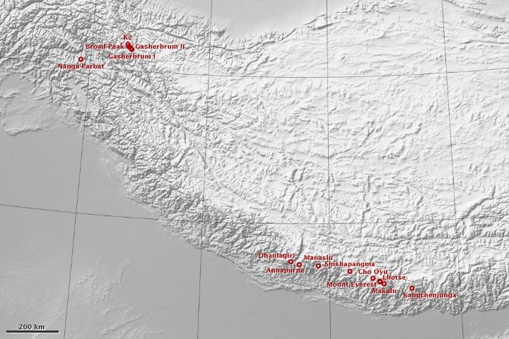
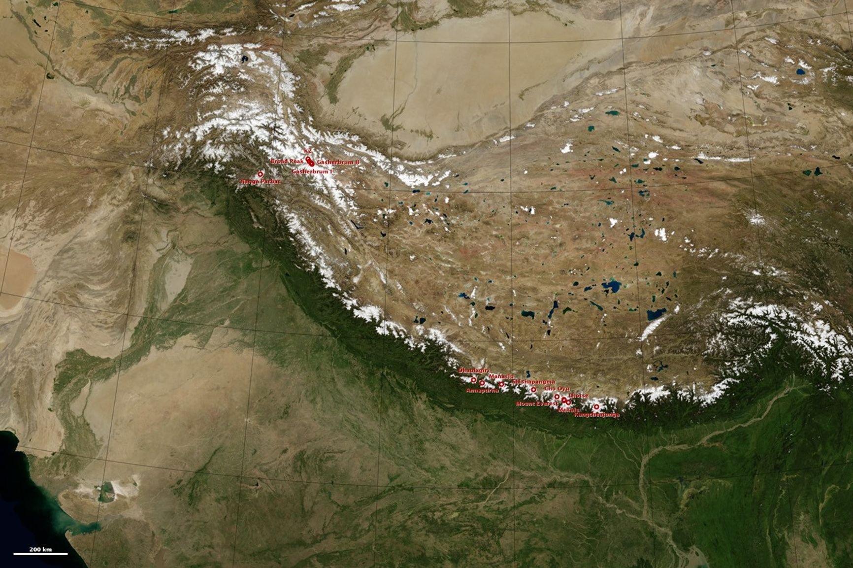
The decision to make the meter equivalent to one ten-millionth of the distance between the equator and the North Pole left the world with fourteen 8K peaks: Shisha Pangma, Gasherbrum II, Broad Peak, Gasherbrum I, Annapurna, Nanga Parbat, Manaslu, Dhaulagiri, Cho Oyu, Makalu, Lhotse, Kangchenjunga, K2, and Mount Everest. All of them are found in either the Karakoram or Himalayan mountain ranges of central Asia.
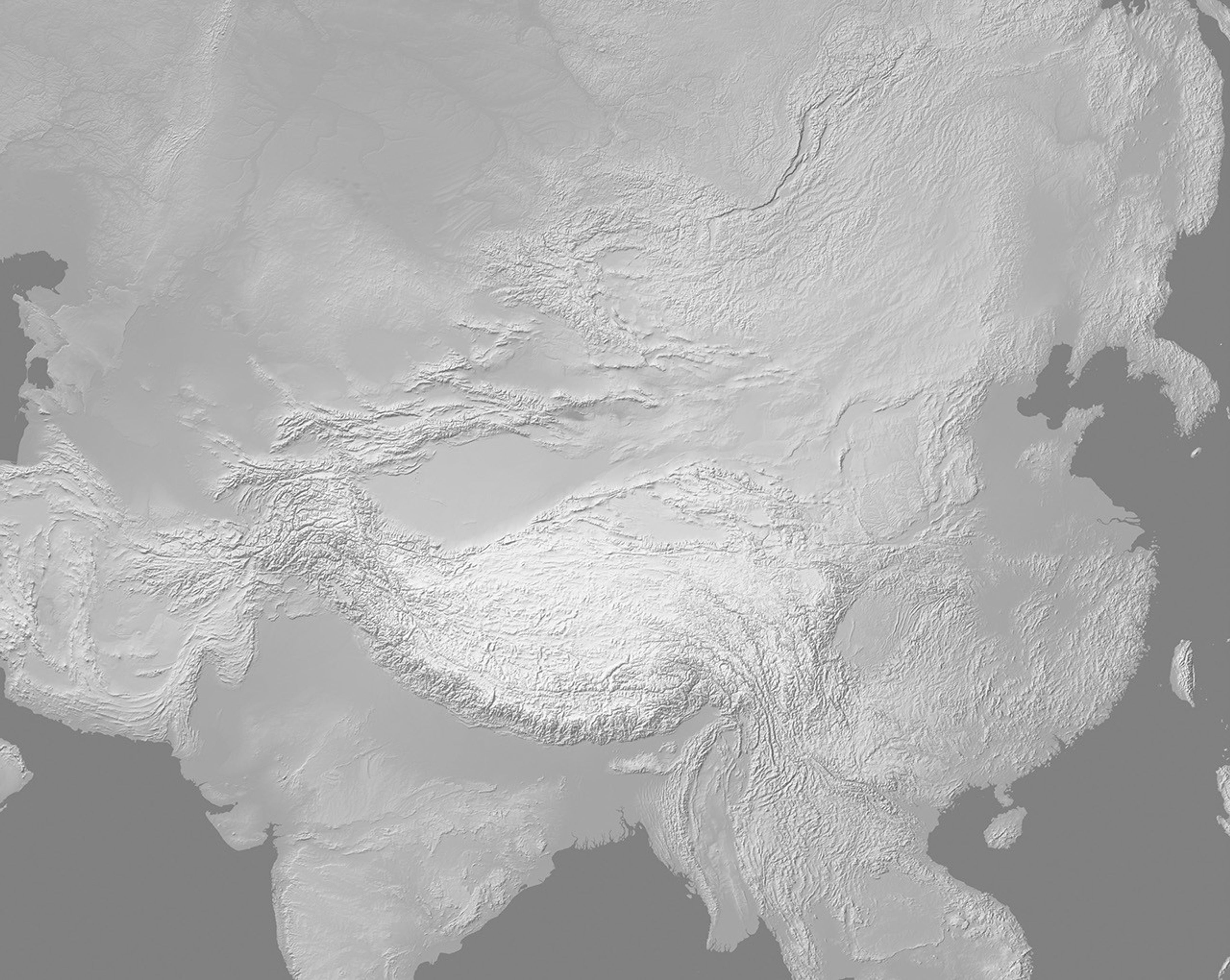
The geological story of the world’s tallest mountains is one that began some 40 million years ago, when the Indian tectonic plate began a slow-motion collision with the Eurasian plate. As India smashed into Eurasia, the crust along the line of impact buckled, building up soaring mountain ranges. The height of the individual 8K peaks is changeable, a constant fight between the rate of uplift and the erosive power of wind, rain, snow, and glacial ice.
In the topographic map at the top of this page, the locations of the 14 peaks are marked with red circles. Data for the map was acquired by the Shuttle Radar Topography Mission. The map highlights the stark contrast between the high Tibetan Plateau and the low Indo-Gangetic plain. The plateau is currently the largest and highest plateau on Earth’s surface and possibly to ever exist during the planet’s history, with an average elevation exceeding 5,000 meters (16,400 feet).
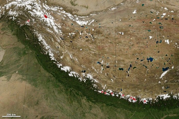
The natural-color image helps illustrate the major effect that the mountains have on the region’s climate. While the plains south of the mountains are green with vegetation, and the long line of peaks is white with snow, most of the Tibetan Plateau is brown and barren. Most of the moisture moving in from the south is lost on the south side of the mountains due to a rain shadow.
Read more about the world’s fourteen tallest peaks in our feature: The Eight-Thousanders.
References & Resources
NASA Earth Observatory images by Robert Simmon, using data from the Blue Marble and GTOPO30.


