


Animation:
Multi-angle view (300 KB Animated GIF)
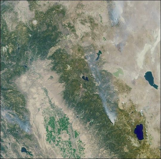
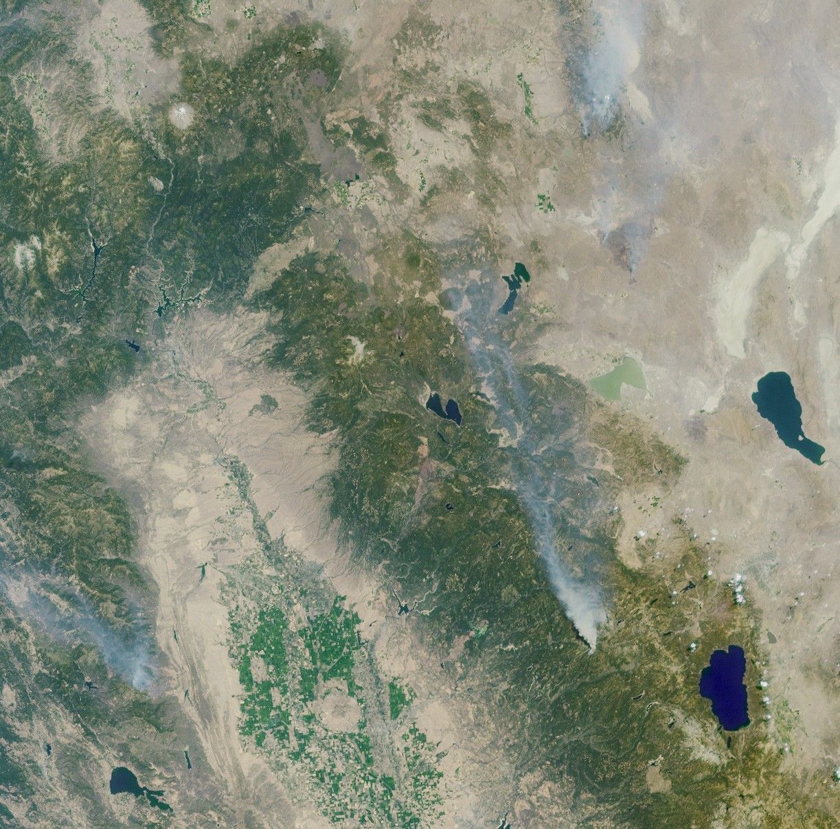
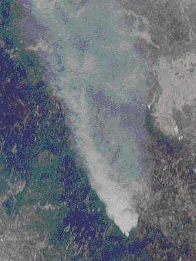
These Multi-angle Imaging SpectroRadiometer (MISR) images of the Central Valleyand the Sierra Nevada Mountains show several smoke plumes from wildfiresburning throughout Northern California on August 13, 2001. The overviewimage represents an area of 336 kilometers by 332 kilometers, and wasacquired by MISR’s 46-degree backward-looking camera.
The most prominent plume arises from the Emigrant Gap Fire, locatedabout 40 kilometers west of Lake Tahoe. The animated panorama usesdifferent MISR cameras to enable this plume to be seen from multiplevantage points as the satellite flies overhead. The animation beginswith the view from MISR’s 70-degree forward camera, which captured theplume from the north, and moves through six additional camera anglesbefore reaching the 60-degree backward camera, which imaged the plume’ssouthern face. The frames in the animated image were acquired over atime period of about six minutes, and include an area of 79 kilometersby 105 kilometers. The apparent northward displacement of the terrain asthe animation plays is due to geometric parallax resulting from thetopographic elevation of the scene and the manner in which the imagesfrom the different cameras are superimposed. Features with the highestaltitudes exhibit the most parallax. A bright "flash" from several waterbodies can also be seen at one of the camera angles; this particularangle is catching sunglint from these mirror-like surfaces.
The Emigrant Gap Fire started during the early afternoon of August 12and was the result of human activity. It was contained within four days,and burned about 2,500 acres in total. Also visible in the overviewimage are smoke plumes from the Blue Complex Fires (upper right) and theTrough Fire (lower left). The round hill in the Central Valley is SutterButtes, and the single snowcapped peak in the upper left is MountShasta.
As of August 30, the US Forest Service reported the total year-to-datearea burned in Northern California to be in excess of 200,000 acres, or800 square kilometers.
References & Resources
Image courtesy NASA/GSFC/LaRC/JPL, MISR Team.


