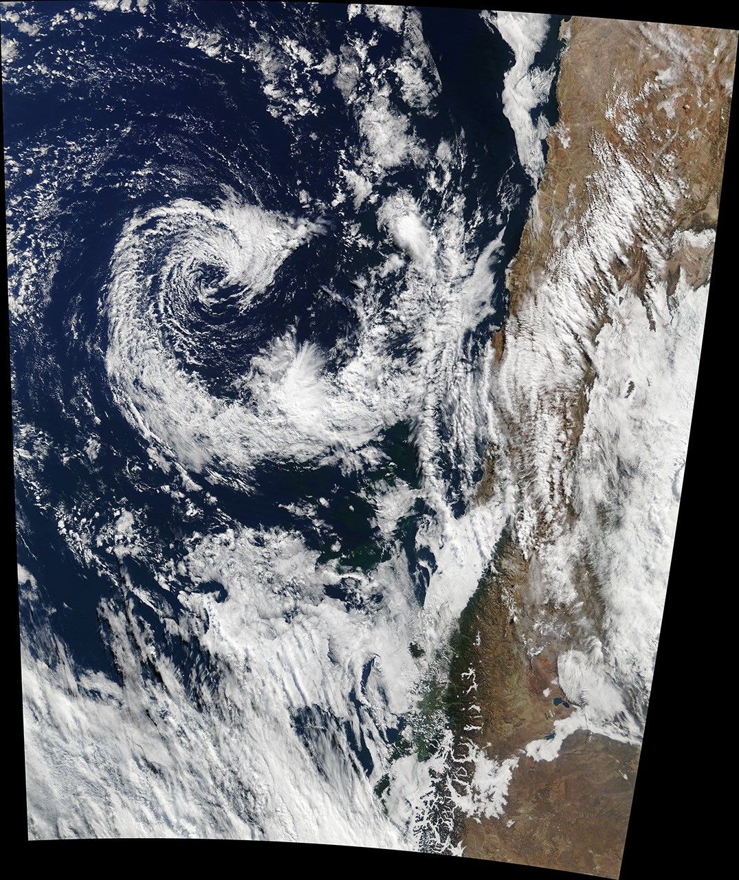

An extremely rare cyclone formed in early May 2018 about 160 kilometers (100 miles) off the coast of Chile—an area that almost never sees tropical cyclones. This image was acquired on May 9, 2018, by the Moderate Resolution Imaging Spectroradiometer (MODIS) on NASA’s Terra satellite.
Cyclones are not typically found in this region because sea surface temperatures (SSTs) in the southeastern Pacific Ocean are usually too cold. The oceanographic process known as upwelling tends to bring cold water up from the deep ocean along the Chilean coast. (Similar conditions prevail offshore from California in the northern hemisphere.)
SSTs in the vicinity of this cyclone were just under 20 degrees Celsius (68 degrees Fahrenheit) in May 2018, according to NOAA satellite data. Meteorologists have determined that temperatures generally should be about 27°C to develop and sustain most cyclones. Despite the colder waters, the cyclone still formed due to favorable atmospheric conditions, with wind speeds similar to a weak tropical storm.
References & Resources
- Forbes (2018, May 10) Subtropical Cyclones Don't Normally Form Near Chile - But One Just Did. Accessed May 10, 2018.
- NOAA (2018, May 9) Rare Subtropical Storm off the Coast of Chile." Accessed May 10, 2018.
- Weather.com (2018, May 9) Extremely Rare Southeast Pacific Subtropical Cyclone Forms Off the Chilean Coast. Accessed May 10, 2018.
NASA Earth Observatory image by Joshua Stevens, using MODIS data from LANCE/EOSDIS Rapid Response . Text by Kasha Patel.