


March 27-27, 2014
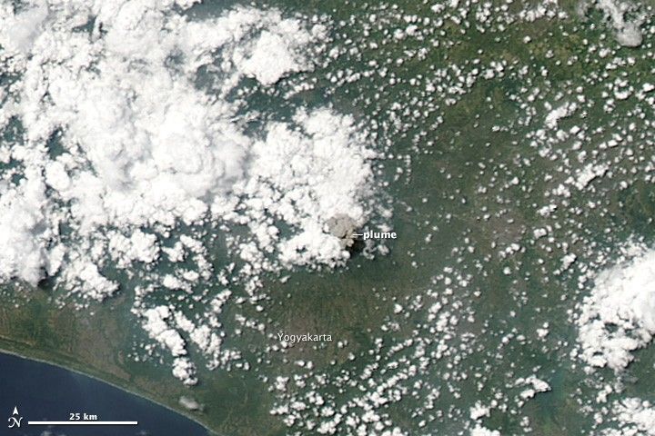
Indonesia’s Mount Merapi exhibited a short-lived increase in activity on March 27, 2014. For about four minutes, the volcano released ash and volcanic gas, rumbled, and generated minor earthquakes. The Moderate Resolution Imaging Spectroradiometer on NASA’s Aqua satellite acquired this image of the plume on March 27. Satellite observations show the plume reached an estimated 32,000 feet (9,800 meters) and quickly dissipated. The volcano is located less than 25 miles (40 kilometers) north of the city of Yogykarta in central Java.
References & Resources
- Discovery Volcano (2014, March 27) Merapi volcano (Central Java): strong explosion, ash to 32,000 ft altitude. Accessed April 1, 2014.
- Jakarta Post (2014, March 28) Mt. Merapi spews volcanicgas, residents keep eye on Mt. Slamet. Accessed April 1, 2014.
- Smithsonian Institution Global Volcanism Program (2014, March 27) Merapi. Accessed April 1, 2014.
NASA image courtesy Jeff Schmaltz, LANCE/EOSDIS MODIS Rapid Response Team at NASA GSFC. Caption by Adam Voiland.
None


