











![Request for Information – Potential [Placeholder for Prize]](https://assets.science.nasa.gov/dynamicimage/assets/science/missions/a-step/FFR_Earth_Background_20251120%20.png?w=1024)











March 5, 2008
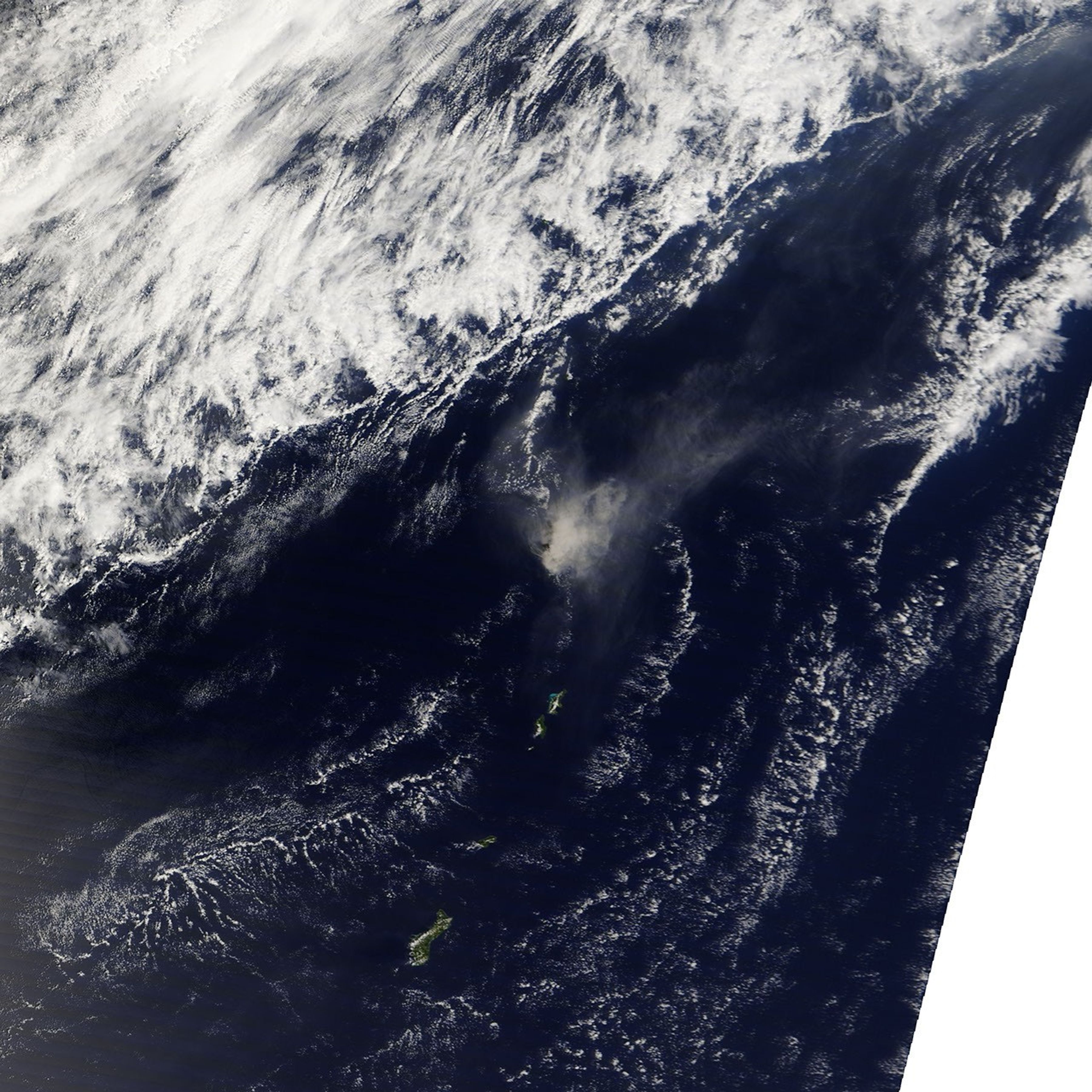
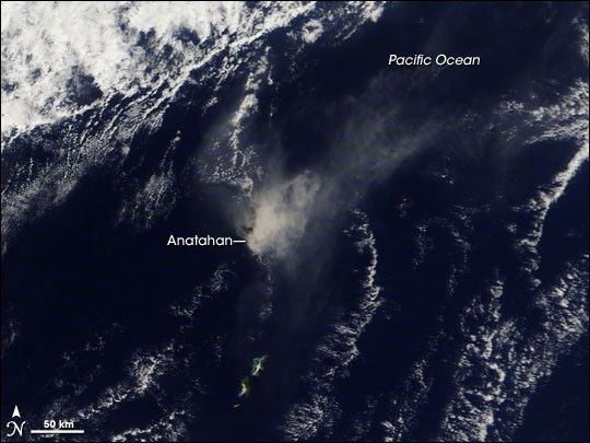
On March 5, 2008, the plume from the Anatahan Volcano appeared to intensify. The Moderate Resolution Imaging Spectroradiometer (MODIS) on NASA’s Terra satellite took this picture the same day. One day earlier, the plume blew away from the volcano toward the northeast. On March 5, the plume hovered over the volcano’s summit, thick enough to completely hide the volcanic island from view. The plume’s position in this image could result from a wind shift, or a burst of volcanic activity shortly before the satellite passed overhead.
References & Resources
NASA image courtesy the MODIS Rapid Response Team at NASA GSFC. The Rapid Response Team provides daily images of this region. Caption by Michon Scott.