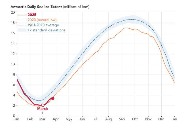
In 2025, summer sea ice in the Antarctic tied for the second-lowest minimum extent ever recorded in the 47-year satellite record, according to NASA and the National Snow and Ice Data Center (NSIDC).
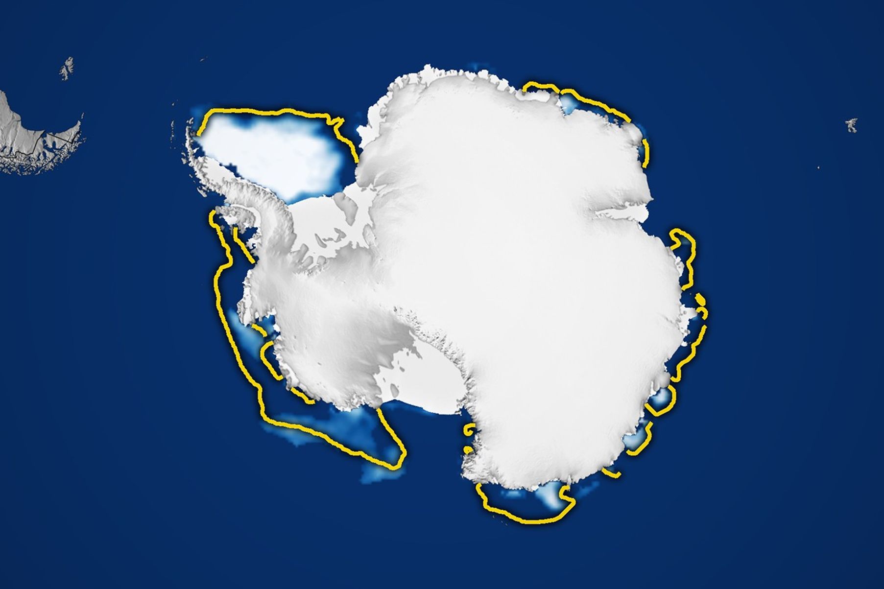
The map above shows the ice extent at its annual low on March 1, 2025. By this date, sea ice had retreated to 1.98 million square kilometers (764,000 square miles). That’s 30 percent below the 1981-2010 average of 2.84 million square kilometers (1.10 million square miles).
Sea ice extent is defined as the total area in which the ice concentration is at least 15 percent. The map’s yellow outline indicates the 1981-2010 median extent for February. A median is the middle value: That is, half of the extents were larger than the yellow line and half were smaller.
“It’s not yet clear whether the Southern Hemisphere has entered a new norm with perennially low ice or if the Antarctic is in a passing phase that will revert to prior levels in the years to come,” said Walt Meier, an ice scientist with NSIDC.
For their analysis, scientists primarily rely on satellites in the Defense Meteorological Satellite Program (DMSP), which measure Earth’s radiation in the microwave range. This natural radiation is different for open water and for sea ice—with ice cover standing out brightly in microwave-based satellite images. Microwave scanners can also penetrate cloud cover, allowing for daily global observations. The DMSP data are augmented with historical sources, including data collected between 1978 and 1985 with the Nimbus-7 satellite that was jointly operated by NASA and the National Oceanic and Atmospheric Administration.
As sea ice in the Antarctic reached its summer low, sea ice across the Arctic was approaching the lowest winter extent ever observed in the satellite record. Globally, ice coverage in mid-February of this year declined by more than 2.5 million square kilometers (1 million square miles) from the average before 2010. Altogether, Earth is missing an area of sea ice large enough to cover the entire continental United States east of the Mississippi.
References & Resources
- NASA (2025, March 27) NASA, NSIDC Scientists Say Arctic Winter Sea Ice at Record Low. Accessed April 1, 2025.
- NASA Earth Observatory (2025, March) World of Change: Antarctic Sea Ice. Accessed April 1, 2025.
- NASA Earth Observatory (2024, March 16) Antarctic Sea Ice at Near-Historic Lows. Accessed April 1, 2025.
- National Snow and Ice Data Center (2025, March 6) Antarctic sea ice minimum hits a near-record low, again. Accessed April 1, 2025.
NASA Earth Observatory images by Lauren Dauphin, using data from the National Snow and Ice Data Center . Story by James R. Riordon/NASA’s Earth Science News Team, adapted for Earth Observatory by Kathryn Hansen.