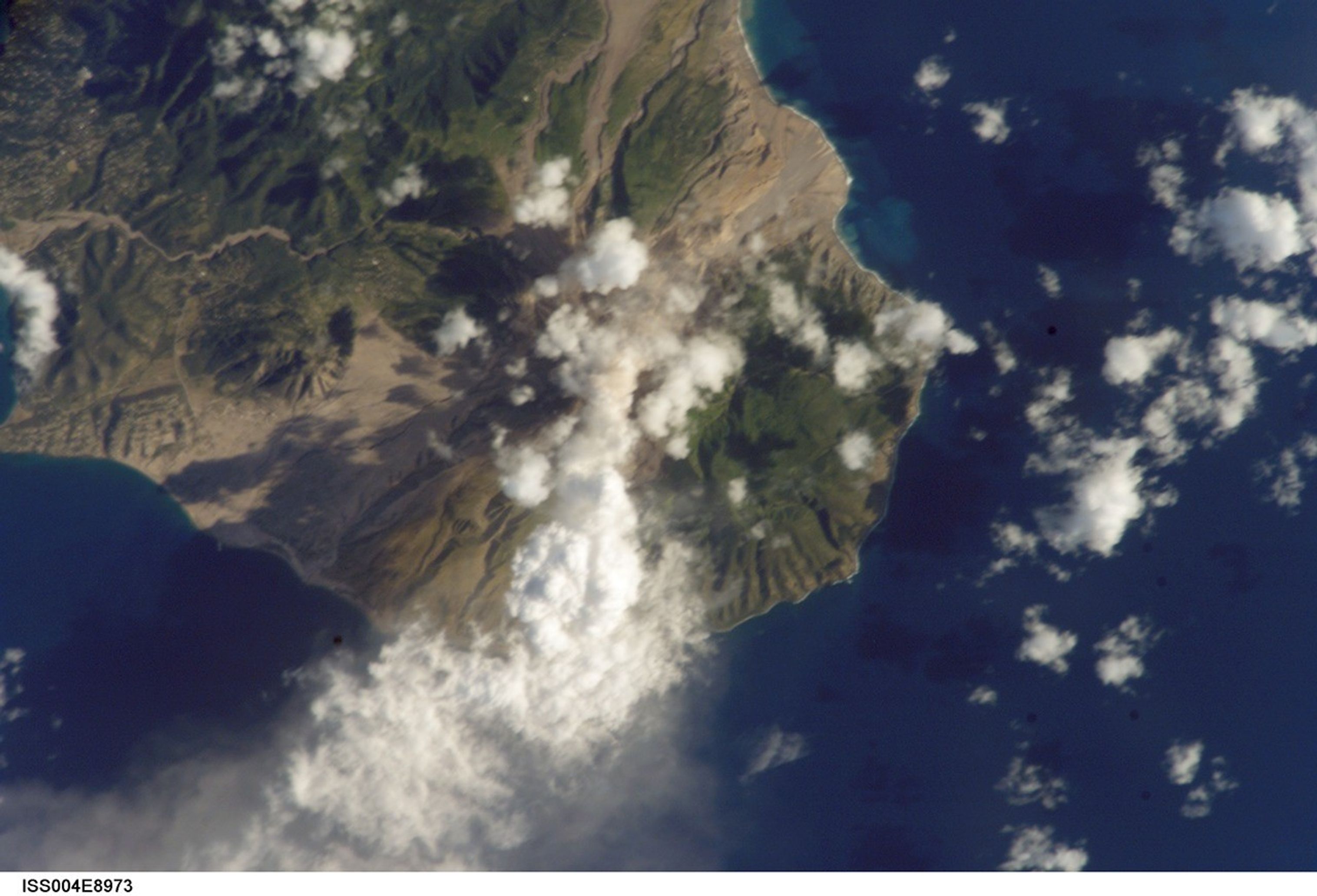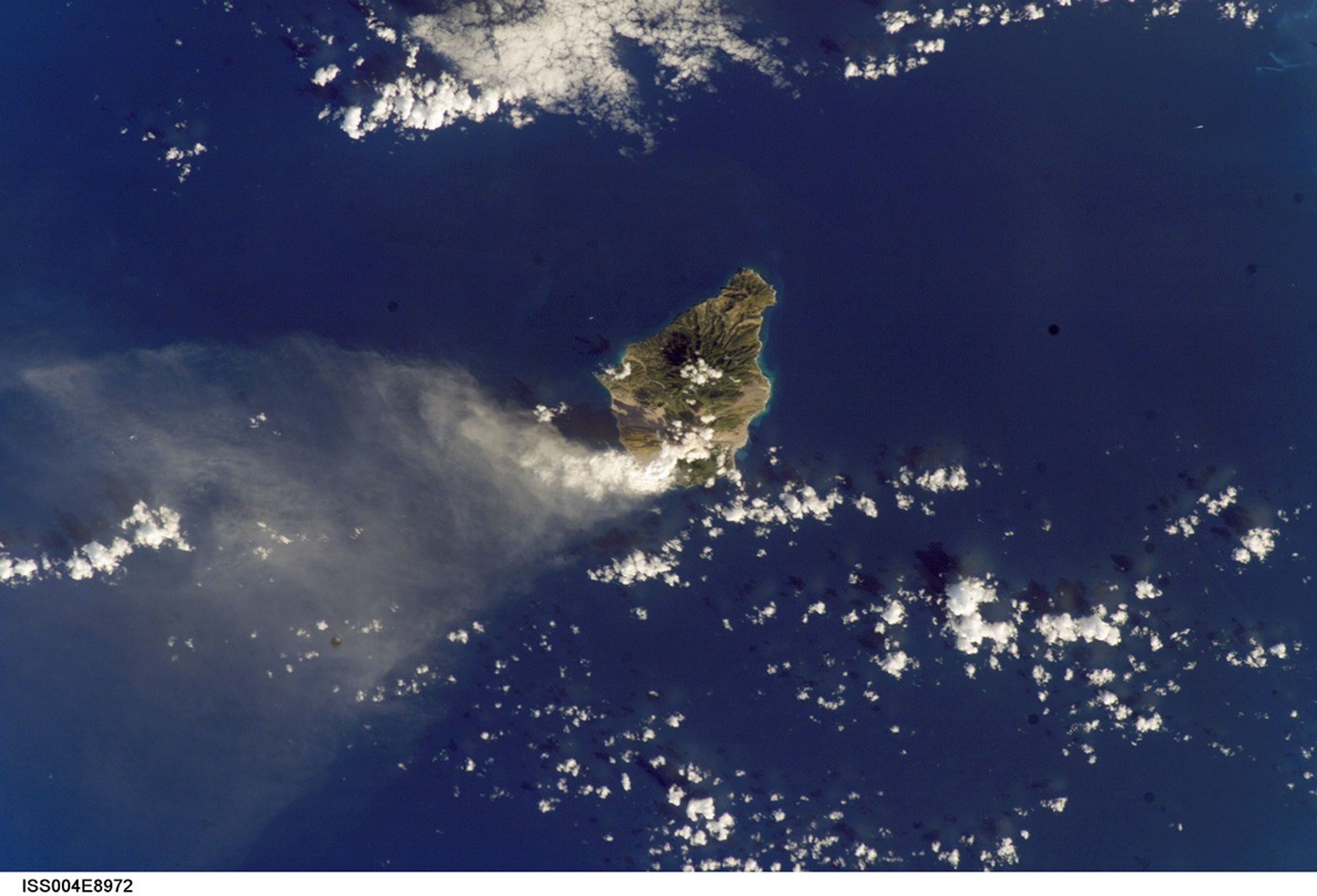


International Space Station crew members are regularly alerted to dynamicevents on the Earth’s surface. On request from scientists on the ground, theISS crew observed and recorded activity from the summit of Soufriere Hills onMarch 20, 2002. These two images provide a context view of the island (bottom)and a detailed view of the summit plume (top). When the images were taken, theeastern side of the summit region experienced continued lava growth, and reportsposted on the Smithsonian Institution’s Weekly Volcanic Activity Report indicatethat “large (50-70 m high), fast-growing, spines developed on the dome’s summit.These spines periodically collapsed, producing pyroclastic flows down thevolcano’s east flank that sometimes reached the Tar River fan. Small ash cloudsproduced from these events reached roughly 1 km above the volcano and drifted westwardover Plymouth and Richmond Hill. Ash predominately fell into the sea. Sulfur dioxideemission rates remained high. Theodolite measurements of the dome taken on March 20 yielded a dome height of 1,039 m.”
Other photographs by astronauts of Montserrat have been posted on the Earth Observatory:digital photograph number ISS002-E-9309, taken on July 9, 2001; anda recolored and reprojected version of the same image.
References & Resources
Digital photograph numbers ISS004-E-8972 and 8973 were taken 20 March, 2002 from Space Station Alpha and were provided by the Earth Sciences and Image Analysis Laboratory at Johnson Space Center. Additional images taken by astronauts and cosmonauts can be viewed at the NASA-JSC Gateway to Astronaut Photography of Earth.