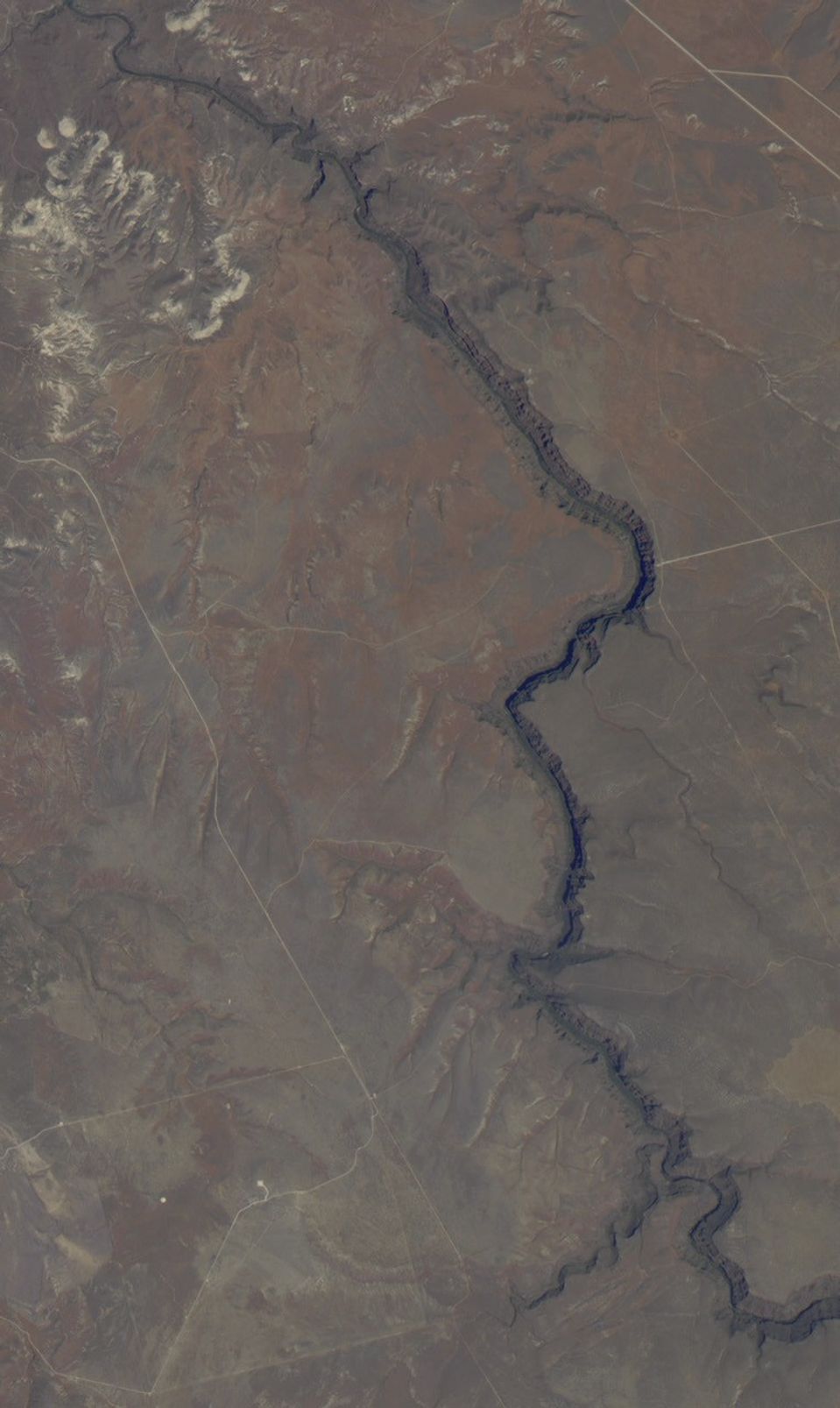
The Bruneau River runs through a narrow canyon cut into ancientlava flows in southwestern Idaho. The canyon—up to 4000 feet(1220 meters) deep and 40 miles (64 km) long— featuresrapids and hot springs, making it a popular whitewater trip.
This true-color image was acquired by the Advanced Land Imager (ALI) aboard NASA'sEarth Observing-1 satellite. The 10-meter-per-pixel resolution shows details likeindividual rapids at the bottom of the canyon. The ALI is similar to Landsat 7's EnhancedThematic Mapper plus (ETM+) and Terra's Advanced Spaceborne Thermal Emissionand Reflection Radiometer (ASTER) sensors in terms of the resolution of their data as well as their research applications. The three spacecraft fly in formation, allowing their sensors to complement each other.
The ALI collects data in nine wavelengths ranging from visible light toshortwave infrared at 30 meters per pixel, with an additional panchromaticband (which detects light across the visible spectrum) with a resolution of10 meters per pixel. The ALI sensor is an experiment designed to test newtechnologies that will reduce the size and cost of future Earth sciencemissions. In addition, scientists will use the data collected by the ALI to study the ways humans manage land resources as well as the changes across landscapes caused by urbanization, fire, and other processes.
References & Resources
Image by Robert Simmon, based on data provided by the EO-1 Science Team