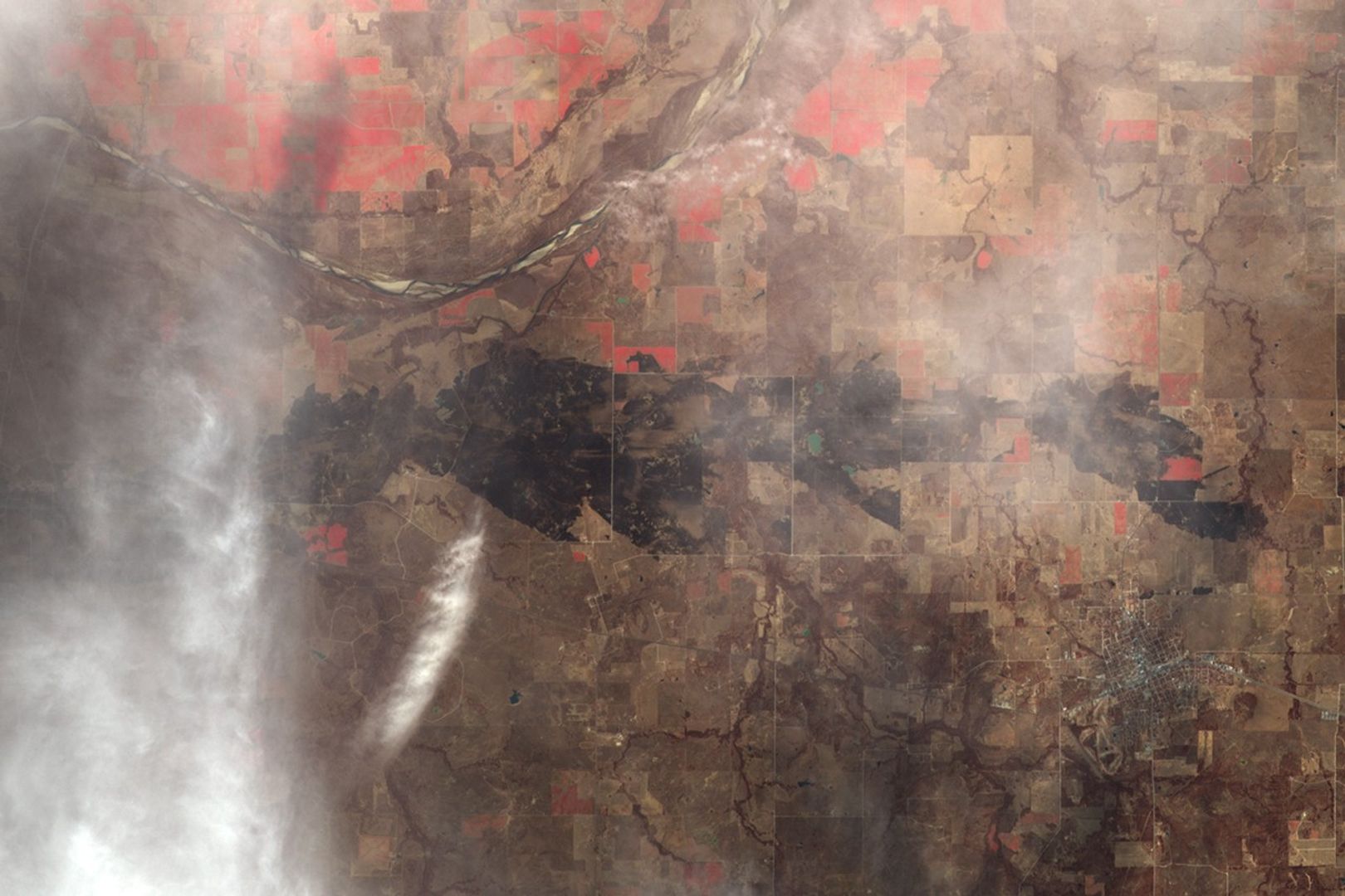
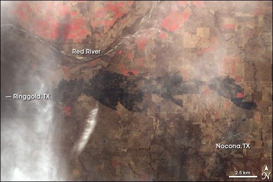
On January 2, 2006, winds whipped a fast-moving fire across the grasslands just south of the Red River, which marks the border between Oklahoma and Texas. According to reports from the Associated Press, the fire nearly razed the small ranch town of Ringgold, Texas, destroying as many as 50 homes and most of the buildings along the small town’s Main Street. The fire scorched tens of thousands of acres between Ringgold and the town of Nocona, to the southeast.
The charcoal-colored burn scar slices through the center of this image, captured on January 8, 2006, by the Advanced Spaceborne Thermal Emission and Reflection Radiometer (ASTER) on NASA’s Terra satellite. To make the burn scar stand out more prominently, the image was enhanced with the sensor’s observations of near- and shortwave-infrared energy as well as visible light. Winter-bare ground is tan and brown, while patches of red indicate growing vegetation, probably irrigated crops. The small town of Nocona appears as a cement-gray splash at lower right of the scene, while the location of Ringgold is obscured by a cloud at image left.
According to the U.S. Drought Monitor map for January 3, drought stretched across the south-central United States in the first of January, affecting Arizona, southern Colorado, New Mexico, Texas, Oklahoma, and western Arkansas. A pocket of Exceptional Drought—the highest drought category on the scale—spanned northeastern Texas, southeastern Oklahoma, and intruded a short distance into western Arkansas. The lack of rain, high temperatures, and strong winds were a menace for firefighters across the region, who continued to battle grassland and other wildfires through the first part of the month.
References & Resources
NASA image created by Jesse Allen, Earth Observatory, using data provided courtesy of the NASA/GSFC/METI/ERSDAC/JAROS and U.S./Japan ASTER Science Team