October 21, 2017
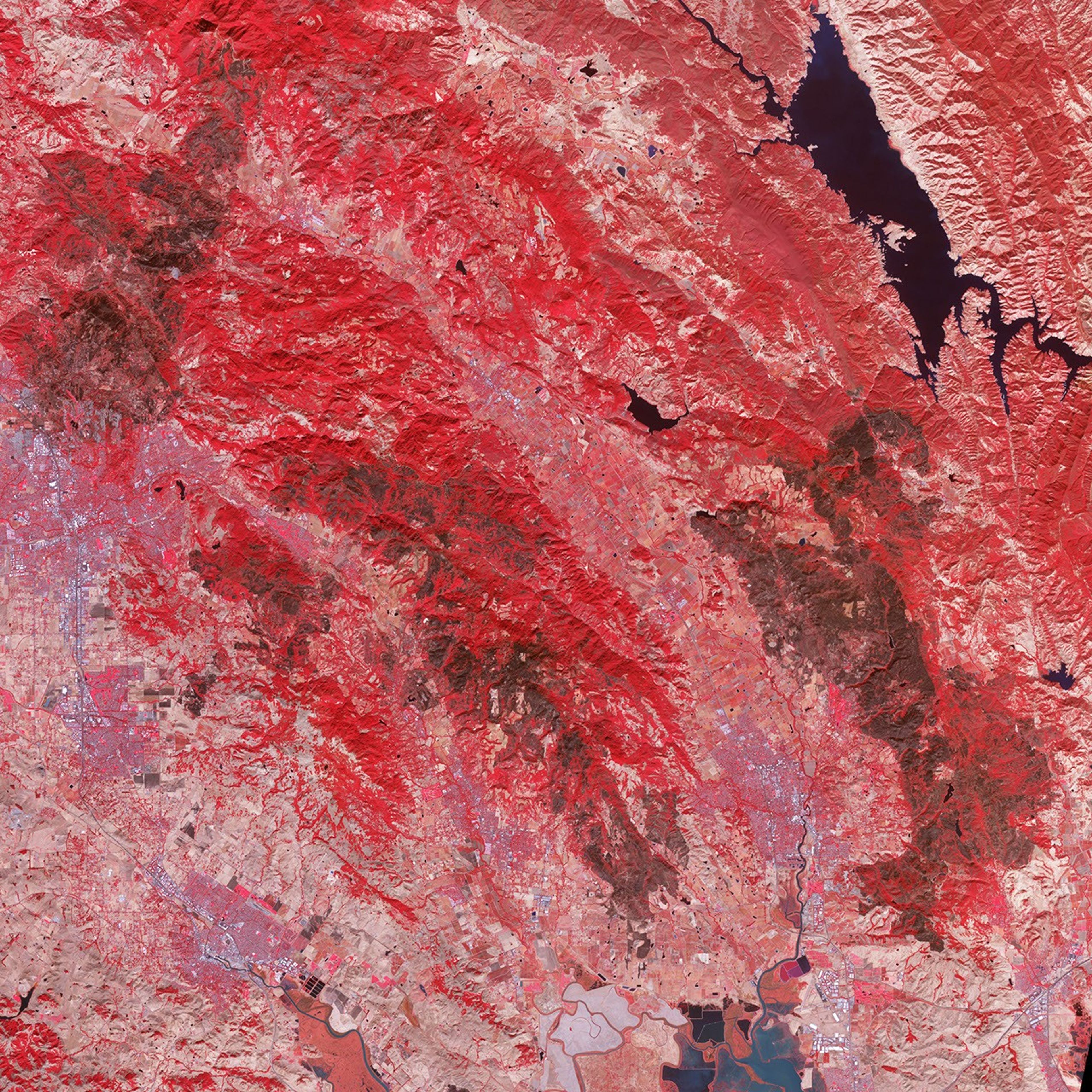
Devastating wildfires burned through California’s wine country in October 2017, taking several lives and leaving thousands of people homeless. On October 21, the Advanced Spaceborne Thermal Emission and Reflection Radiometer (ASTER) on the Terra satellite acquired this false-color image of the burn scars left by the Tubbs (upper left), Nuns (center), and Atlas (lower right) fires. Unburned vegetation appears red; burned vegetation appears brown. Buildings, roads, and other developed areas appear light gray and white.
References & Resources
- Cal Fire (2017) Central LNU Complex Incident Update. Accessed October 25, 2017.
- Los Angeles Times (2017, October 23) Mapping the destruction from California’s wine country fires. Accessed October 25, 2017.
- NASA Jet Propulsion Laboratory Photojournal (2017, October 23) Impact of Northern California Fires Seen in New NASA Satellite Image. Accessed October 25, 2017.
NASA Earth Observatory image by Jesse Allen, using data from NASA/GSFC/METI/ERSDAC/JAROS, and U.S./Japan ASTER Science Team. Text by Adam Voiland.