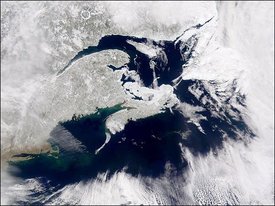
On the Northern Hemisphere’s first day of spring, 2001, Canada’s Maritime Provinces remain covered in snow. This true-color image from the Sea-viewing Wide Field-of-view Sensor (SeaWiFS) was taken on March 20, 2001. Near the top of the image the white circle is the Manicouagan impact crater, formed 210 million years ago. The arc of open water to the south (below) is the St. Lawrence River, which widens into the Gulf of St. Lawrence. To the east, on the other side of the Gulf (and partially obscured by clouds), is the Island of Newfoundland. South of the Gulf is Nova Scotia, separated from New Brunswick by the Bay of Fundy, scene of the highest tides in the world [up to 16 meters (52 feet)]. The high tides stir up sediment in the Bay, which is green and brown. Further south along the coast of mainland North America, snow-free Cape Cod and Long Island appear prominently. The clouds bordering the southern edge of the image occur along the edge of the relatively warm water of the Gulf Stream.
References & Resources
Provided by the SeaWiFS Project, NASA/Goddard Space Flight Center, and ORBIMAGE