


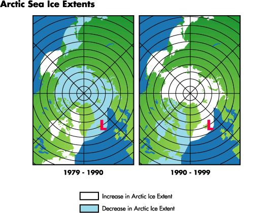
Largely natural “ups and downs” in a weather system centered nearIceland have contributed to regional variations and an overall decreasein Arctic sea ice cover over the last twenty years, according to newNASA research.
As this semi-permanent low-pressure system intensifies and weakens,it affects the amount of air (generally warm) being brought into theArctic to the east of the low and the amount of air (generally cold)being swept out of the Arctic to the west. These changes in turn affectthe amount of ice cover in the respective regions, adding to the effectsof climate warming.
Claire L. Parkinson of NASA’s Goddard Space Flight Center inGreenbelt, Md., highlights the changes in Arctic sea ice and theirpossible connection to the Icelandic low-pressure system in a paperappearing in the most recent issue of Polar Geography.
Parkinson plotted the extent of sea ice using satellitepassive-microwave data from 1979 through 1999. Data were analyzed fromthe Nimbus 7 satellite and three satellites of the DefenseMeteorological Satellite Program (DMSP). Results confirm an overalldecline in Arctic ice extent that has been connected with climatewarming, but also show regional differences that suggest there are otherinfluences.
The “Icelandic Low” is a key to bringing a greater orlesser amount of warm air into the Arctic depending on the intensity ofthe system, and is part of a larger weather pattern called the NorthAtlantic Oscillation (NAO). NAO is the name for changes in thedifference of air pressure between the semi-permanent low-pressuresystem centered near Iceland (the Icelandic Low) and a semi-permanenthigh-pressure system centered near the Azores Islands (better known asthe Bermuda-Azores High).
On average, both of these systems are present all year; however, bothare strongest in winter. When both the high and the low intensify andfluctuate in pressure relative to one another, they change thecirculation of cold and warm air in the region.
When the Icelandic Low is strong, it forces cold Arctic air southwardto the area west of Iceland and Greenland, setting the stage forincreasing sea ice cover in Baffin Bay, the Labrador Sea, Hudson Bay andthe Gulf of St. Lawrence. At the same time, to the east, warm air thatis swept northward reduces ice extent. This warmer air contributes tothe reduced ice extents east and north of Greenland, and the reducedextent of ice in the entire Arctic overall. “When the Icelandic Low isweak, it will still bring warm air northward to the east of Iceland, butnot as much as when the Icelandic Low is strong,” Parkinson said.
For more information, visit: Icelandic Weather System Helps Decipher Changes in the Arctic Ice Puzzle
For information about other effects of the North Atlantic Oscillation, read: Searching for Atlantic Rhythms: Winter Weather and the North Atlantic Oscillation
References & Resources
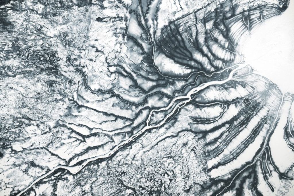
Image courtesy Claire Parkinson and Nick Digirolamo, NASA Goddard Space Flight Center
None


