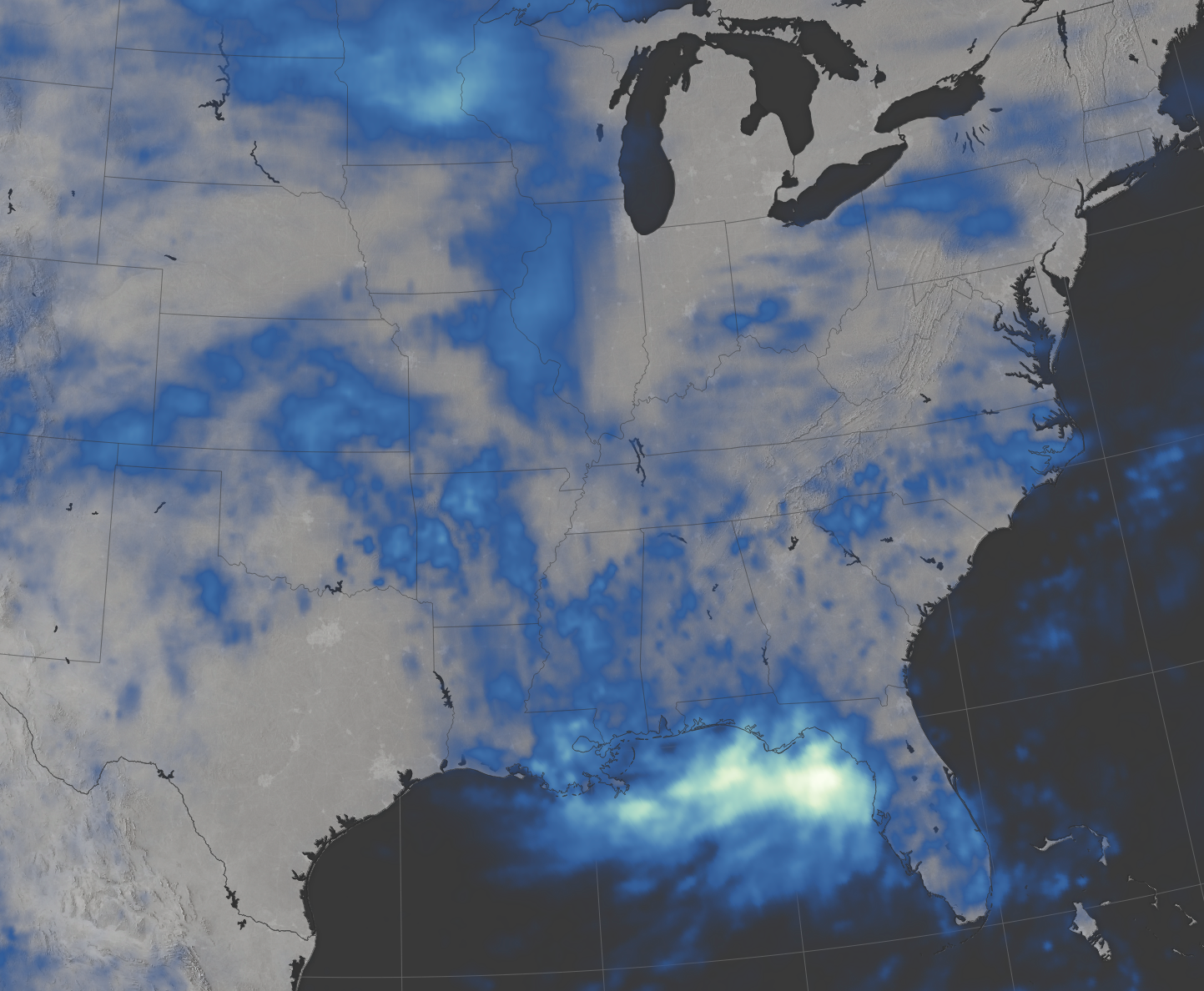

Heavy rains dumped buckets of water on the U.S. Gulf Coast on August 11, 2016. The downpour triggered flood warnings in low-lying areas, according to AccuWeather.
NASA’s Integrated Multi-satellite Retrievals for Global Precipitation Measurement (IMERG) data calculated total rainfall over the Gulf of Mexico between August 4 and 11. The heaviest rain (between 500 and 900 millimeters, or 20 to 35 inches) fell over the northern Gulf Of Mexico, just south of the Florida Panhandle. On land, the highest totals ranged between 300 to 400 millimeters (12 to 16 inches) of rain, mostly along the Florida Gulf Coast and in southeastern Louisiana.
Parts of Louisiana and Mississippi are forecast to receive as much as 254 millimeters (10 inches) more rain over the coming days.
References & Resources
- NASA Precipitation Measurement Missions Extreme Rainfall Along the Gulf Coast Measured by IMERG. Accessed August 11, 2016.
NASA Earth Observatory map by Joshua Stevens, using IMERG data provided courtesy of the Global Precipitation Mission (GPM) Science Team's Precipitation Processing System (PPS). Caption by Pola Lem.