February 14, 2009
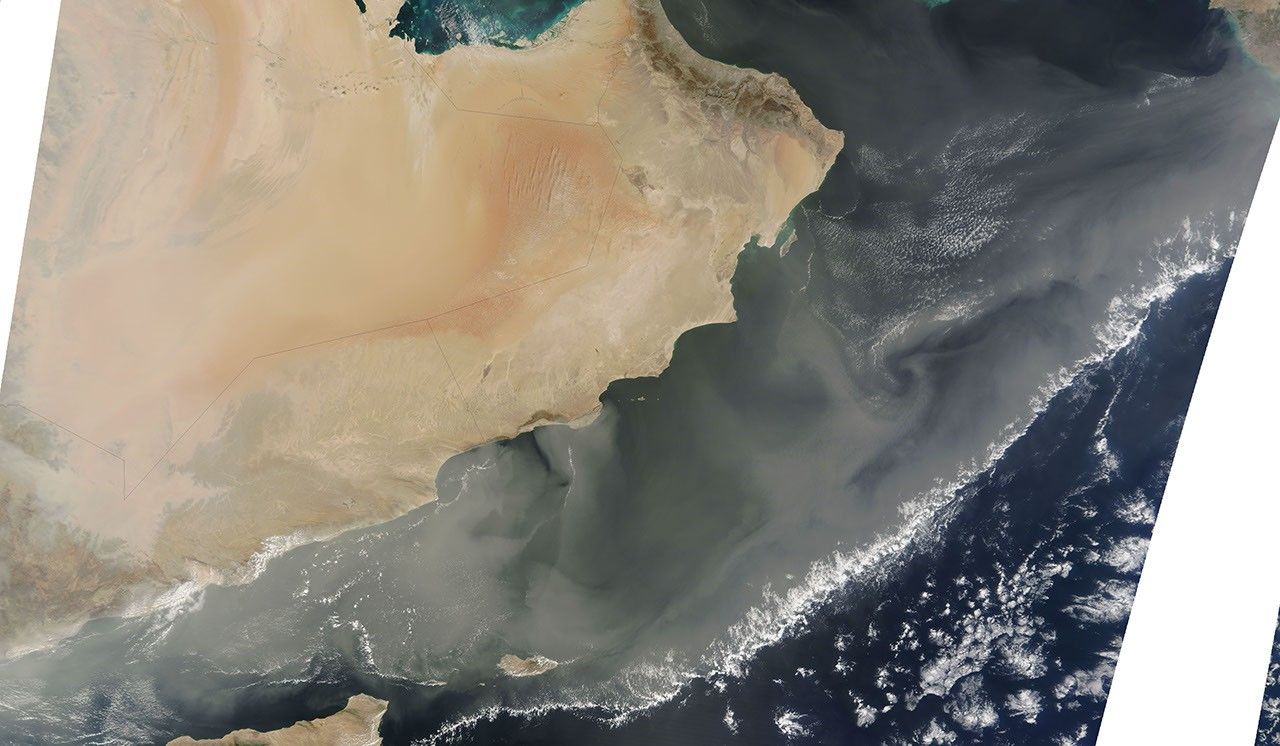
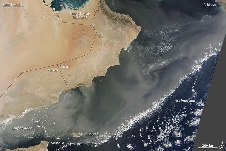
The dust storm that covered much of the Arabian Peninsula on February 12, 2009, thinned and spread eastward over the next two days. The Moderate Resolution Imaging Spectroradiometer (MODIS) on NASA’s Terra satellite took this picture on February 14, 2009. In this image, a massive dust plume stretches all the way to the coast of Pakistan. South of the Arabian Peninsula, dust has blown past Suqutrá (Socotra) and is skirting the northeastern tip of Somalia. Diminutive clouds line the dust plume’s southern margin.
The gray area along the right edge of this image results from a gap between satellite tracks.
References & Resources
NASA image courtesy MODIS Rapid Response Team, Goddard Space Flight Center. Caption by Michon Scott.