


June 26, 2016
Erskine Fire, California
A wildfire burning northeast of Bakersfield, California, is the state’s largest so far in 2016, according to news reports. It has also been called the season’s a most destructive fire. As of June 27, the Erskine fire had scorched 18,368 hectares (45,388 acres), destroyed at least 250 structures, and was responsible for at least two deaths.
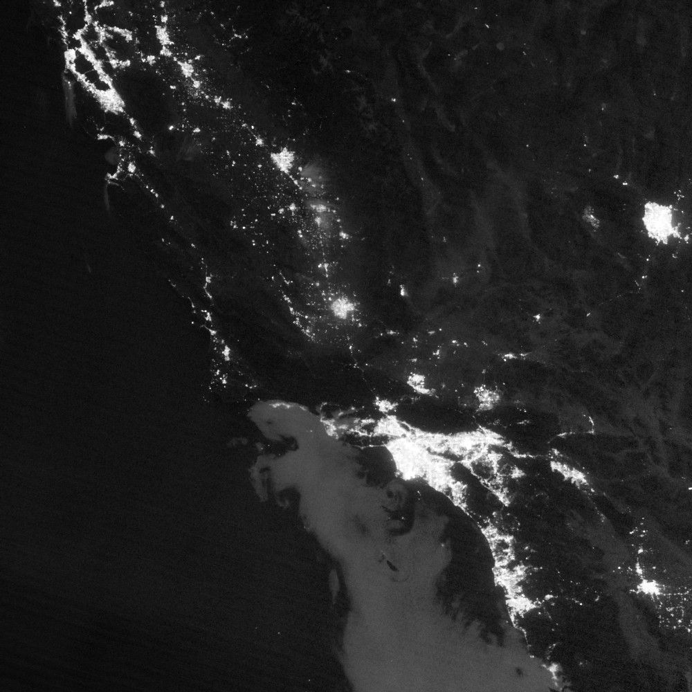
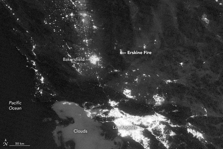
The top image shows the region at 3:34 a.m. Pacific Time on June 26, 2016. It was acquired with the day-night band (DNB) of the Visible Infrared Imaging Radiometer Suite (VIIRS) on the Suomi NPP satellite. The DNB can detect relatively dim signals such as city lights and reflected moonlight. In this case it also shows the glow of wildfire.
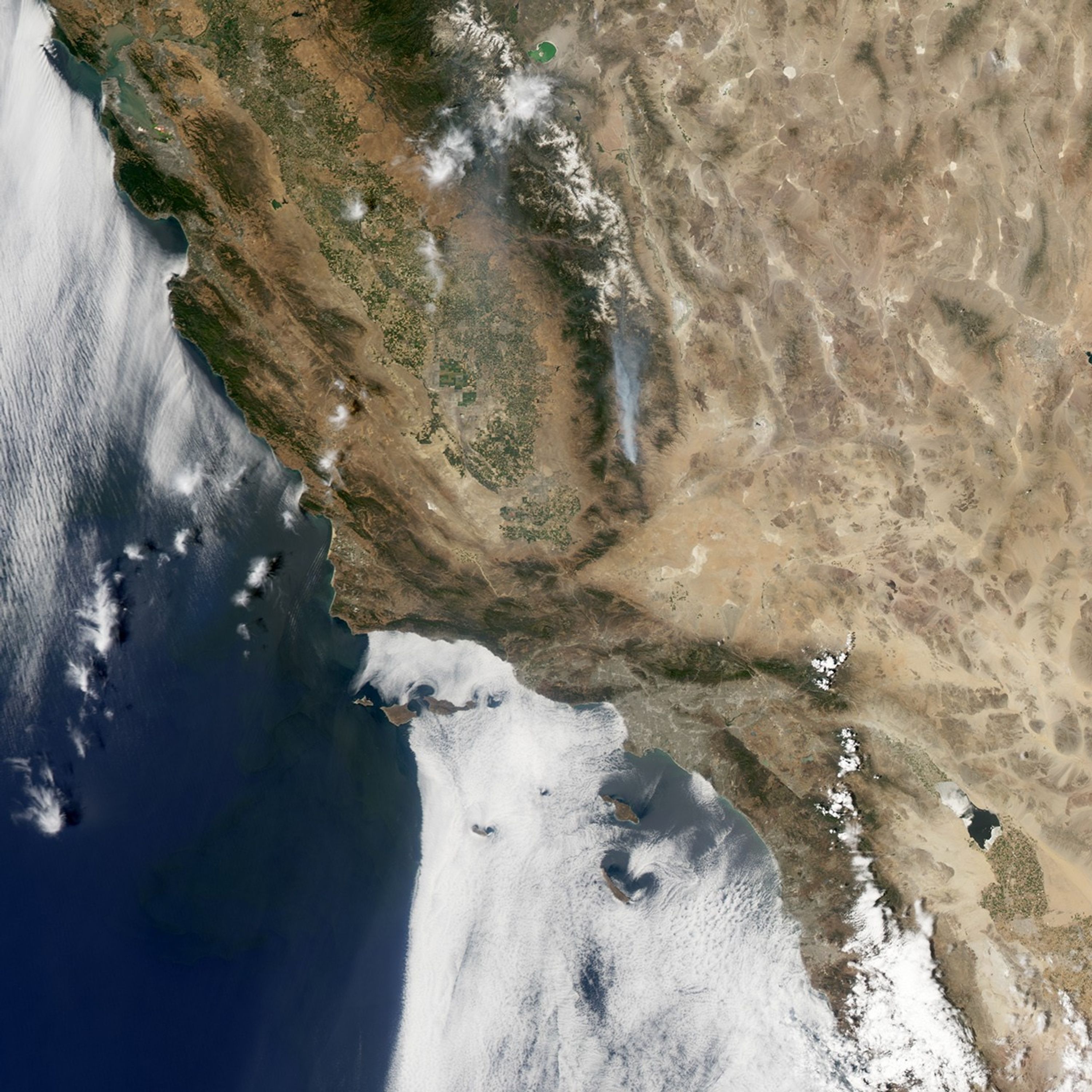
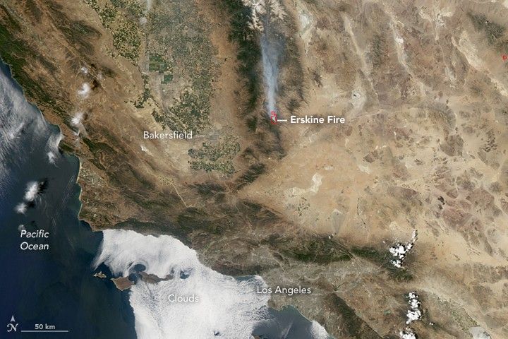
The second image shows the fire later that same day. This natural-color image was acquired with the Moderate Resolution Imaging Spectroradiometer (MODIS) instrument on NASA’s Aqua satellite. Red outlines indicate hot spots where MODIS detected warm surface temperatures associated with fires. Winds carried smoke from the fire northward.
The fire first ignited on June 23 due to a yet-unknown cause. On the date these images were acquired, the fire had burned 17,588 hectares (43,460 acres). As of June 27, the fire was 40 percent contained and continued to pose a threat to structures.
According to the National Interagency Fire Center, above normal fire potential is expected to expand into the Sierras and central coast region of California as summer progresses. According to the outlook: “The highest potential may be over the Sierra Foothills where a severe, multiyear drought has exacted a toll on the vegetation of the area.”
References & Resources
- ABC7 Eyewitness News (2016, June 26) Deadly Erskine Fire Grows to 43,460 Acres, 40 Percent Contained. Accessed June 27, 2016.
- InciWeb (2016, June 27) Erskine Fire. Accessed June 27, 2016.
- InciWeb (2016, June 26) Erskine Fire. Accessed June 27, 2016.
- Los Angeles Times (2016, June 27) As some residents chafe under evacuation order, deadly fire in Kern County is 40% contained. Accessed June 27, 2016.
- National Interagency Fire Center (2016, June 1) National Significant Wildland Fire Potential Outlook. Accessed June 27, 2016.
- NWS Sacramento via Twitter (2016, June 25) Nighttime #California imagery reveals brightly burning #ErskineFire. Accessed June 27, 2016.
NASA Earth Observatory image by Jesse Allen, using VIIRS day-night band data from the Suomi National Polar-orbiting Partnership and Aqua MODIS data from the Land Atmosphere Near real-time Capability for EOS (LANCE). Suomi NPP is the result of a partnership between NASA, the National Oceanic and Atmospheric Administration, and the Department of Defense. Caption by Kathryn Hansen.