


June 20, 2015
Fire and Smoke in San Bernardino National Forest
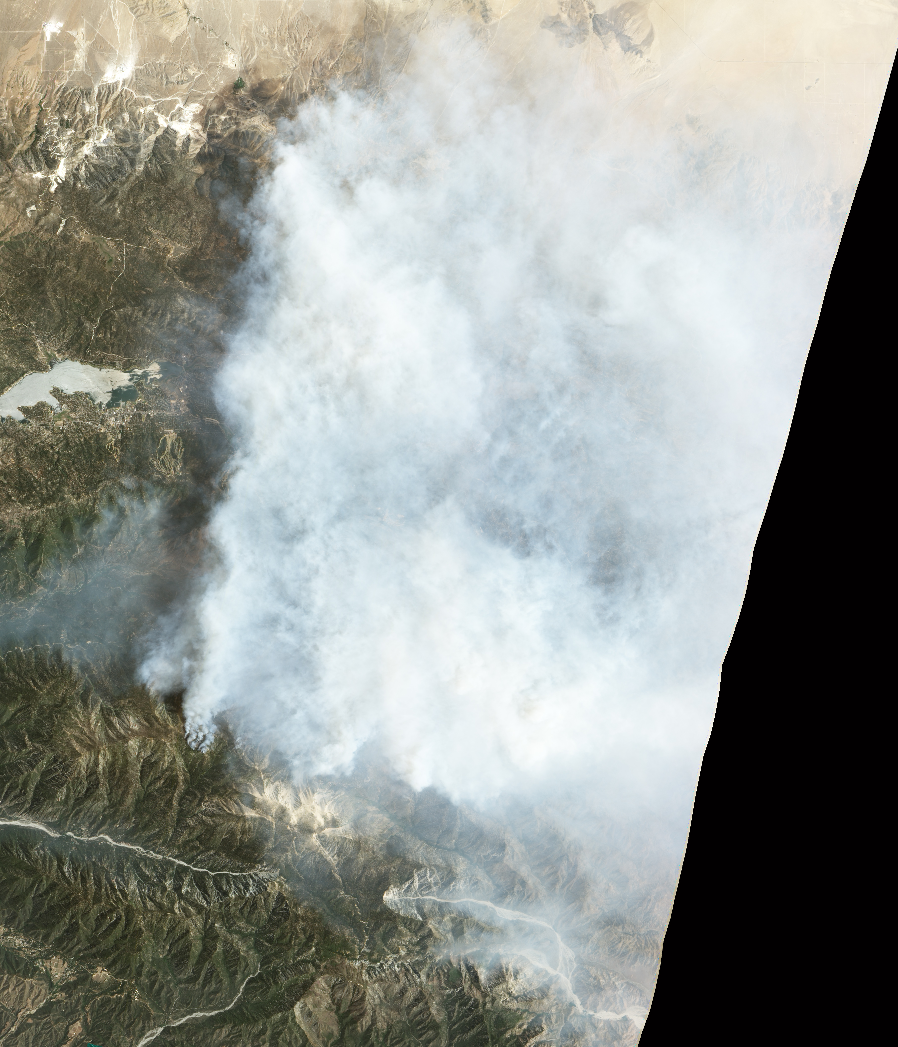
Fueled by hot, dry winds, the Lake fire has been spreading through California’s San Bernardino National Forest. The blaze, located about 130 kilometers (80 miles) east of Los Angeles, was first reported on June 17, 2015, and grew quickly on June 18. By the afternoon of June 22, the fire had burned 70 square kilometers (17,305 acres) and was 21 percent contained.
The Advanced Land Imager (ALI) on the Earth Observing-1 (EO-1) satellite captured this pair of images on June 20, 2015. The top image shows a natural-color view of the fire’s thick smoke plume. The bottom image shows a false-color view of the same scene in short-wave infrared. Hot areas of active fires glow bright orange-red; relatively cooler areas of recently burned land glow dark red. Turn on the image comparison tool to see the fires and scars below the smoke.
When these images were acquired on June 20, the fire had burned about 60 square kilometers (15,000 acres) and was 10 percent contained. Westerly winds blew smoke away from Los Angeles, but caused smoke advisories to be issued in the Yucca and Morongo valleys to the east and the Lucerne Valley to the north. Download the larger natural-color image to see the wider extent of the plume.
According to a June 22 news report, the fire was the largest to burn in a California national forest so far in 2015, and fire fighting costs were around $5 million. InciWeb reported that the fire was threatening about 500 structures, and evacuations were in place for all areas east of Angelus Oaks.
References & Resources
- Inciweb (2015, June 22) Lake Fire. Accessed June 22, 2015.
- The Los Angeles Times (2015, June 22) Price tag for fighting Lake fire near Big Bear: $5 million, 17,305 acres so far. Accessed June 22, 2015.
- Mojave Desert air quality management district (2015, June 18) Smoke Advisory Issued for Yucca, Lucerne & Morongo Valleys. Accessed June 22, 2015.
- NASA Earth Observatory (2015, June 18) Lake Fire, California.
NASA Earth Observatory image by Jesse Allen, using EO-1 ALI data provided courtesy of the NASA EO-1 team. Caption by Kathryn Hansen.


