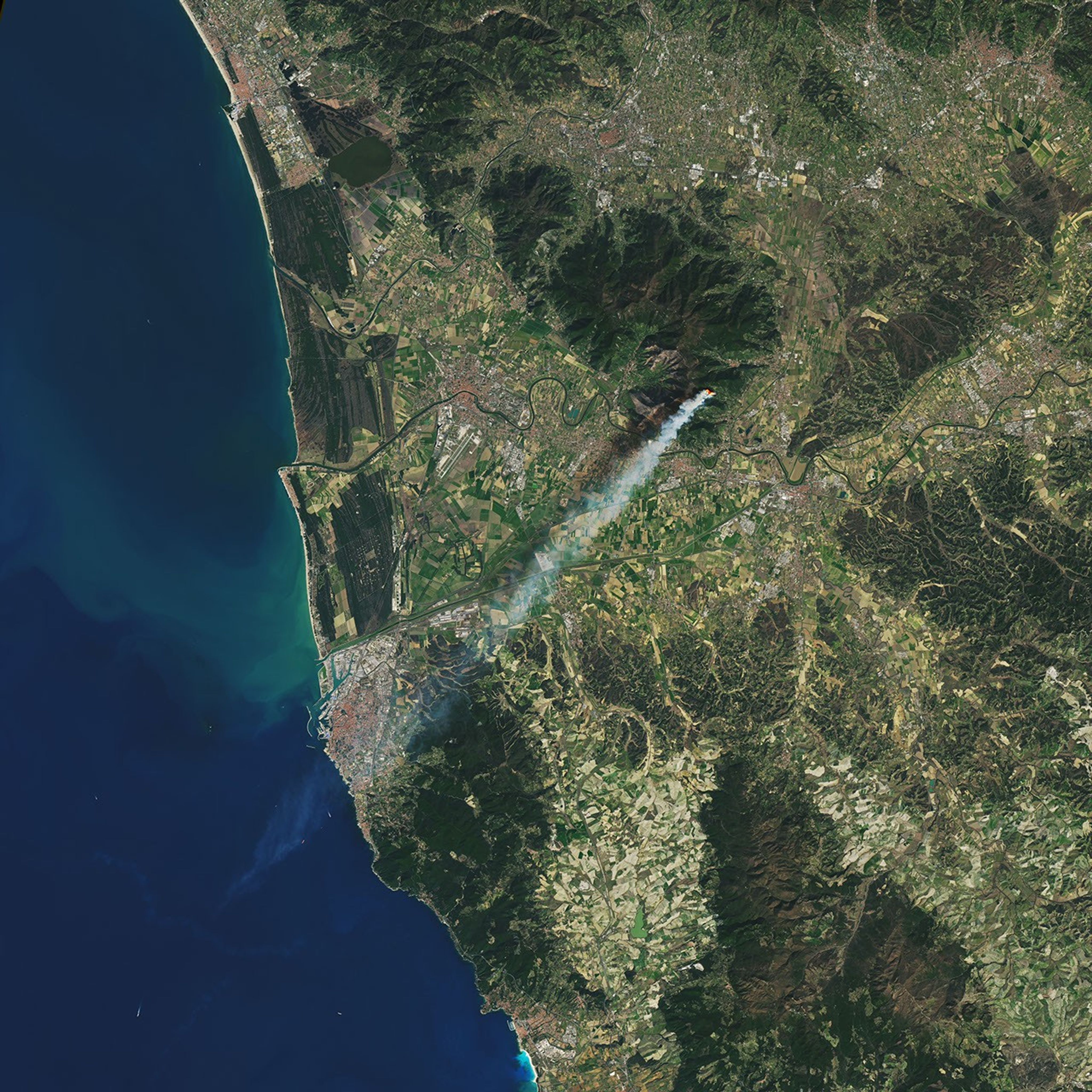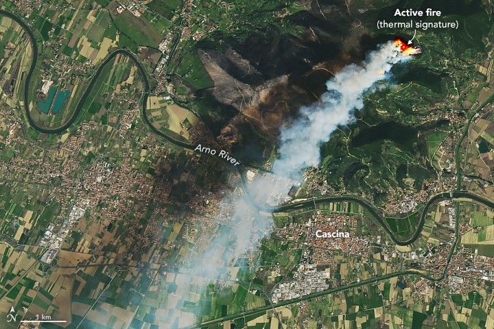

On the morning of February 25, 2019, a fire on the slopes of Monte Pisano sent smoke billowing across the western Italian coast. Reports estimate at least 180 hectares (less than 1 square mile) of forest and vegetation have been burned.
The Landsat 8 satellite acquired these images on February 25, 2019, around 10:58 a.m. local time, approximately thirty minutes after the fire commenced. Both images are a combination of natural color (bands 4-3-2) and infrared (band 10), which was used to highlight the active fire.
News outlets report that the event started from a bonfire that spread due to strong winds. People were evacuated from the nearby village of Vicopisano, located on the slopes of Monte Pisano.
References & Resources
- Adnkronos (2019, February 25) Rogo in pineta, evacuate case a Vicopisano. Accessed February 25, 2019.
- Cascina Notizie (2019, February 25) Continua a bruciare il Monte Pisano nel comune di Vicopisano, il fuoco provocato da un abbruciamento maldestro ed imprudente. Accessed February 25, 2019.
- Pisa Today (2019, February 25) Incendio Monte Serra: l'innesco da un rogo di sterpaglie. Accessed February 25, 2019.
- Pisa Today (2019, Febraury 25) Incendio sul Serra: il monte brucia ancora. Accessed February 25, 2019.
NASA Earth Observatory images by Joshua Stevens, using Landsat data from the U.S. Geological Survey. Caption by Kasha Patel.