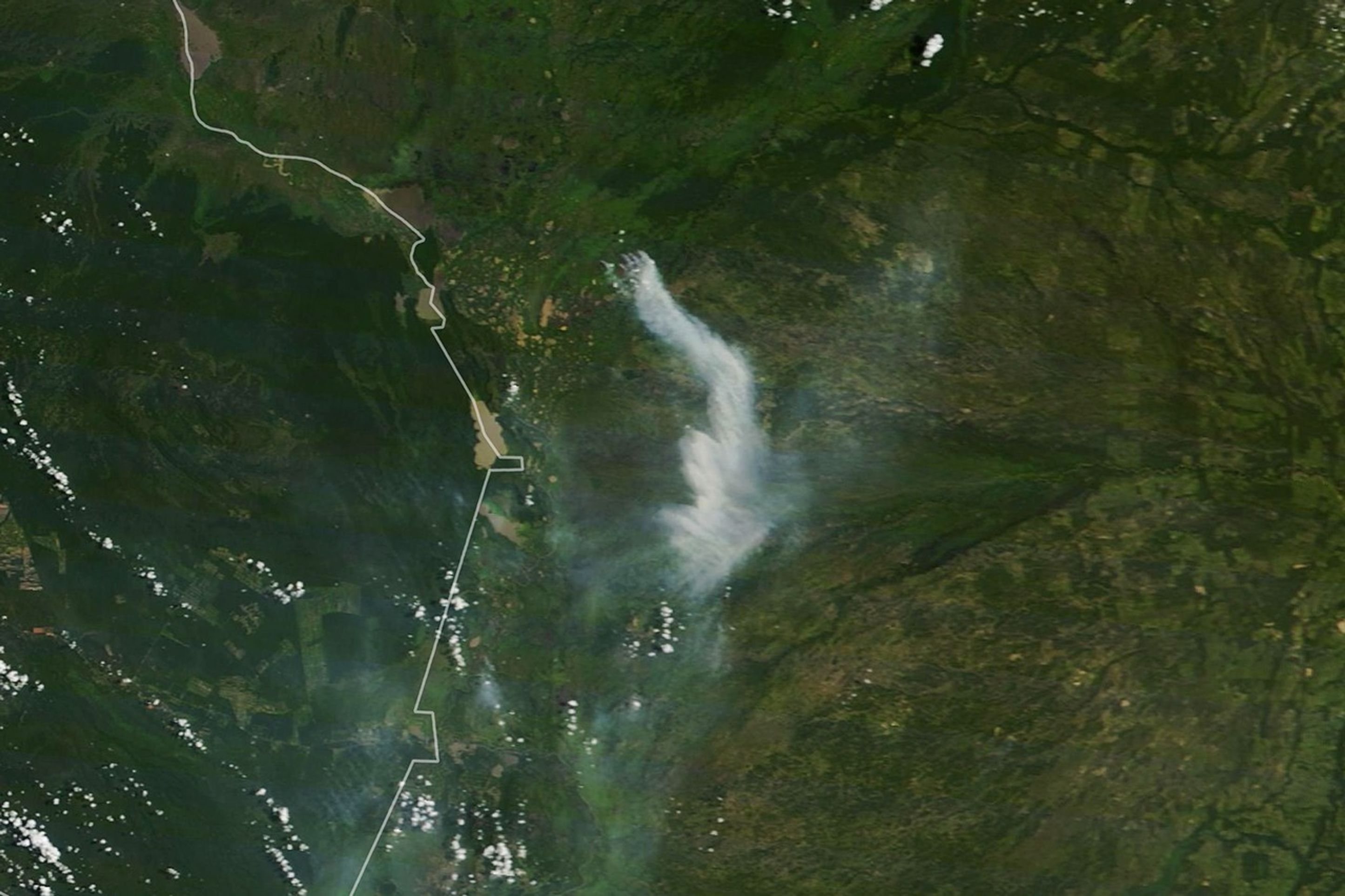
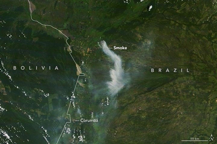
On March 8, 2020, the Moderate Resolution Imaging Spectroradiometer (MODIS) on NASA’s Terra satellite acquired this natural-color image of smoke streaming from a fire in southwestern Brazil.
The fire was burning in the Pantanal, a large wetland region known for sustaining an unusually rich assortment of wildlife. The blaze was located just east of Pantanal Matogrossense National Park and quite close to the location of another sizable fire in late-January 2020.
January, February, and March are usually quiet months for fires in the Pantanal. It is the wet season, so rains are typically plentiful, water covers much of the landscape, and the occasional fires ignited by lightning or farmers do not generally grow to be very large. However, sparse rainfall in early 2020 has dried out some of those swamps, and satellites have detected some large and smoky fires in the area.
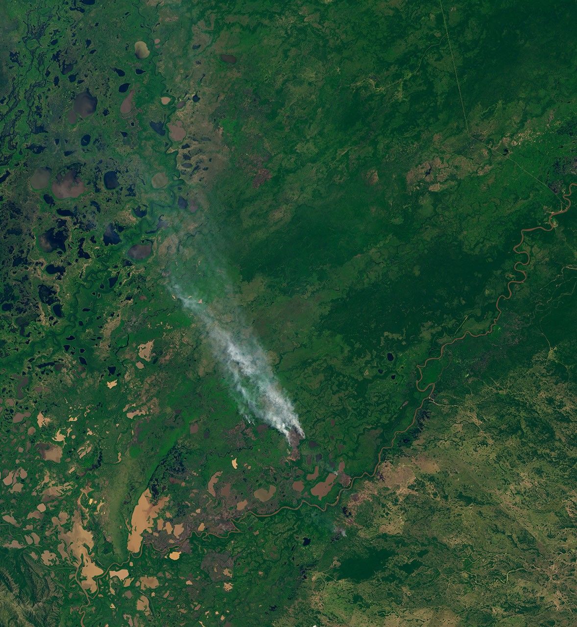
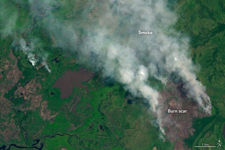
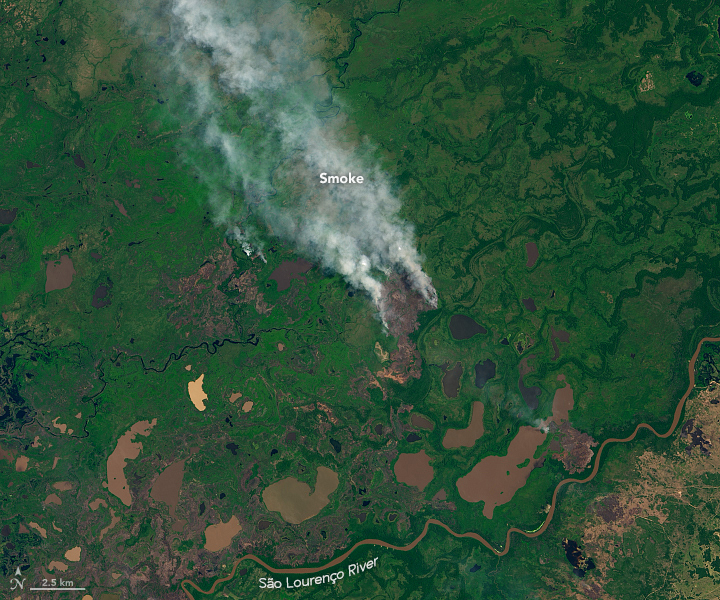
The Operational Land Imager (OLI) on Landsat 8 acquired a more detailed image (below) of the fire on March 4, 2020. As seen from a wider perspective (third image), the fire was burning just north of wetlands near the São Lourenço River.
Most of the fires have been concentrated in the Corumbá municipality in Mato Grosso do Sul and in the Poconé municipality in Mato Grosso, according to an article published by Mongabay. This unseasonable fire activity in the Pantanal follows an unusually intense fire season in 2019.Fire season in the Pantanal is only just beginning. In 2019, the number of hot spots detected in the region by Aqua MODIS between January 1 and March 9 accounted for just 5 percent of the total detected that year, explained Alberto Setzer, a senior scientist at Brazil’s National Institute for Space Research (INPE). “Since most fires in the Pantanal occur between July and December, we do not see any particular reason for alarm at this point this year,” he said.
References & Resources
- Arruda, WdS. et al. (2016) Inundation and Fire Shape the Structure of Riparian Forests in the Pantanal, Brazil. PLoS ONE, 11 (6).
- Climate to Travel Climate â Pantanal. Accessed March 9, 2019.
- Instituto Nacional de Pesquisas Espaciais (INPE) Queimadas. Accessed February 26, 2020.
- Mongabay (2020, February 27) âOut of controlâ: Unprecedented fires ravage Brazilâs Pantanal wetlands. Accessed March 9, 2019.
- NASA Earth Observatory (2020, March 4) Reflecting on a Tumultuous Amazon Fire Season.
- National Geographic Brazilâs Best Kept Secret: The Pantanal. Accessed March 9, 2019.
NASA Earth Observatory images by Lauren Dauphin, using MODIS data from NASA EOSDIS/LANCE and GIBS/Worldview and Landsat data from the U.S. Geological Survey. Caption by Adam Voiland.