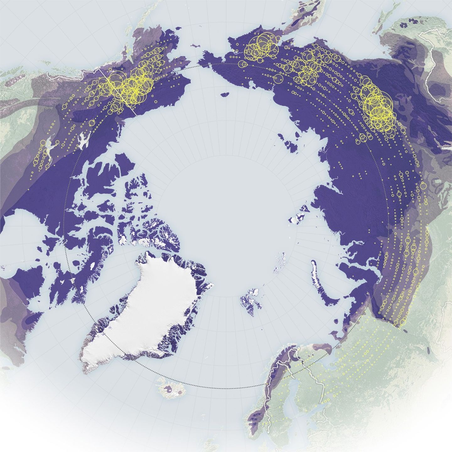
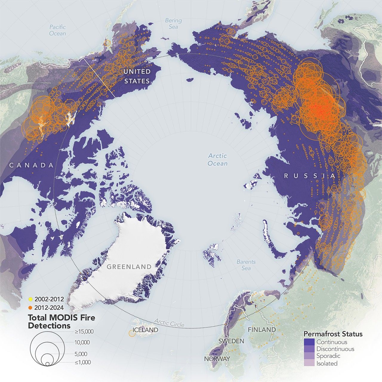
The number of wildland fires burning in the Arctic is on the rise, according to NASA researchers. Moreover, these blazes are burning larger, hotter, and longer than they did in previous decades.
These trends are closely tied to the region’s rapidly changing climate. The Arctic is warming nearly four times faster than the global average, a shift that directly impacts rain and snow in the region and decreases soil moisture, both of which make the landscape more flammable. Lightning, the primary ignition source of Arctic fires, is also occurring farther north. These findings are detailed in a report published in 2025 by the Arctic Monitoring and Assessment Programme (AMAP), a working group of the Arctic Council.
“Fire has always been a part of boreal and Arctic landscapes, but now it's starting to act in more extreme ways that mimic what we've seen in the temperate and the tropical areas,” said Jessica McCarty, Deputy Earth Science Division Chief at NASA’s Ames Research Center and an Arctic fire specialist. McCarty, the report’s lead author, worked as part of an international team for AMAP.
But it’s not just the number of fires that concerns scientists; it’s how hot they burn.
“It's the intensity that worries us the most because it has the most profound impact on how ecosystems are changing,” said Tatiana Loboda, chair of the Department of Geographical Sciences at the University of Maryland.


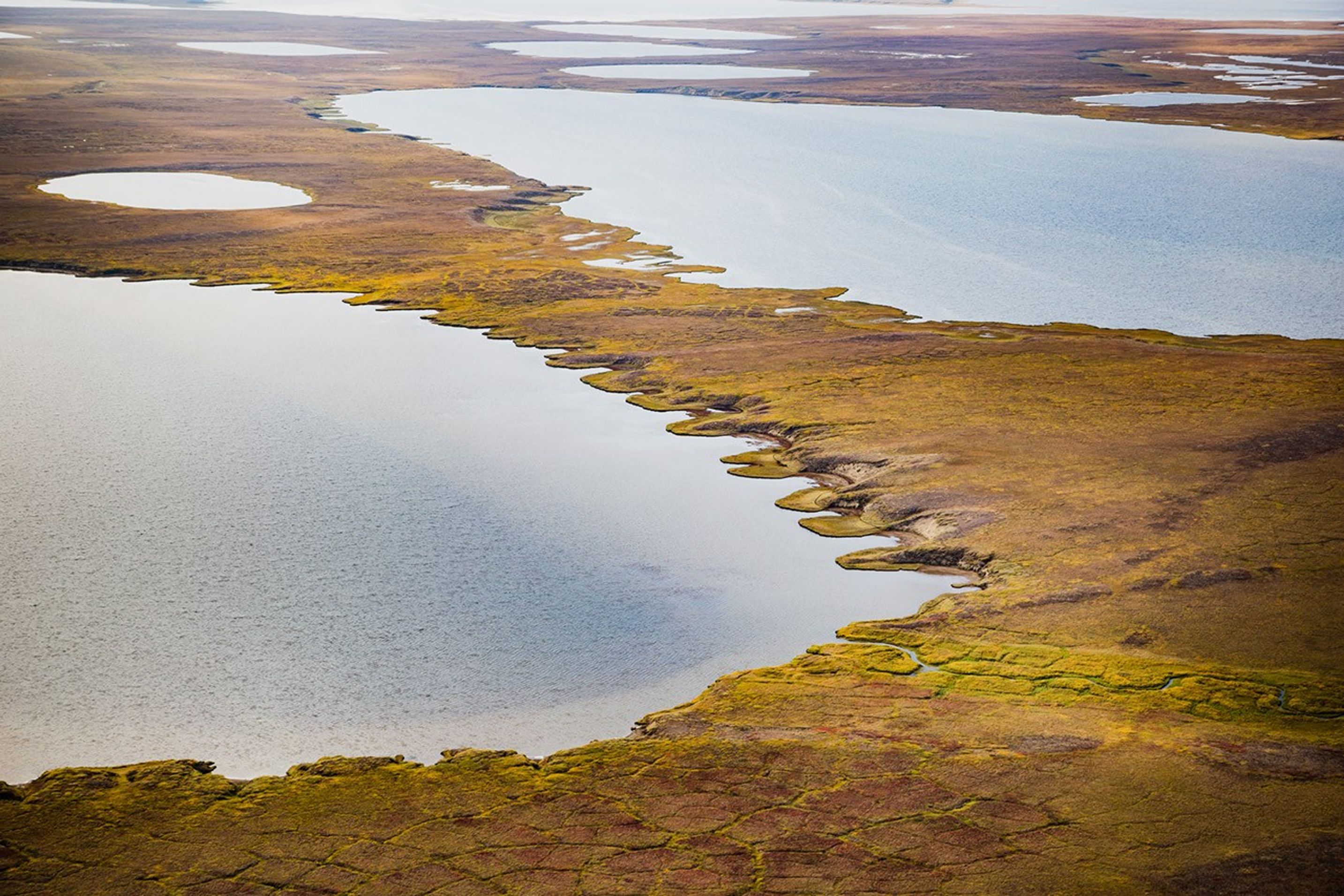
Arctic ecosystems: How are there fires in the Arctic?
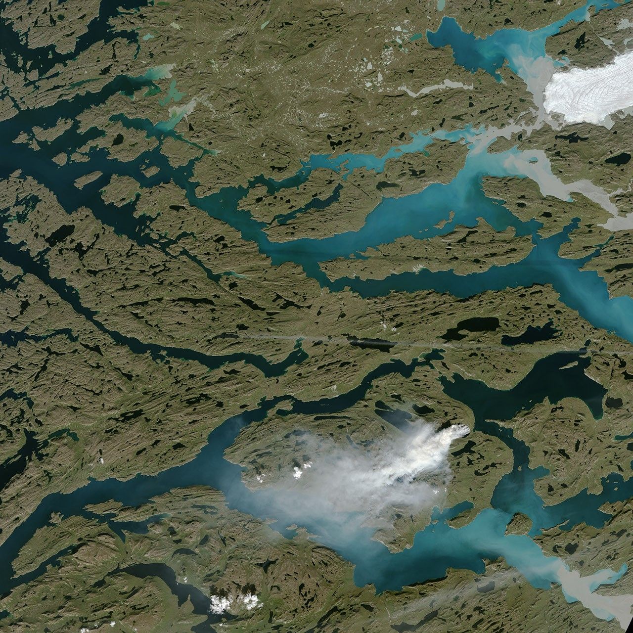
The word ‘Arctic’ often conjures images of glaciers, snow, and a frozen ocean. So how can such a place catch fire?
Officially, the Arctic refers to the region north of 66.5 degrees north, though many Arctic researchers study 60 degrees north and above. While much of the area is covered in snow and ice, the Arctic also boasts a diverse range of ecosystems that change as they extend toward the pole.
It begins with boreal forests, which are primarily made up of coniferous trees like spruce, fir, and pine. As these forests thin to the north, they give way to shrublands, then to grassland tundra, and eventually to rock, ice, and polar bears.
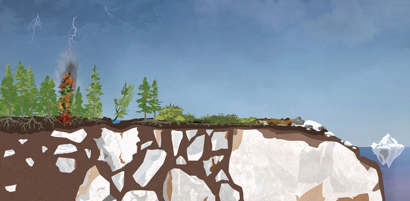
Much of the vegetation is covered in snow during the winter, which thaws in the spring. Exposed, the vegetation dries out in the sunlight. When given an ignition source like a lightning strike, it can quickly become fuel for a fire.
What is changing?
According to the 2025 AMAP report, an increasingly flammable landscape combined with more lightning strikes is leading to larger, more frequent, and more intense fires than the landscape is adapted for.
“There is variability year to year, but across the decades we are averaging about double the burned area in the North American Arctic compared to the mid-20th century,” said Brendan Rogers, senior scientist at the Woodwell Climate Research Center.
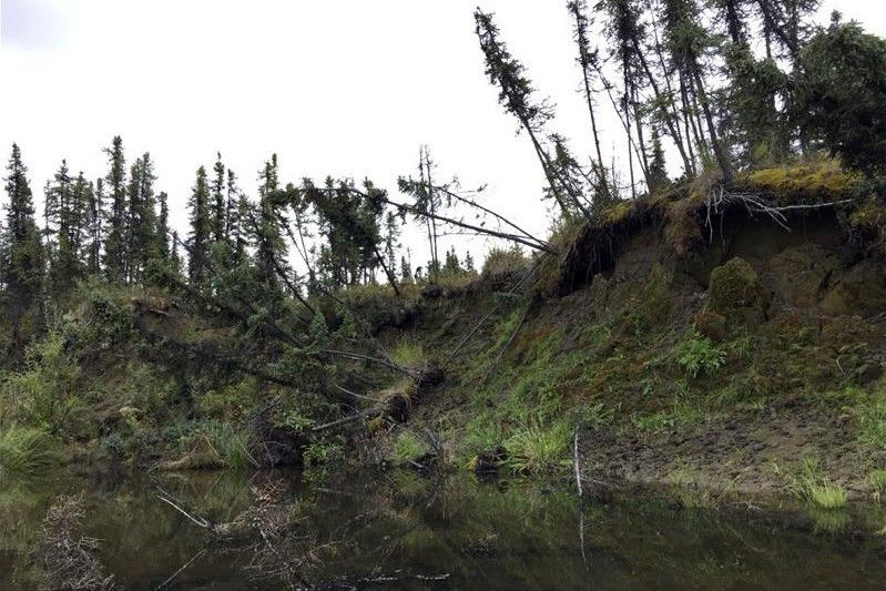
Low-intensity fires, which the Arctic is accustomed to, leave most of the forest standing, which allows the understory and upper soil layers to recover quickly.
In contrast, intense fires kill off trees and can trigger a process known as secondary succession, in which new species replace those that died. These fires also burn deep into the carbon-rich soil, change the area’s hydrology, and accelerate snowmelt. In addition, the smoke and habitat damage from massive, hot fires pose significant health risks to human communities and local wildlife.
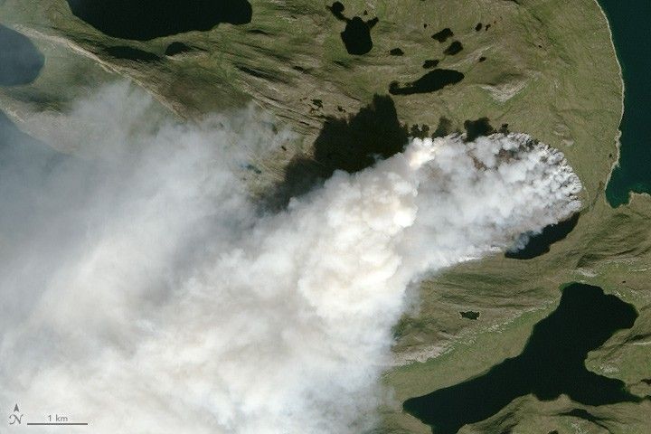
The mid-2010s ushered in a novel fire regime. For instance, Greenland saw significant wildfires in 2015, 2017, and in 2019. Researchers also began observing fires consistently springing up in the Arctic as early as late March, much earlier in the year than historical records show, and burning well after the first snow. “It’s concerning how frequently these fires burn the same place,” Loboda said. “A lot of areas now burn two, three, or even five times during a very short period. It’s an immense impact: It’s happening across the tundra and the boreal regions, and these areas can’t recover.”
Peat, permafrost, and zombie fires
What makes Arctic ecosystems, and by extension Arctic fire, unique compared to much of the world is what is happening below ground: specifically in the peat and permafrost.
Peat is old—thousands and thousands of years old.
When glaciers retreated at the end of the last ice age, they left behind deposits of old trees, grasses, and other organic matter that have partially decomposed to form carbon-rich soil. Over time, layers of deposits built up into peat, which is now a primary ingredient in soil across the Arctic.
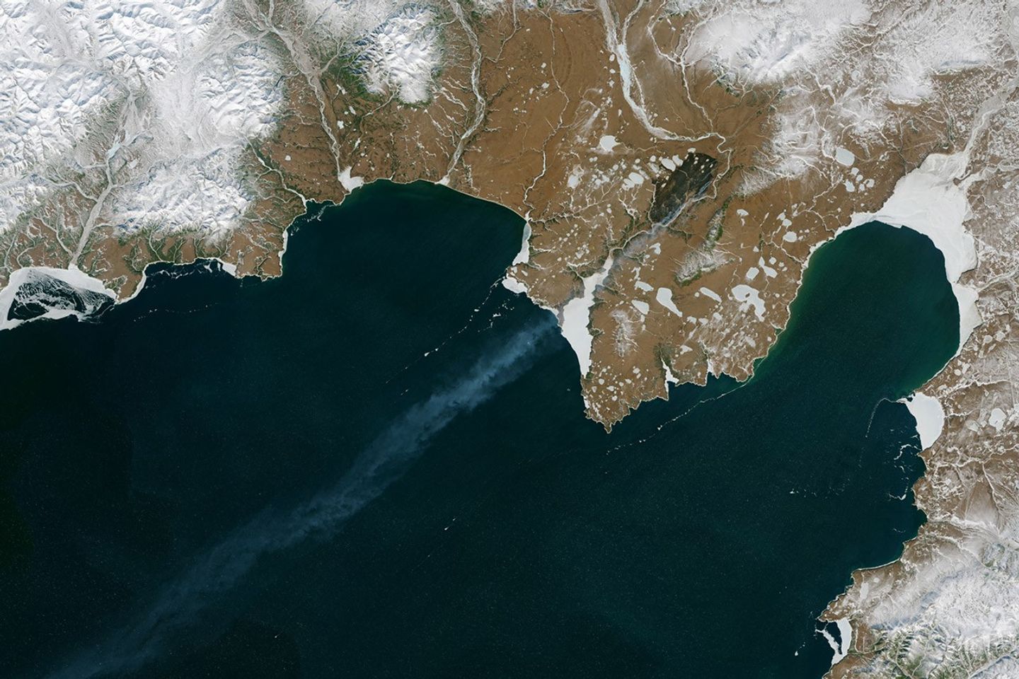
When intense fires burn into deep peat deposits, they can create a phenomenon called a holdover fire, more commonly known as a zombie fire, in which remnants of fire stay alive throughout the winter. These fires appear extinguished on the surface but continue to smolder underground through the winter, bursting back to life when spring brings drier conditions.
Permafrost—ground that remains frozen year-round—can be even older. Some permafrost predates the human species, Homo sapiens, remaining continuously frozen for more than 400,000 years. This age is what makes these frozen layers so significant: They’ve been storing ancient organic matter, and the carbon within it, for millennia.
When organisms die and decompose, that process naturally releases carbon dioxide and methane. In the Arctic, permafrost keeps these organisms literally frozen, which effectively freezes them in time.
NASA scientist and permafrost expert Clayton Elder describes seeing this effect in the Permafrost Tunnel in Fairbanks, Alaska. “You can walk into the tunnel and see grass embedded in the wall,” Elder said. “It’s still green, but when you carbon date it, it’s 40,000 years old.”
But as the Arctic warms, thaws, and burns, the carbon stored in peat and permafrost releases into the atmosphere. That matters, because what’s locked below the surface is enormous. Together, Arctic peat and permafrost store twice as much carbon as the entirety of Earth’s atmosphere.
According to McCarty, this thawing will lead to global change.
“This is old ice— ice that is part of our hydrologic system and formed a homeostasis of climate that we as a species grew up in,” McCarty said. “There will be changes that we can't predict: humanity has not experienced the climate the planet is heading towards. It will be interesting to model; there are so many different ways it could go.”
What’s next?
To address the challenges of the Arctic, scientists are finding new applications of existing data and developing new technologies.
“NASA satellites form the real backbone of what we understand,” said Rogers. “These satellites have given us a 25-year record of wildfire data, which is invaluable. They are critical for our understanding of how these fire regimes are changing and for thinking through anything in the solution space.”
New satellites and artificial intelligence developments are advancing understanding of ignition sources, fuel availability and flammability, and fire behavior. All of these data are important for monitoring fires and modeling future fire behavior, as well as evaluating the vulnerability of boreal and Arctic ecosystems to increasing levels of fire.
“One of our conclusions is that the observations need to be more targeted,” McCarty said. “We know some of what is happening, but we need to better understand why, and how to monitor these isolated areas. This means we’ll need satellites and field campaigns that are thinking about this more complex fire landscape. What happens in the Arctic will impact the rest of the planet.”
Story by Milan Loiacono, NASA's Ames Research Center.
References & Resources
- Arctic Monitoring and Assessment Programme (2025, June) AMAP Arctic Climate Change Update 2024: Key Trends and Impacts. Accessed January 14, 2026.
- NASA (2026) Fire Information for Resource Management System. Accessed January 14, 2026.
- NASA Earth Observatory (2026, January) Fires on the Rise in the Far North. Accessed January 14, 2026.