


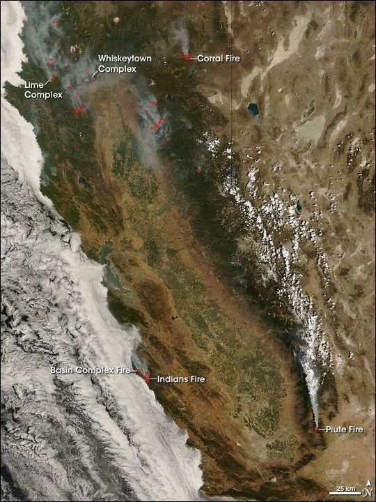
For days in late June, wildfires across California blanketed the state with smoke. A shift in the winds over the area over the last weekend of June brought residents and firefighters a reprieve, however, and when the Moderate Resolution Imaging Spectroradiometer (MODIS) on NASA’s Terra satellite captured this image on June 29, 2008, skies over the state were relatively clear. The fires were still burning, however; places where MODIS detected active fires are marked in red. Clouds cover the Pacific Ocean (image left).
The high-resolution image provided above is at MODIS’ maximum spatial resolution (level of detail) of 250 meters per pixel. The MODIS Rapid Response Team provides twice-daily images of Northern and Southern California in additional resolutions and formats.
References & Resources
NASA image by Jeff Schmaltz, MODIS Rapid Response Team. Caption by Rebecca Lindsey.


