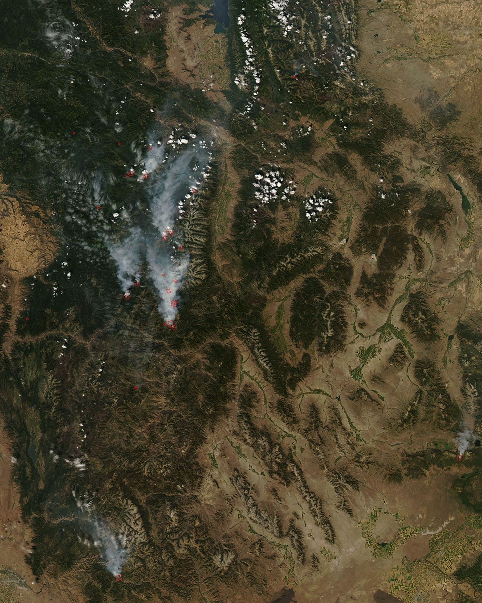


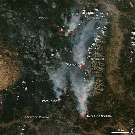
A handful of wildfires sprang up in Idaho in the third week of August 2008, affecting hundreds of acres in forests and wilderness areas west of the Bitterroot Range Mountains. This image from the Moderate Resolution Imaging Spectroradiometer (MODIS) on NASA’s Aqua satellite shows the area on August 18. Places where MODIS detected active fires are outlined in red. A few of the larger fires are labeled.
According to the August 20 morning report from the National Interagency Fire Center, the Diamond Fire was 693 acres; the Hell’s Half Saddle Fire was 1,110 acres; and the Porcupine Fire was 300 acres. Because much of the area is wilderness, not all fires that occur are aggressively battled. Some are allowed to burn to benefit the ecosystem according to pre-determined natural resource plans.
The high-resolution image provided above is at MODIS’ maximum spatial resolution (level of detail) of 250 meters per pixel. The MODIS Rapid Response Team provides daily images of the region in additional resolutions and formats, including an infrared-enhanced version that highlights burned ground.
References & Resources
- References
- USDA Forest Service. (2008, August 20). Incident Management Situation Report, Wednesday, August 20, 2008—0530 MDT. Incident Management Situation Report Webpage (pdf). Accessed August 20, 2008.
NASA image by Jeff Schmaltz, MODIS Rapid Response Team. Caption by Rebecca Lindsey