July 18, 2018
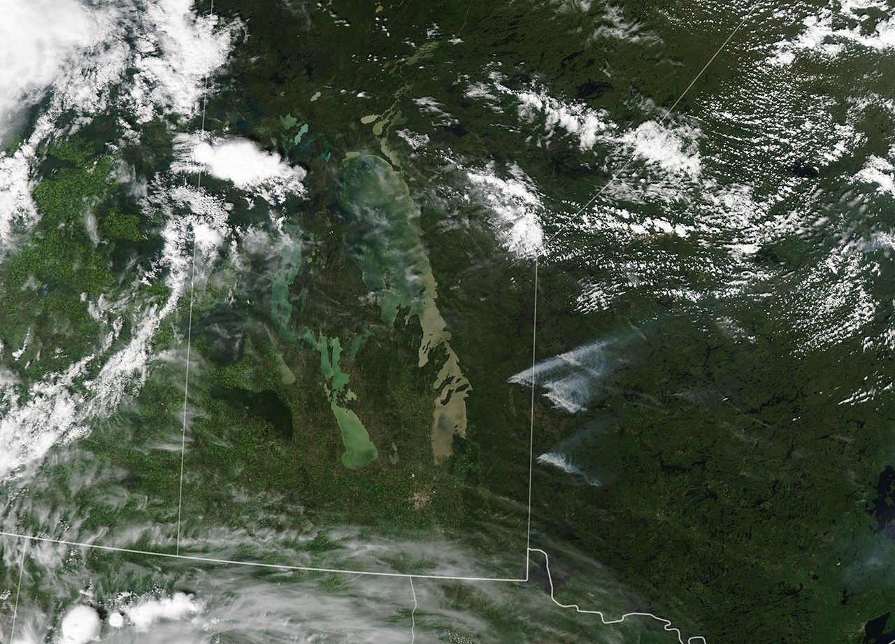
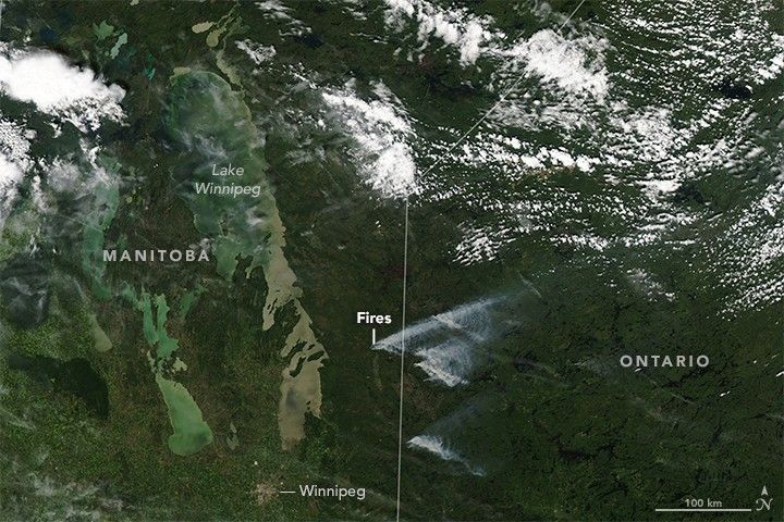
On July 18, 2018, the Moderate Resolution Imaging Spectroradiometer (MODIS) on NASA’s Aqua satellite acquired this image of fires along the border between Manitoba and Ontario, Canada.
According to the Canadian Wildland Fire Information System (CWFIS), 4,077 fires have been reported so far in Canada in 2018, consuming 606,221 hectares of forest. 382 new fires started in the past week, with nearly 60 percent of them due to lighning. “The total number of fires so far this year is above the 10-year average (119.7 percent), and the area burned is well below average (36.3 percent),” CWFIS reported.
References & Resources
NASA Earth Observatory image by Lauren Dauphin, using MODIS data from LANCE/EOSDIS Rapid Response . Caption by Mike Carlowicz.