April 30, 2005
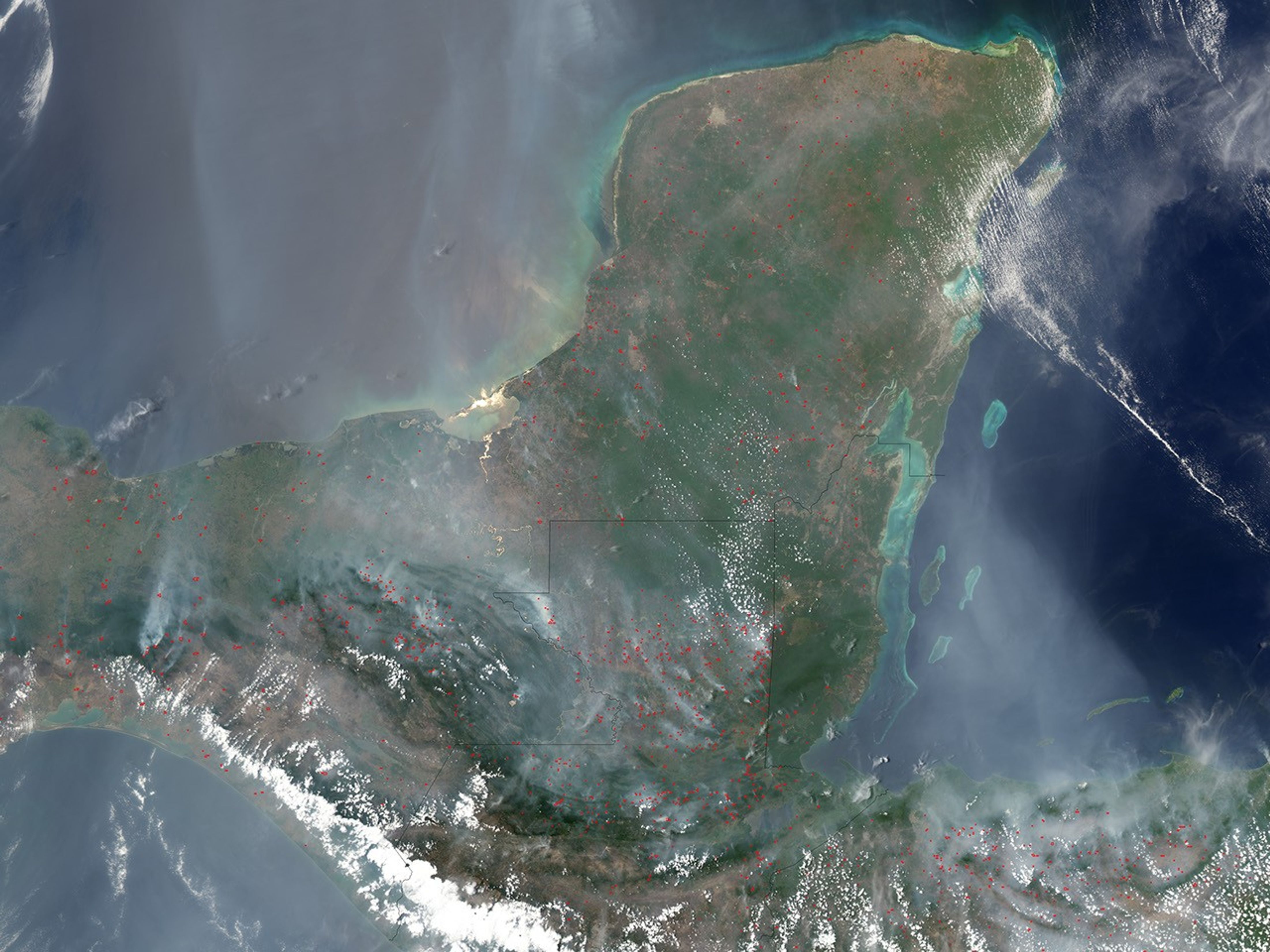
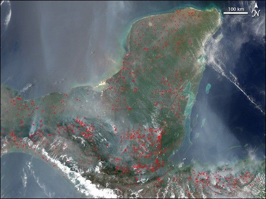
On April 30, 2005, scores of fires continued to smoke across the Isthmus of Tehuantepec (left of center) and the Yucatan Peninsula (top right) in southern Mexico, as well as in Guatemala (below and to the right of center), Belize (east of Guatemala), and Honduras (lower right). This image of the region captured by the Moderate Resolution Imaging Spectroradiometer (MODIS) on NASA’s Aqua satellite shows active fire locations marked in red. Smoke flows northward over the Gulf of Mexico, eastward over the Gulf of Honduras, and southward over the Gulf of Tehuantepec. The region’s annual dry season is reaching its peak in May.
References & Resources
NASA image created by Jesse Allen, Earth Observatory, using data obtained from the Goddard Earth Sciences DAAC.