


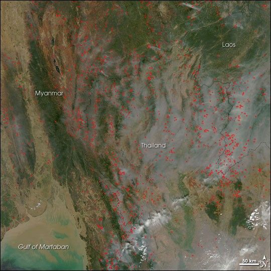
The agricultural fire season in Southeast Asia spreads smoke across a large portion of Myanmar, Thailand, and Laos in this photo-like image captured by the Moderate Resolution Imaging Spectroradiometer (MODIS) on NASA’s Aqua satellite on March 4, 2007. Places where MODIS detected actively burning fires are marked in red. During the area’s dry season (roughly fall-winter in the Northern Hemisphere), intentional land management fires, as well as accidental forest fires that spread from agricultural areas, are common in Southeast Asia.
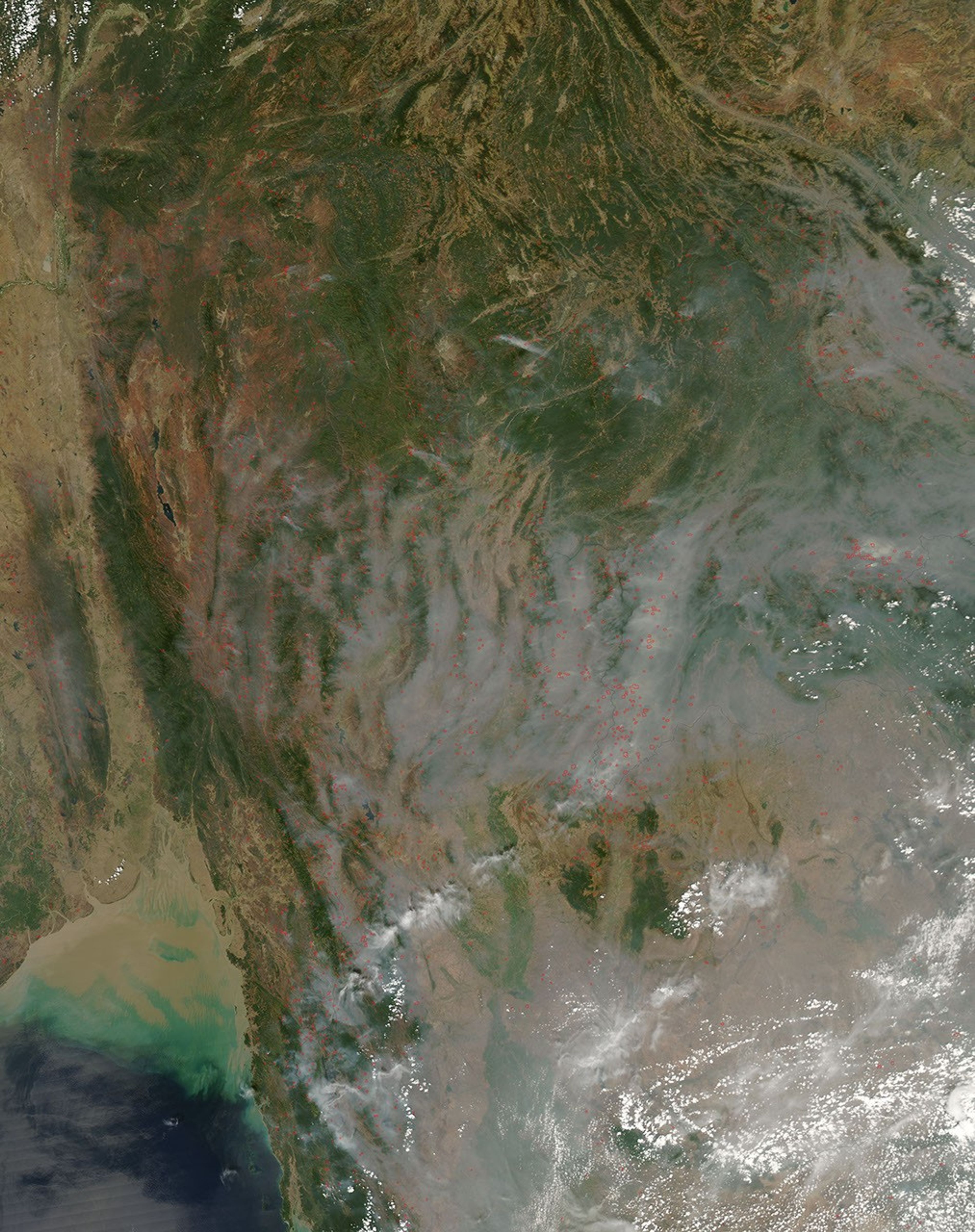
The large image provided above has a spatial resolution (level of detail) of 250 meters per pixel. The MODIS Rapid Response Team provides the image at additional resolutions.
References & Resources
NASA image courtesy the MODIS Rapid Response Team, Goddard Space Flight Center


