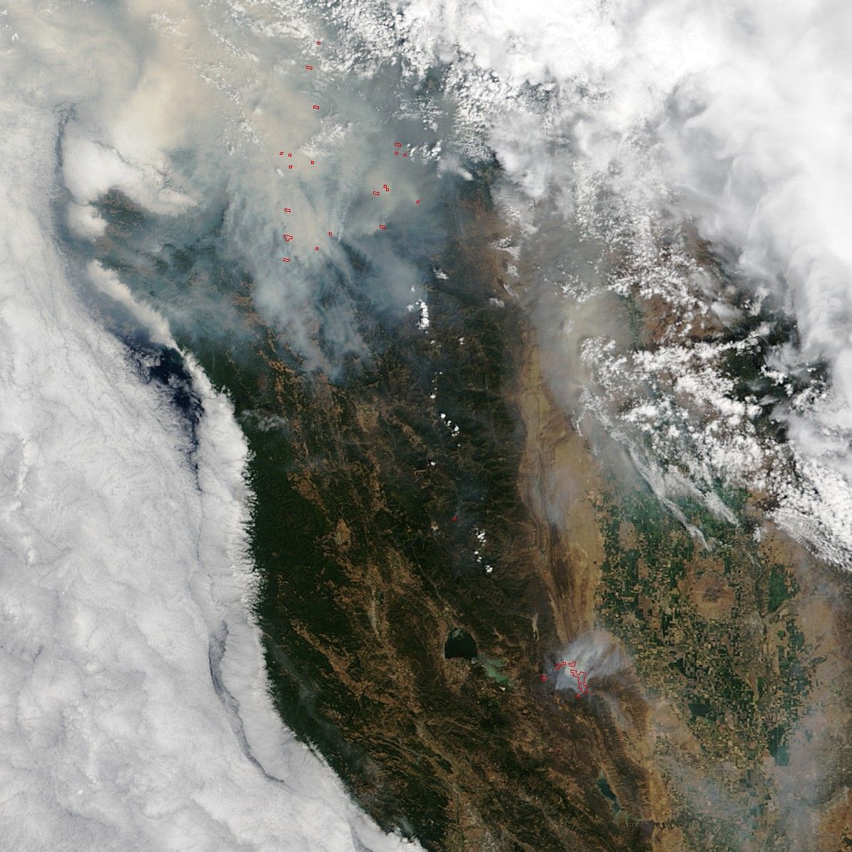

Several large wildfires have charred tens of thousands of acres in northern California. The largest, the Rocky fire, had burned about 60,000 acres (24,000 hectares) in Lake, Yolo, and Colusa counties as of August 3, 2015. Farther north, the Fork Complex fire and the Mad River Complex fire had burned a combined 39,000 acres.
The Moderate Resolution Imaging Spectroradiometer (MODIS) on NASA’s Terra satellite collected this image on August 2, 2015. Red outlines indicate hot spots where the sensor detected unusually warm surface temperatures associated with fires. Plumes of smoke are visible drifting from the hot spots.
The Rocky fire has destroyed two dozen homes and forced the evacuation of 12,000 people, according to news reports.
References & Resources
- Cal Fire (2015, August 3) Current Fire Information. Accessed August 3, 2015.
- InciWeb (2015, August 3) California Incidents. August 3, 2015.
- NBC News (2015, August 3) California Wildfires: 12,000 Evacuated as Rocky Fire Rages, Grows. Accessed August 3, 2015.
- Wired (2015, August 3) The Hellish Beauty of California’s Wildfires. August 3, 2015.
NASA image by Jeff Schmaltz, LANCE/EOSDIS Rapid Response. Caption by Adam Voiland.