


- October 21, 11:35 a.m. (1.2 MB jpeg)
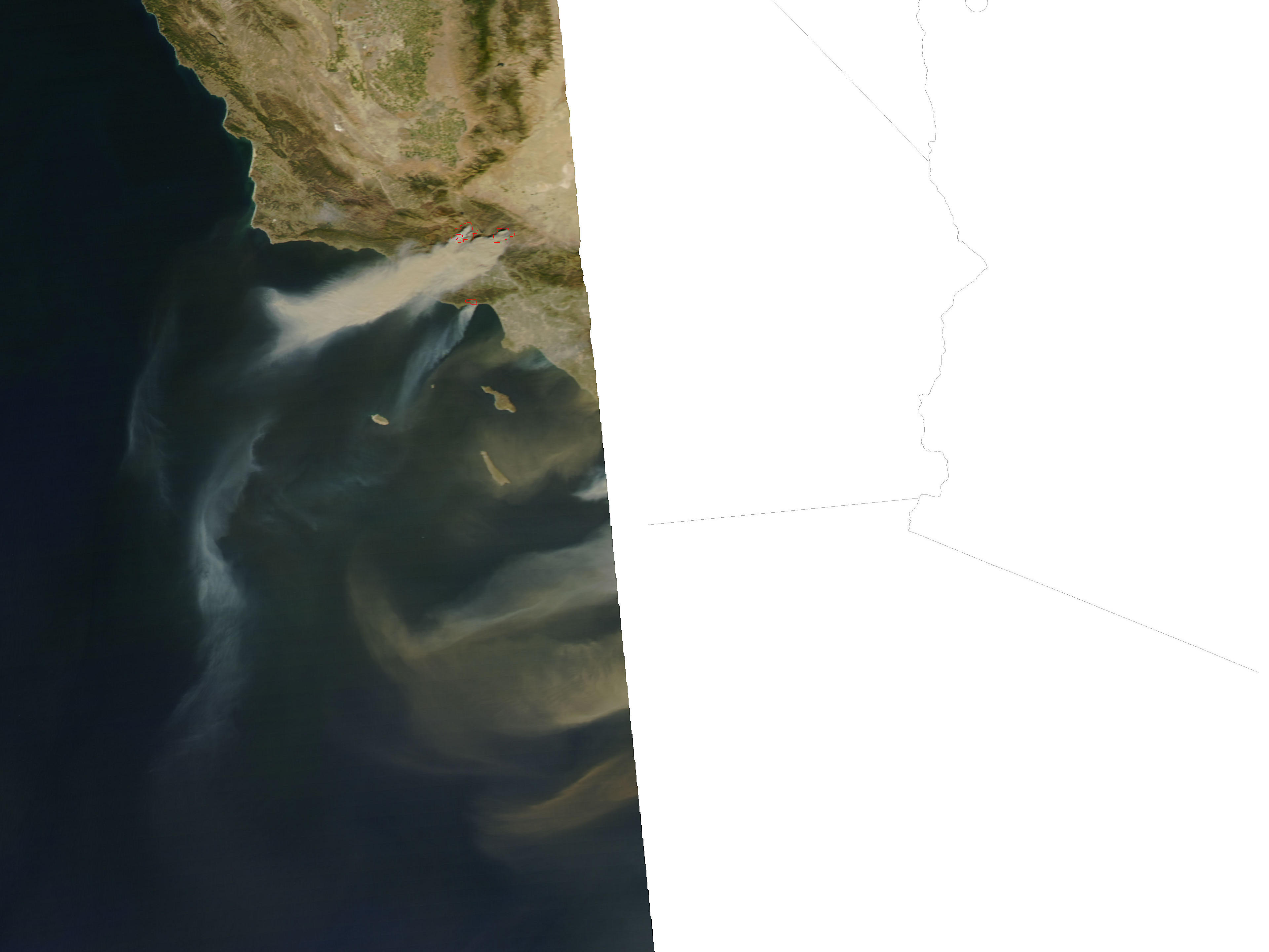
- October 21, 2:50 p.m. (469 kb jpeg)
Driven by Santa Ana winds, several large wildfires flared across Southern California over the weekend of October 20, 2007. This pair of images of the area around Los Angeles on October 21 shows just how rapidly the fires grew. The top image, taken by the Moderate Resolution Imaging Spectroradiometer (MODIS) on NASA’s Terra satellite at 11:35 a.m. local time, shows several active fires (outlined in red) emitting small plumes of smoke. By 2:50 p.m., when the Aqua satellite passed overhead, smoke was pouring from several large blazes northwest of Los Angeles. Although Aqua MODIS only caught the edge of the scene during this satellite overpass, the plumes of smoke and dust that can be seen blowing off the coast in the large image indicate the intensity of the winds and the presence of additional fires farther south.
Santa Ana winds are a California firefighter’s nightmare. These blustery, dry, and often hot winds blow out of the desert and race through canyons and passes in the mountains on their way toward the coast. The air is hot not because it is bringing heat from the desert, but because it is flowing downslope from higher elevations. As fall progresses, cold air begins to sink into the Great Basin deserts to the east of California. As the air piles up at the surface, high pressure builds, and the air begins to flow downslope toward the coast. When winds blow downslope, the air gets compressed, which causes it to warm and dry out. In fact, the air can warm at a rate of 10 degrees Celsius per kilometer of descent (29 degrees Fahrenheit per mile). Canyons and passes funnel the winds, which increases their speed. Not only do the winds spread the fire, but they also dry out vegetation, making it even more flammable.
The large images provided above have a spatial resolution (level of detail) of 250 meters per pixel. The MODIS Rapid Response Team provides twice-daily images of the region in additional resolutions.
References & Resources
NASA image courtesy the MODIS Rapid Response Team, Goddard Space Flight Center


