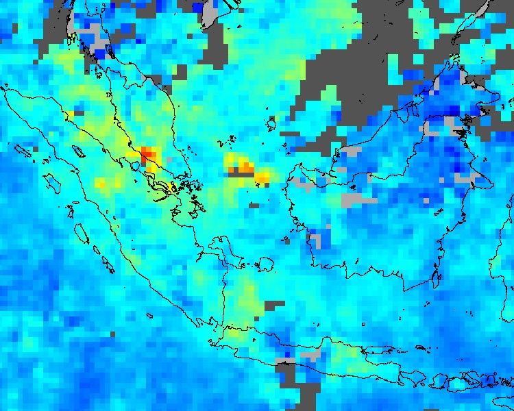























This false-color image shows concentrations of carbon monoxide in the lower atmosphere over the island of Sumatra, Indonesia. This image represents a composite of data collected from June 17-24, 2004, by the Measurements Of Pollution In The Troposphere (MOPITT) instrument aboard NASA’s Terra satellite. The colors represent the mixing ratios of carbon monoxide in the air, given in parts per billion by volume. In this scene, values range from as high as 210 ppbv (red pixels) to as low as 0 ppbv (blue pixels). The grey areas show where no data were collected, either due to persistent cloud cover or gaps between viewing swaths. (Light gray shows land masses and dark gray shows the Pacific Ocean.)
During the time MOPITT collected these data, the MODIS sensor aboard NASA’s Aqua satellite observed widespread fires actively burning on the island. Along with smoke and particulate emissions, carbon monoxide is a byproduct of burning biomass and fossil fuels.
References & Resources
NASA image by Jesse Allen, using data courtesy the MOPITT instrument team at NCAR/UCAR