


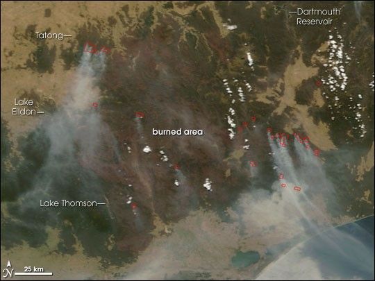
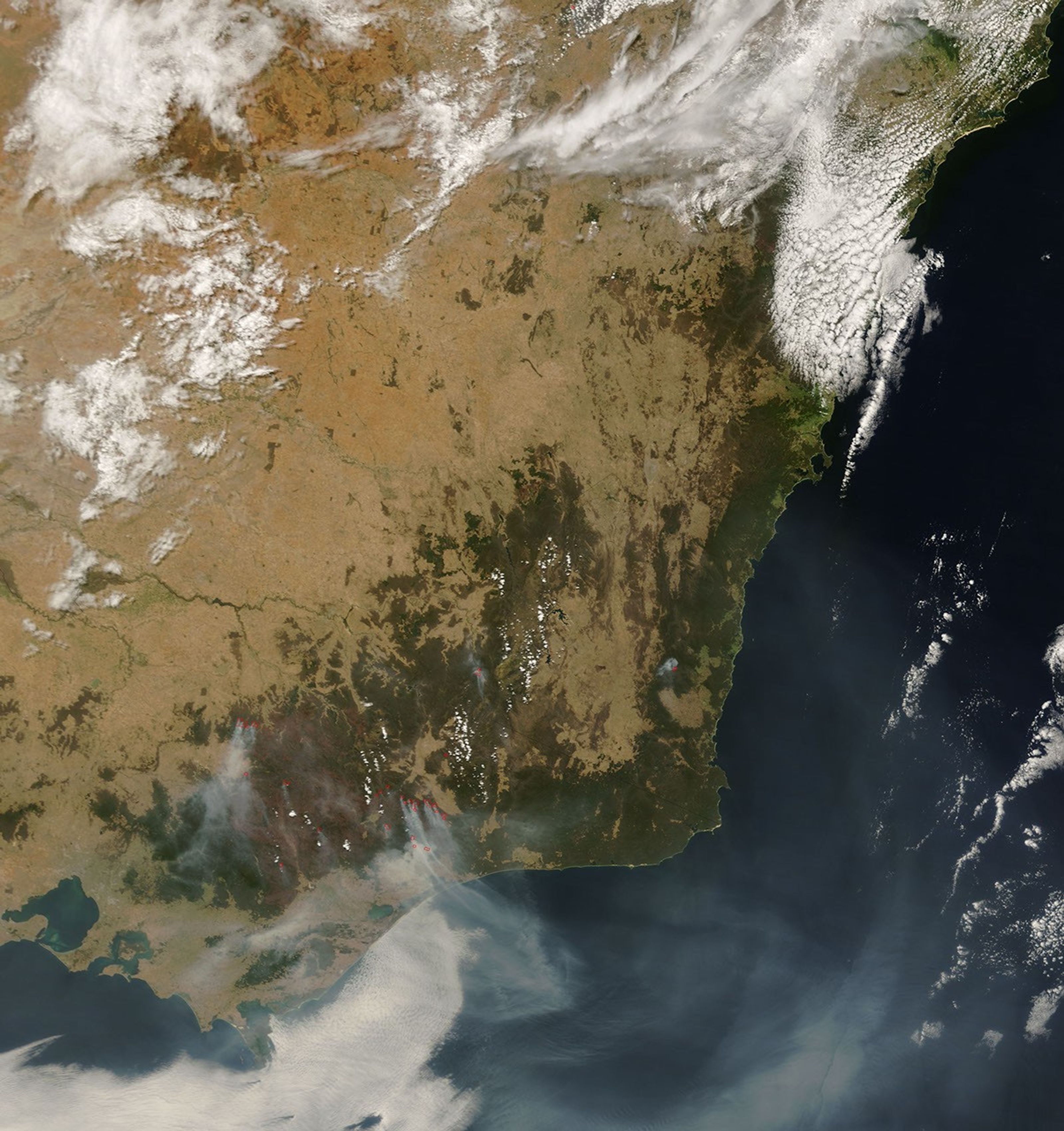
Fires that began in early December 2006 were still raging through the Great Dividing Range Mountains of eastern Victoria, Australia, on January 16, 2007. This image of the region was captured by the Moderate Resolution Imaging Spectroradiometer (MODIS) on NASA’s Terra satellite just before 11:00 a.m. local time. Places where MODIS detected actively burning fires are outlined in red. The forested mountains were green where they had not burned and deep brown where the fires had scorched them. Homes and livestock were lost near Tatong on January 16, when strong winds and high temperatures increased fire activity.
The large image provided above has a spatial resolution (level of detail) of 250 meters per pixel. The MODIS Rapid Response Team provides twice-daily images of the region in additional resolutions.
References & Resources
NASA image courtesy the MODIS Rapid Response Team, Goddard Space Flight Center


