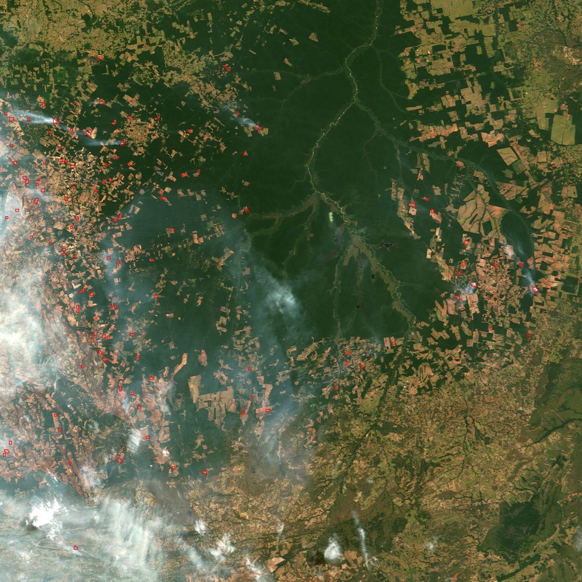




















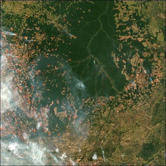
In northeastern Mato Grosso state in south-central Brazil, numerous streams and small rivers flow out of the Serra do Roncador highlands and become the Xingu River, which flows northward for hundreds of miles and empties into the Amazon not far from where it empties into the Atlantic. In this Moderate Resolution Imaging Spectroradiometer (MODIS) image from June 27, 2004, the rainforest that remains around the southern Xingu and its headwaters appears in the top center portion of the scene, while all around, the forest is carved into the geometric shapes of farms and cattle ranches. MODIS detected fires burning across the region; areas in which MODIS detected fire are outlined in red.
Much of the intact forest region is encompassed by the Xingu River Indigenous People’s Reserve, where several native tribes have relocated as part of the Brazilian government’s effort to provide them with a protected place where they can preserve their way of life in the forest, through hunting, fishing, small-scale farming, and other low-impact uses of the forest.
References & Resources
Image by Jesse Allen, based on data from the MODIS Rapid Response Team, NASA-GSFC