


High-resolution Images:
April 11, 2003(1.7 Mb JPEG)
August 24, 2003 (1.8 Mb JPEG)
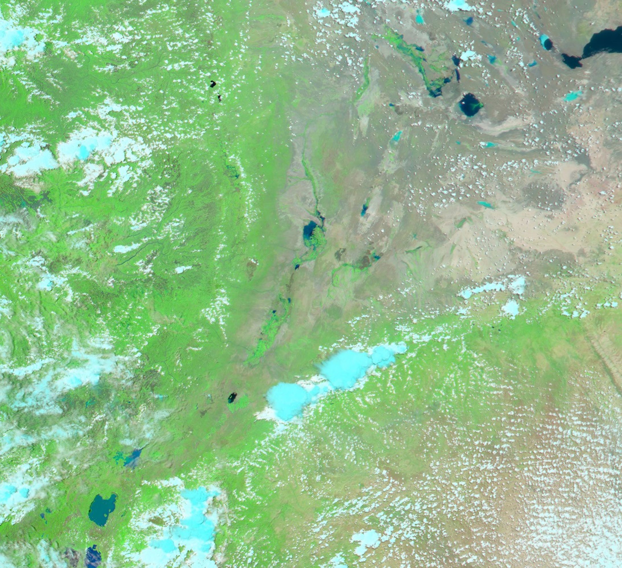
Swollen by heavy rains, Awash River in northeast Ethiopia flooded 19,480 square kilometers of land. Over 7,000 people were forced out of their homes and hundreds of animals were swept away by the water. The rains started on August 19, 2003.
The MODIS sensor on the Aqua satellite captured this false color image of the swollen river on August 24, 2003 (top). Here, the land is green and brown, water is blue, and clouds are light blue and white. The Awash river is the bright green and blue line snaking through the center of the image. The lower image, taken by the MODIS sensor on the Terra satellite, shows the region under normal conditions.
References & Resources
Image courtesy Jesse Allen, based on data from the MODIS Rapid Response Team at NASA GSFC


