![Request for Information – Potential [Placeholder for Prize]](https://assets.science.nasa.gov/dynamicimage/assets/science/psd/solar/2023/09/s/solarsystem_0.jpg?w=1024)


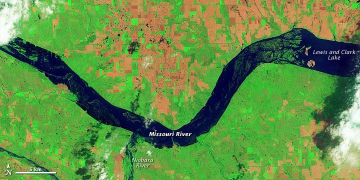

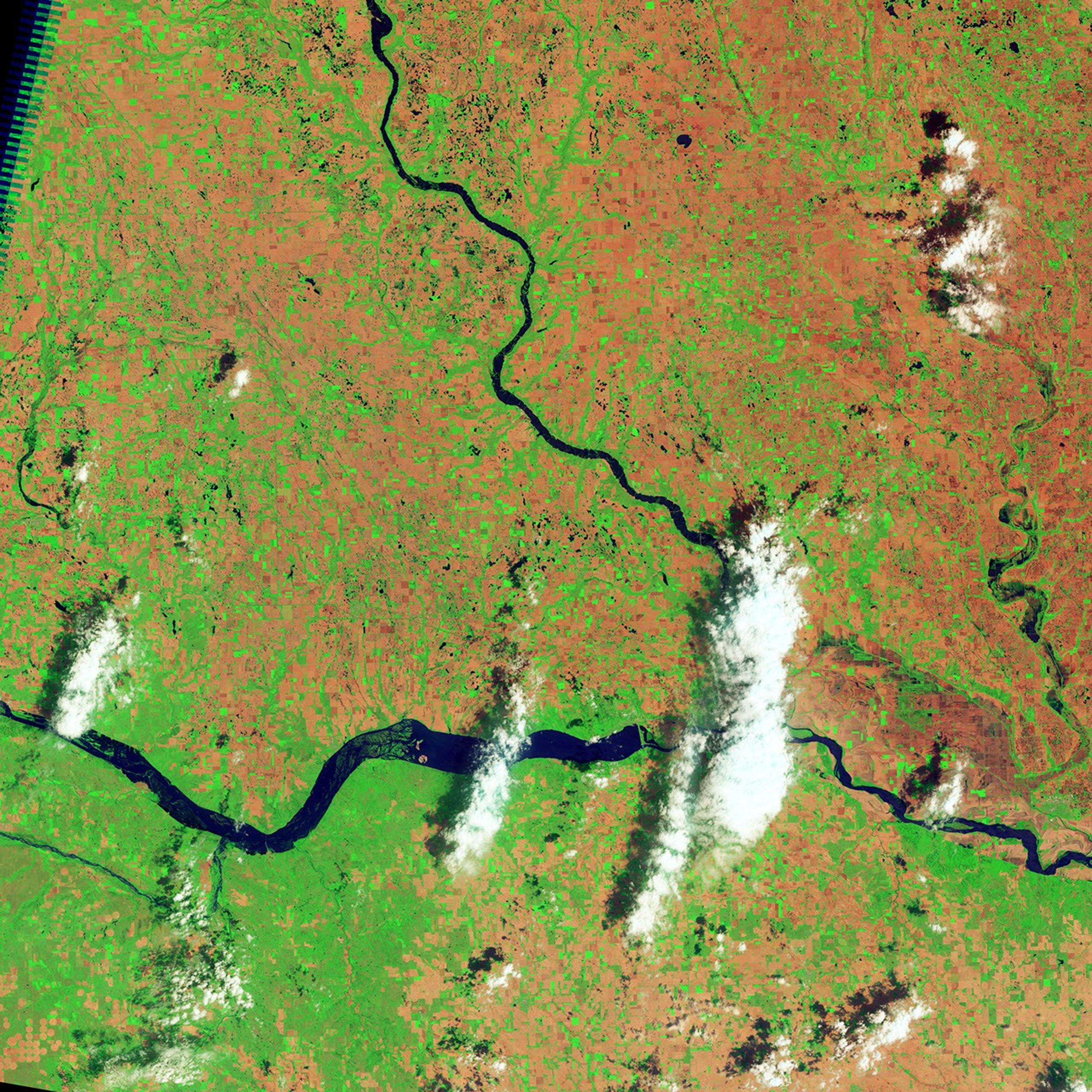
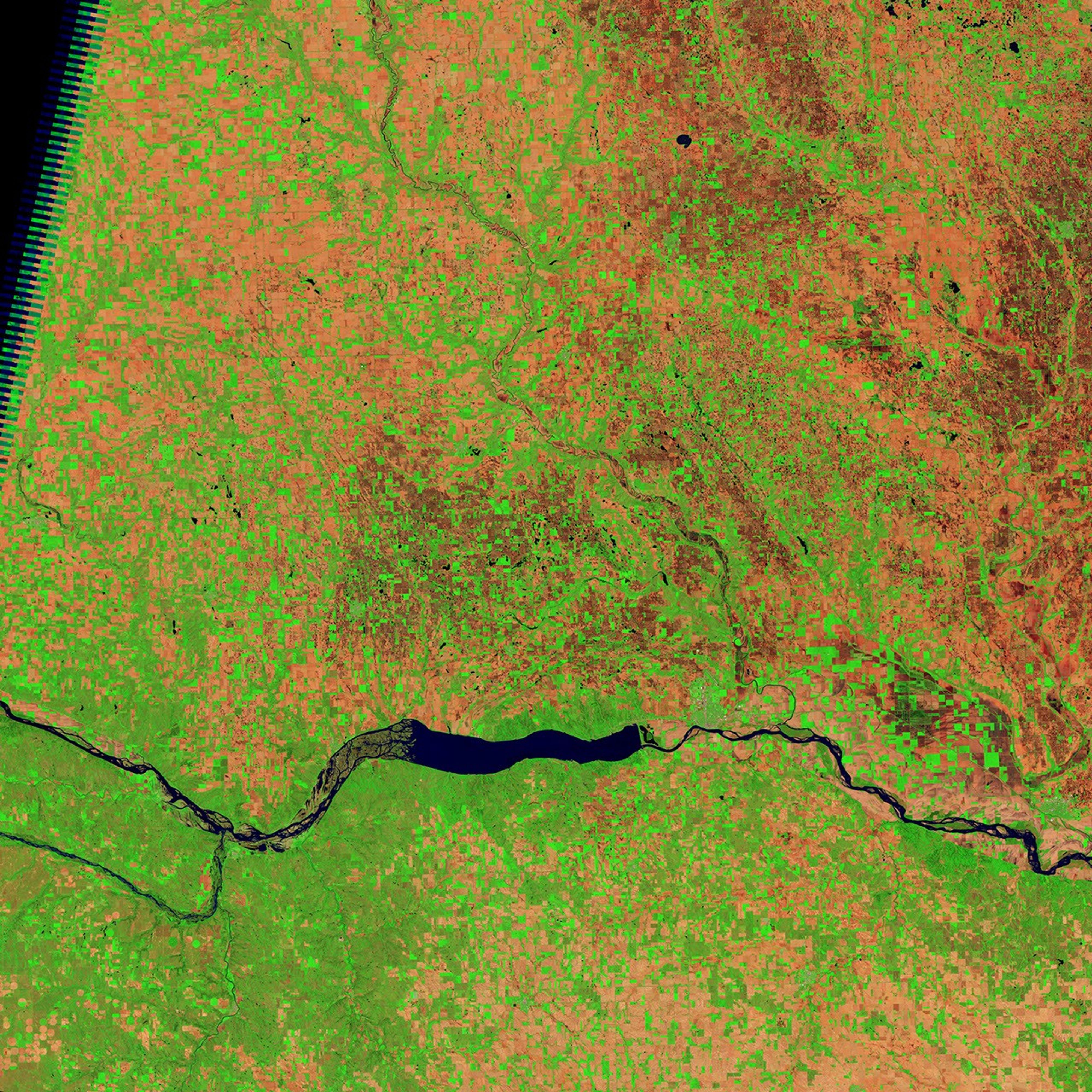
By early June 2011, the Missouri River had risen enough to submerge normally dry land, including some agricultural land, west of Lewis and Clark Lake. Acquired the by Thematic Mapper on the Landsat 5 satellite, these images show part of the Missouri River along the South Dakota-Nebraska border. The top image, from June 5, 2011, shows flooded conditions. The bottom image, from May 19, 2005, shows more typical conditions.
In these false-color images, water appears navy blue. Clouds appear white and cast shadows. Depending on vegetation, land appears green, burnt orange, or orange-red. The rectangular shapes north and south of the river are agricultural fields.
In 2005, the Missouri River flows through braided channels, but in 2011, the river largely fills the river valley, even encroaching on some farmland in the west. The burnt orange areas along the western margin of Lewis and Clark Lake may be sandbars that accumulated enough material after 2005 to rise above the water surface, even in high water.
On June 7, 2011, the Advanced Hydrological Prediction Service (AHPS) of the U.S. National Weather Service reported varying degrees of flooding in this region. Just east of Lewis and Clark Lake, the James River joins the Missouri River. The AHPS reported that the James River was in moderate flood stage near Yankton, South Dakota, although water levels there were projected to decline through June 10. West of the area pictured here, the Missouri River was at major flood stage near Greenwood, South Dakota, although the gauge reading there was affected by reservoir operations, the AHPS said.
References & Resources
- National Weather Service. Advanced Hydrologic Prediction Service. Accessed June 7, 2011.
NASA Earth Observatory image created by Jesse Allen and Robert Simmon, using Landsat data provided by the United States Geological Survey. Caption by Michon Scott.