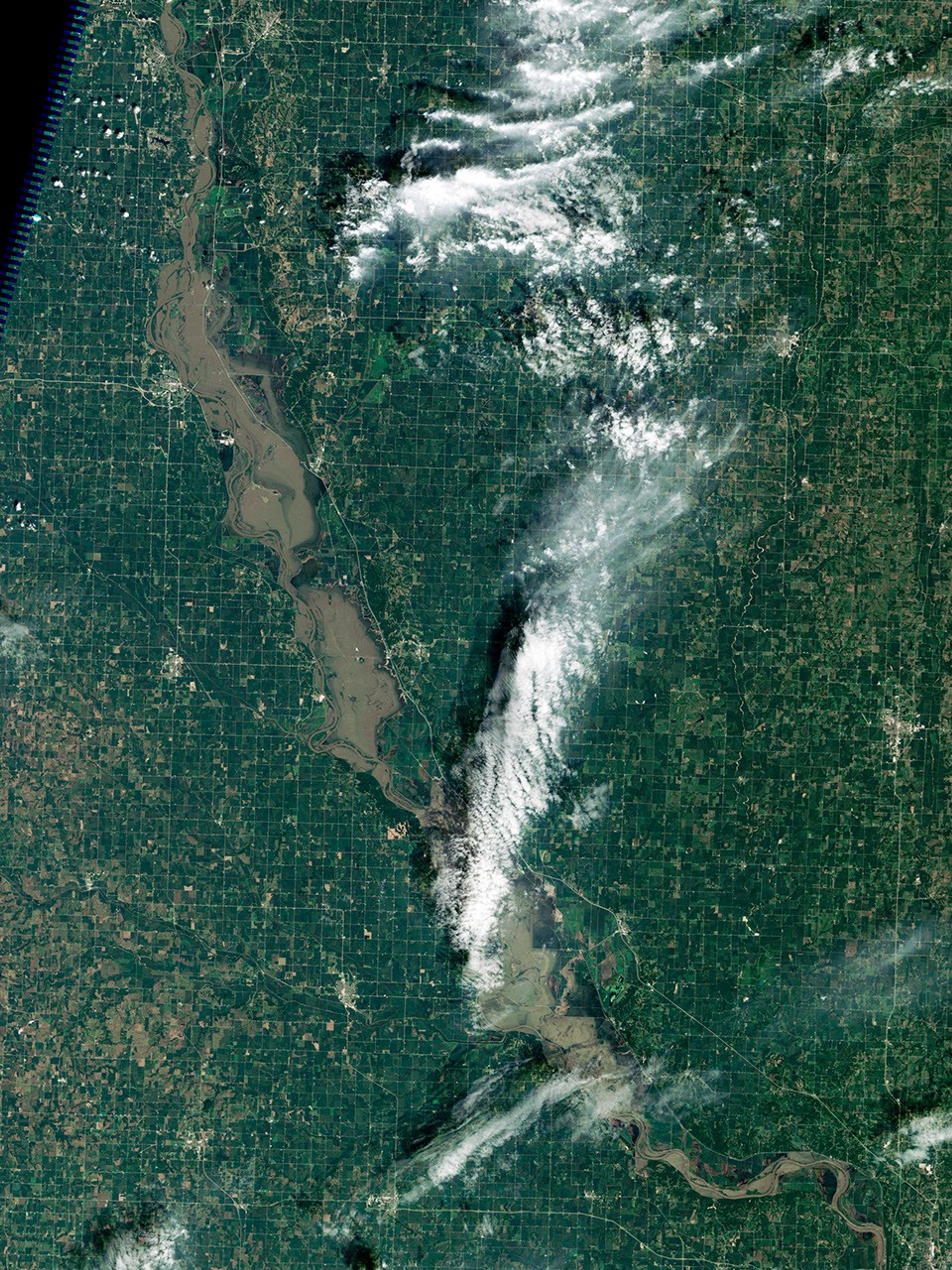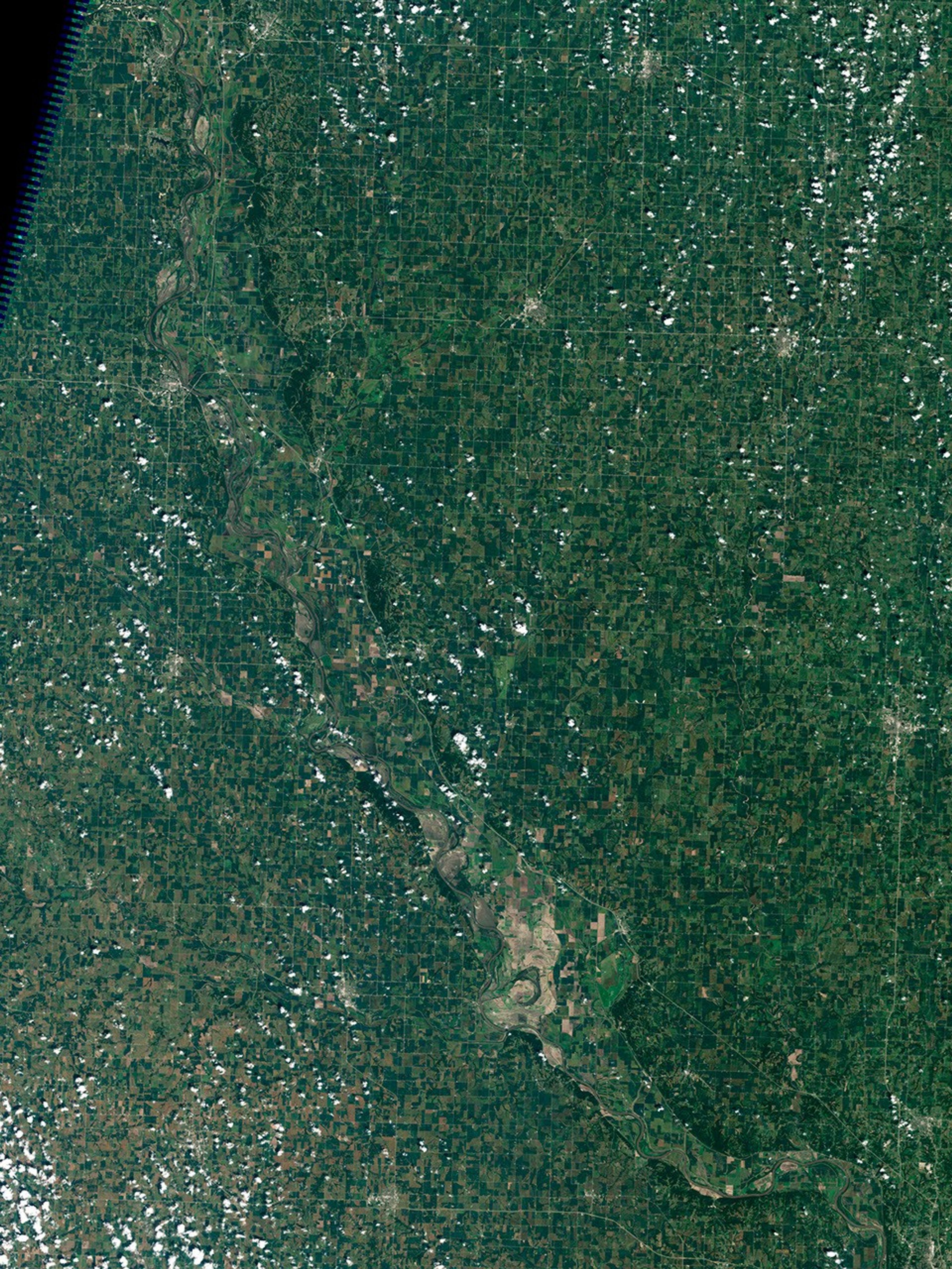


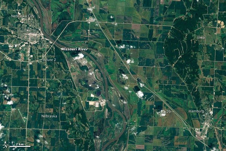
While other parts of the United States suffered from stifling heat and exceptional drought, residents along stretches of the Missouri River continued to cope with floods in early August 2011. One place where floods lingered was between Nebraska City and Hamburg, Iowa, which the Thematic Mapper on the Landsat 5 satellite captured in natural-color on August 10, 2011 (top), and August 23, 2010 (bottom).
The 2010 image shows the river under fairly normal circumstances. The 2011 image shows inundated fields and floodplains east and west of the river. Part of Interstate 29 appears flooded west of Hamburg, and part of Route 2 appears flooded east of Nebraska City. Although both cities have avoided serious flooding, flood waters span most of the distance between them, especially west of the interstate.
On August 12, 2011, the Advanced Hydrological Prediction Service (AHPS) of the U.S. National Weather Service reported that the Missouri River was at minor flood stage (just below moderate flood stage) at Nebraska City. At Brownville, Nebraska, the river was at moderate flood stage. The AHPS forecast that the Missouri would remain at roughly the same levels with slight fluctuations over the next several days at both locations.
In June 2011, the Missouri River broke through two levees near Hamburg, leading to severe flooding along the city margins in June and July. With help from the U.S. Army Corps of Engineers, Hamburg residents quickly built a new levee to protect the community.
References & Resources
- National Weather Service. Advanced Hydrologic Prediction Service. Accessed August 12, 2011.
NASA Earth Observatory image created by Jesse Allen and Robert Simmon, using Landsat data provided by the United States Geological Survey. Caption by Michon Scott.