


![Request for Information – Potential [Placeholder for Prize]](https://assets.science.nasa.gov/dynamicimage/assets/science/missions/a-step/FFR_Earth_Background_20251120%20.png?w=1024)


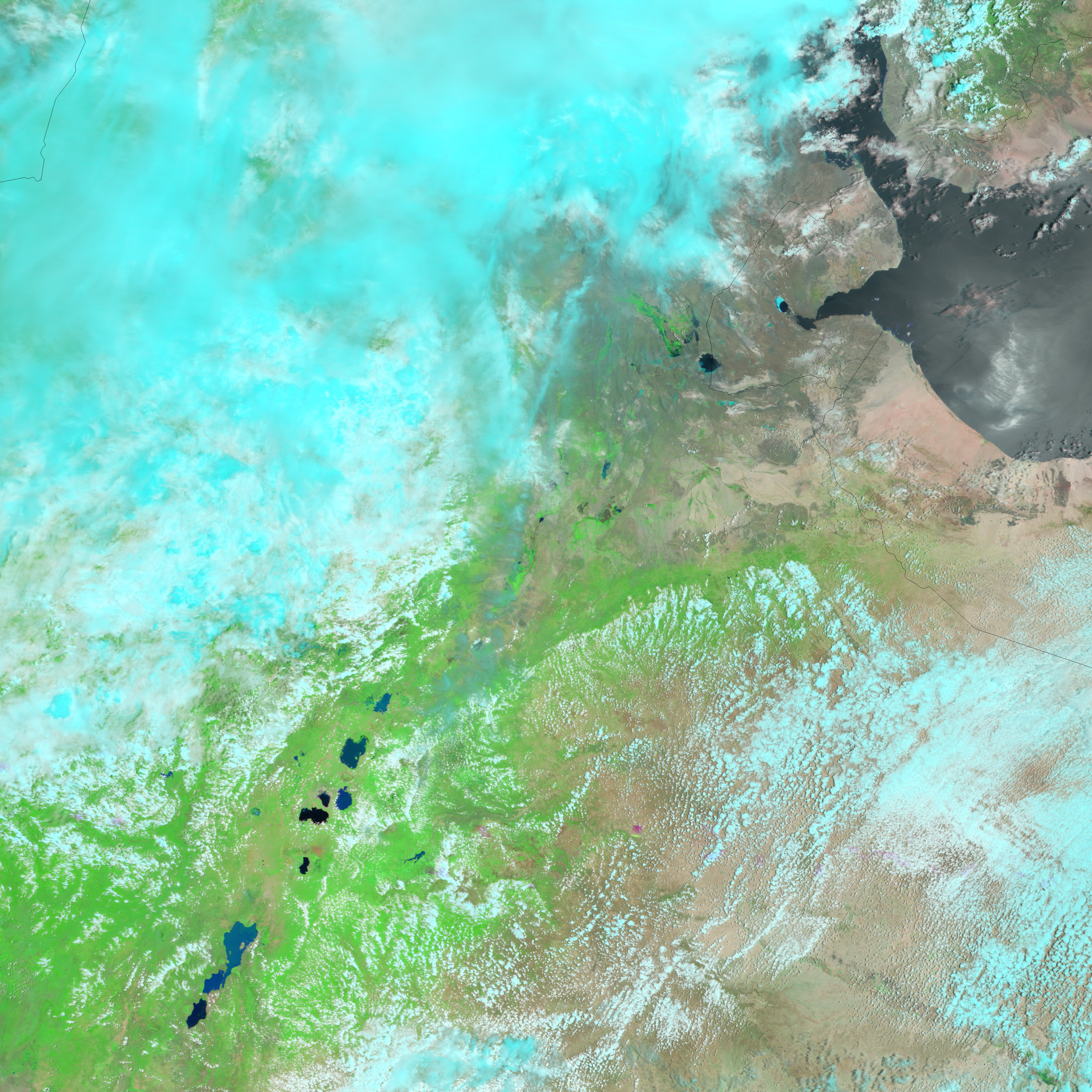
- September 4, 2006 (3.5 MB)
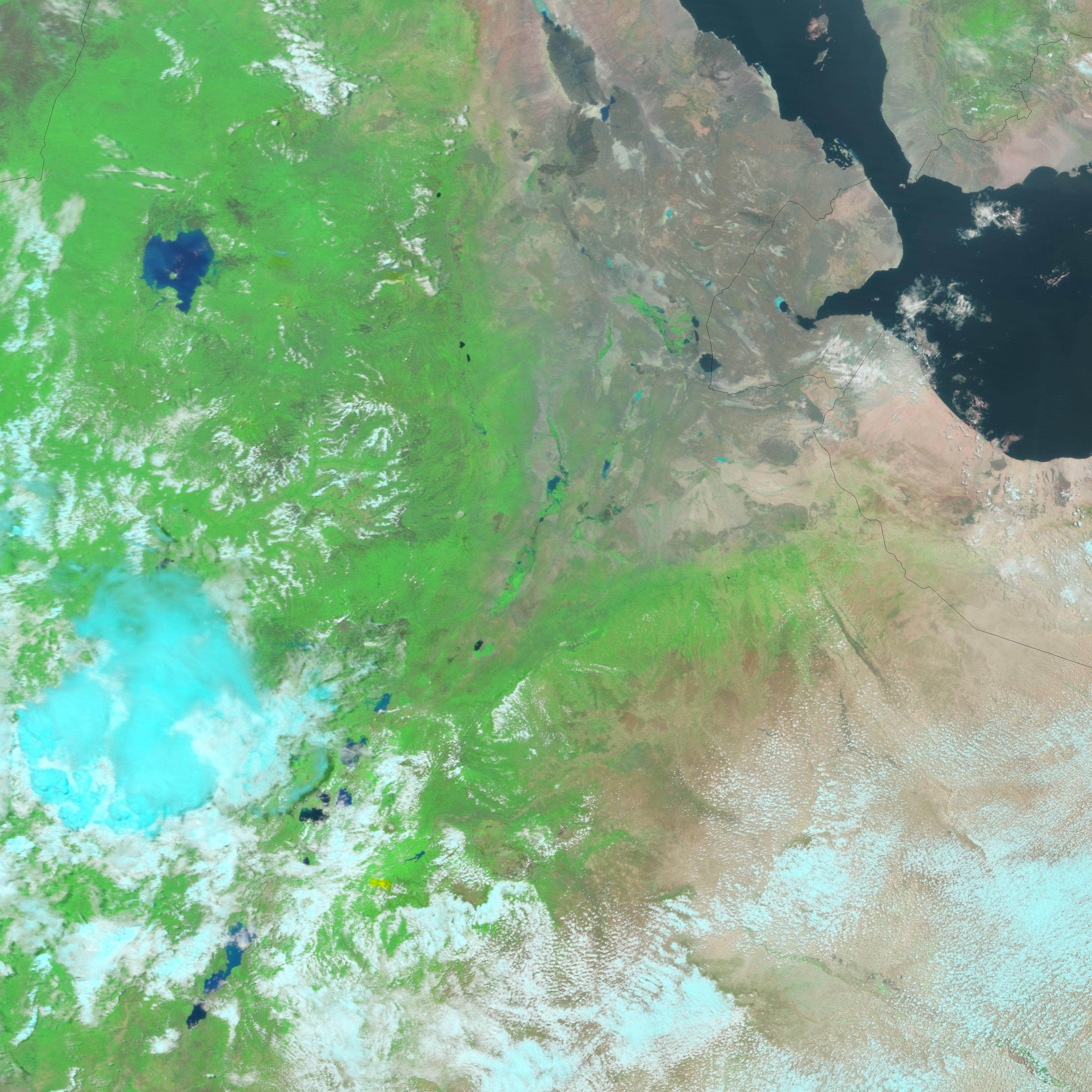
- August 20, 2006 (2.8 MB)
August was a month of floods for Ethiopia. As water accumulated during the latter half of the rainy season, rivers throughout the country burst their banks. On September 4, 2006, when the Moderate Resolution Imaging Spectroradiometer (MODIS) on NASA’s Terra satellite acquired the top image, floods were apparent along branches of the Awash River. One of Ethiopia’s major rivers, the Awash empties into Abhe Bid Hayk (Lake Abbe) through the Gemeri Hayk after flowing about 1,200 kilometers across the center of Ethiopia.
In these images, the course of the river is defined by the strip of green vegetation that surrounds it in the otherwise sparsely vegetated Afar Depression. On September 4, the river itself was wider than it had been on August 20 (lower image), and pools of blue standing water surround the river. Streaks of pale blue radiating from Abhe Bid Hayk and from the Awash River are created by sediment-laden rivers. A few wisps of cloud in the top image are light blue in this false-color image, made using both visible and infrared light.
References & Resources
NASA images created by Jesse Allen, Earth Observatory, using data obtained from the Goddard Earth Sciences DAAC.


