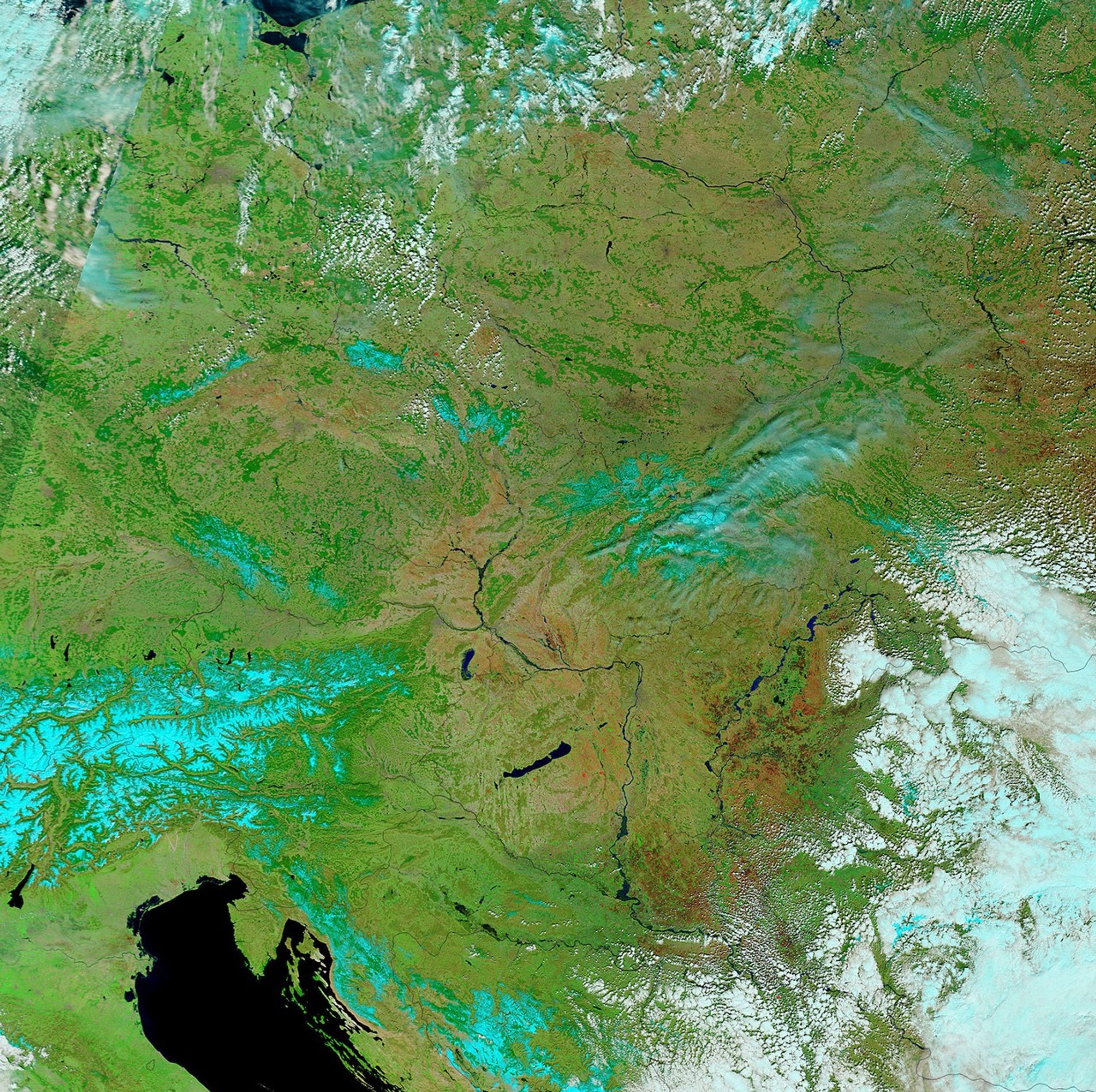
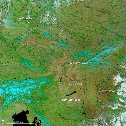
As Central Europe threw off the cold of a particularly harsh winter in late March and early April 2006, it woke to the raging floods of springtime. Melting snow and spring rain combined to fill nearly every river to or beyond its capacity. Major rivers such as the Danube and the Elbe forced evacuations as they poured over their banks, reaching record highs in places. April 8, 2006, afforded a remarkably clear view of many of the river basins that had flooded during early April. Though some of the floods had begun to subside, several major rivers, including the Elbe, Morava, Danube, and Tisza (Tisa) Rivers, and their tributaries remained swollen with spring runoff. The flood-widened rivers trace dark blue, almost black lines across the greening landscape in this false-color image, collected by the Moderate Resolution Imaging Spectroradiometer (MODIS) on NASA’s Terra satellite. The quickly disappearing snow is pale blue, and clouds are light blue and white.
Two European capitals that had been threatened by the floods, Prague and Budapest, form faint cement-colored dots along the banks of the Vltava and Danube Rivers, respectively. Both cities had been braced for rising waters. Prague escaped extensive damage, reported the CTK Czech News Agency, and by the time this image was acquired, the flood warnings had been lifted. Budapest was similarly spared, though the Danube reached an all-time high of 861 centimeters above normal, said the Budapest Times. By April 8, the bulge of spring runoff had wound out of the mountain regions shown in the center of the image, away from the two cities, and was flowing downstream. The lower reaches of the Elbe, upper left, were expanding under the onslaught of the advancing flood. The flood on the Danube was moving south toward the Serbian capital, Belgrade, under the clouds along the lower-right edge of the image. Flood warnings have also been issued along the Tisza and Morava Rivers, both of which are visibly flooded in this image.
Closer views of some of the rivers shown here are available under “Other Images for this Event” to the right of this caption. The large image provided above offers a closer view of the entire region at 500 meters per pixel. It is a composite of daily images generated by the MODIS Rapid Response Team.
References & Resources
NASA image courtesy the MODIS Rapid Response Team at NASA GSFC.