


![Request for Information – Potential [Placeholder for Prize]](https://assets.science.nasa.gov/dynamicimage/assets/science/psd/solar/2023/09/s/solarsystem_0.jpg?w=1024)


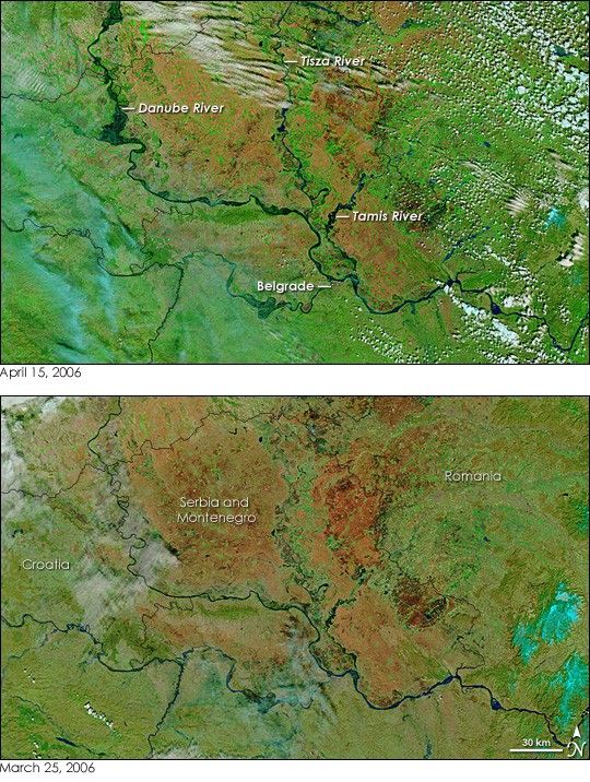
- April 15, 2006 (4.06 MB)
- March 25, 2006 (3.37 MB)
Northern Serbia was inundated with spring floods in mid-April 2006. Melting snow and heavy rain pushed the Danube and its tributaries over their banks, causing flooding in many countries in Central Europe. Three major rivers were noticeably flooded when the Moderate Resolution Imaging Spectroradiometer (MODIS) on NASA’s Terra satellite captured the top image on April 15. Black pools of water surround the Danube, particularly in the far north near the Hungarian border. The Tisza River and the Tamis River were also flooded. Serbia’s capital city, Belgrade, reported flooding along low-lying regions, and many other river-side communities in northern Serbia were building flood defenses or evacuating as waters rose. By April 18, water levels on the Danube in Serbia had started to fall, but the Tisza River was still rising.
These images are shown in false color to highlight the presence of water. Water is black or dark blue, clouds are pale blue and white, vegetation is green, and bare earth ranges from dark red to tan. The reddest regions may be burn scars from extensive agricultural burning.
References & Resources
NASA image courtesy the MODIS Rapid Response Team at NASA GSFC.


