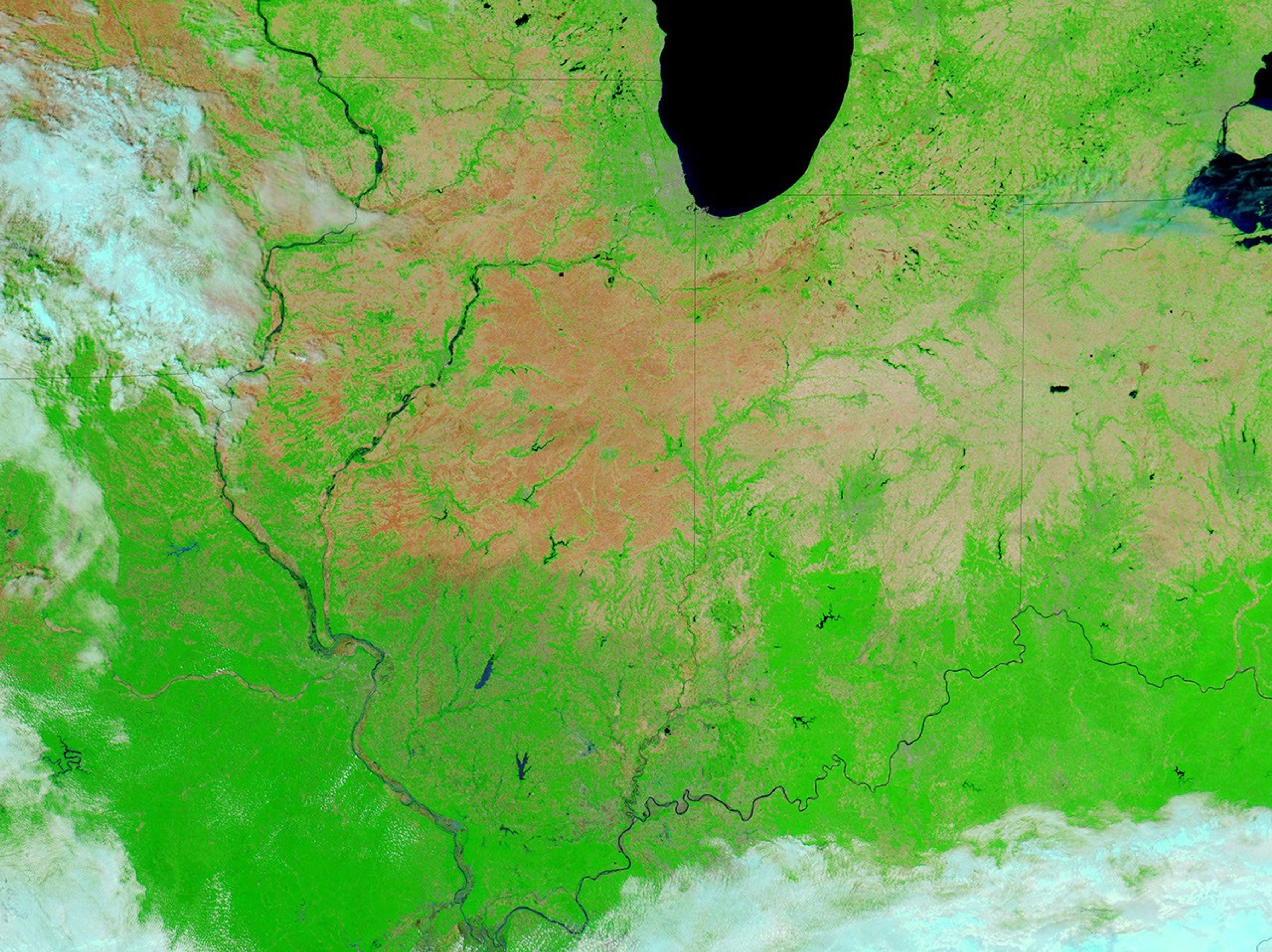


Heavy rains in early June 2008 soaked the U.S. Midwest, leaving swollen rivers in their wake. By June 8, 2008, the National Weather Service had issued flood warnings for numerous counties throughout Indiana and Illinois. The lower Wabash, White, and East Fork White watersheds had all been affected by the deluge, according to National Weather Service bulletins, and streamflow gauges on parts of the White and East Fork White River recorded 100-year-flood levels, according to preliminary reports from the U.S. Geological Survey.
The Moderate Resolution Imaging Spectroradiometer (MODIS) on NASA’s Aqua satellite captured the top image on May 28, 2008, and the bottom image on June 10. These false-color images combine infrared and visible light to enhance the contrast between vegetation (bright green) and water (dark blue). Bare ground is pinkish-tan, and clouds are blue-white. Rivers that were not even visible at MODIS’ resolution on May 28 are wide blue ribbons on June 10. The Embarras, Wabash, White, and East Fork White Rivers are all swollen from the heavy rains.
References & Resources
NASA images courtesy the MODIS Rapid Response Team. Caption by Michon Scott and Rebecca Lindsey.