


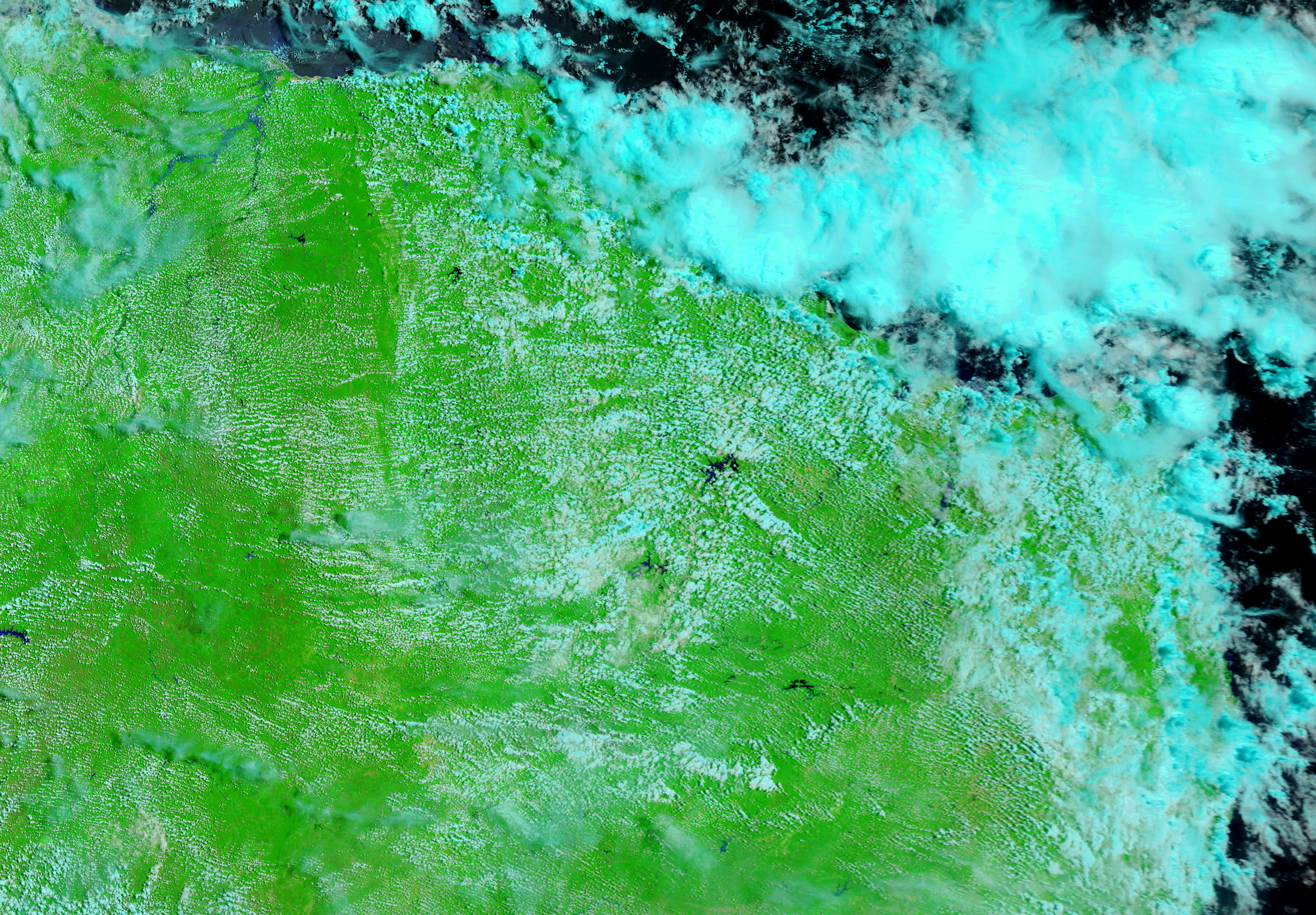
- April 11, 2008 (3.63 MB jpg)
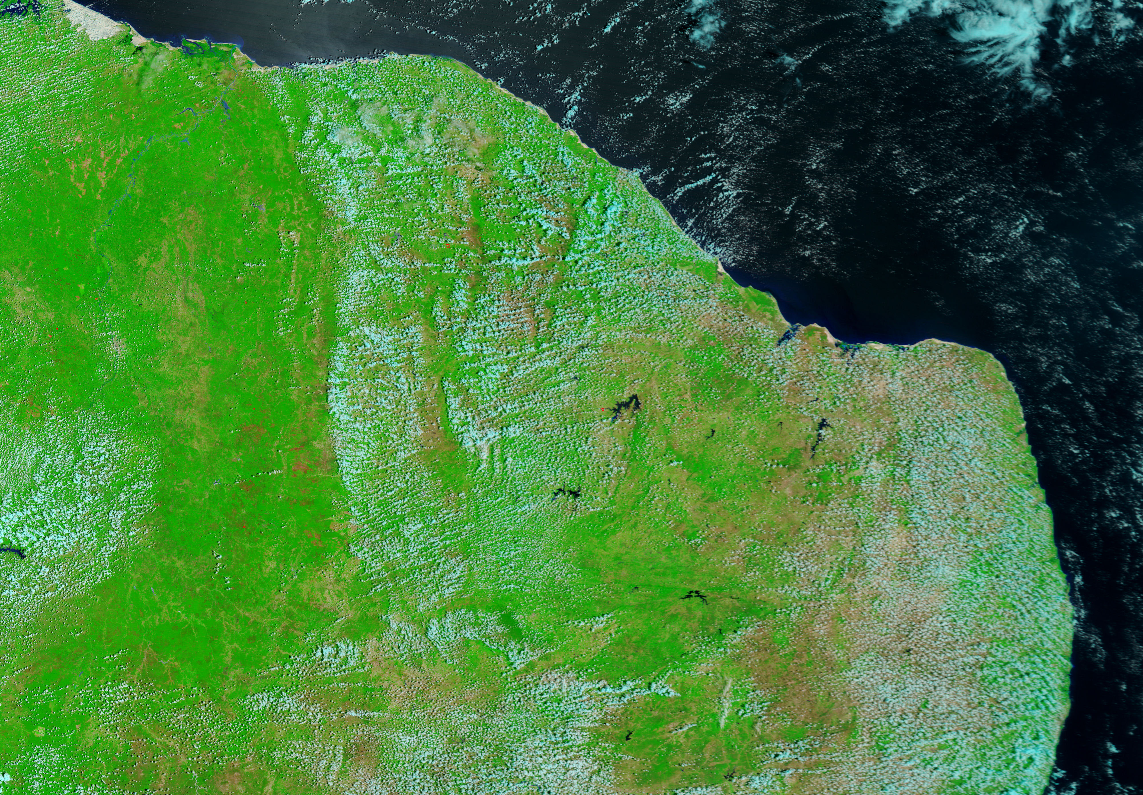
- February 7, 2008 (3.50 MB jpg)
Unusual torrential rain pushed rivers over their banks throughout northeastern Brazil in April 2008. The rising rivers forced thousands from their homes in five states, said the Dartmouth Flood Observatory. A brief break in the clouds permitted the Moderate Resolution Imaging Spectroradiometer (MODIS) on NASA’s Terra satellite this view of the swollen Parnaiba River on April 11, 2008. The lower image, taken by Terra MODIS on February 7, shows the river’s normal extent. Compared to February 7, the Parnaiba and its tributaries were kilometers wider on April 11.
In both images, reflected sunlight and sediment turn the water’s normally black surface blue. The images combine infrared and visible light (the reflected light that can be seen by the human eye) to improve the contrast between water and the surrounding land. Plant-covered land is bright green, while bare earth is tan. Clouds, pale blue and white, dot both images. A fire is outlined in red in the February 7 image. Daily images of northeastern Brazil are available from the MODIS Rapid Response System in both photo-like, true color and in the infrared and visible combination shown here.
References & Resources
NASA images courtesy the MODIS Rapid Response Team at NASA GSFC. Caption by Holli Riebeek.


