


- September 10, 2006 (4.50 MB)
- August 31, 2006 (3.55 MB)
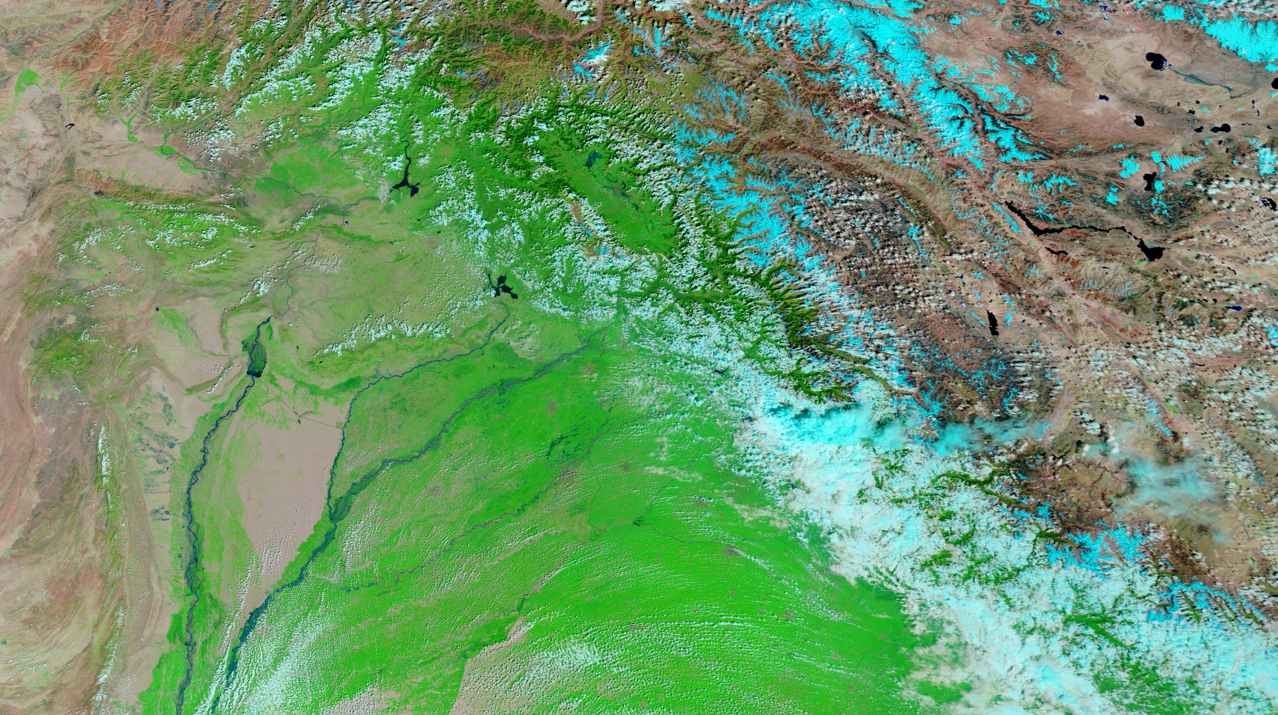
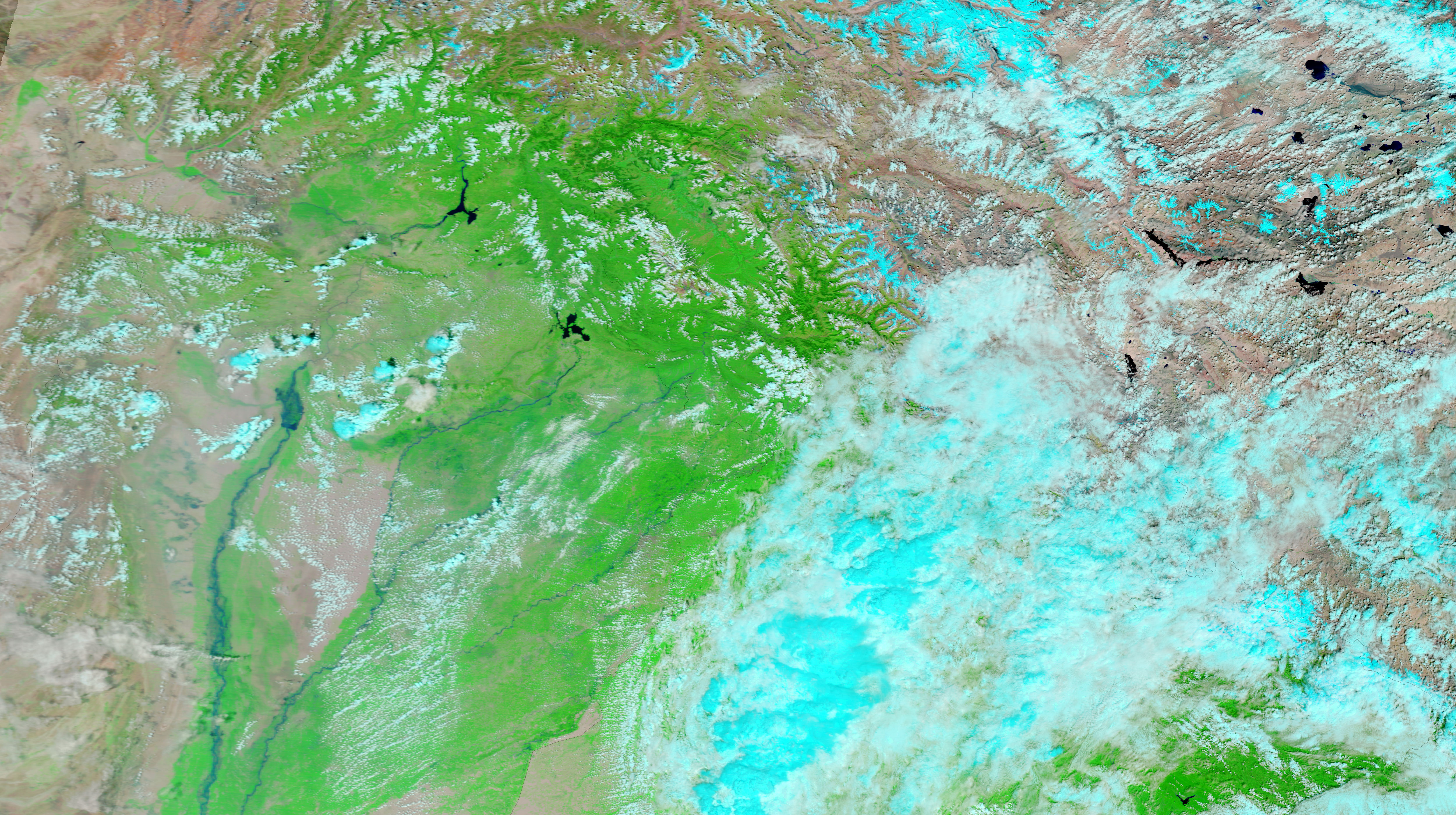
Though water levels had started to recede when the Moderate Resolution Imaging Spectroradiometer (MODIS) on NASA’s Terra satellite captured the top image on September 10, 2006, the Jhelum River had previously risen to dangerous levels in early September 2006. Fueled by monsoon rains, floods on the Jhelum and landslides in the mountainous terrain of Indian Kashmir killed 19 and affected thousands, said the Dartmouth Flood Observatory. In the top image, new pools of blue water surround the slightly swollen river. The lower image shows conditions 10 days earlier, before the flooding started. Clouds, pale blue and white, cover the mountains on either side of the river valley.
These images were created with infrared light to create more contrast between water and land. In this type of image, water is black or dark blue, but appears lighter when it is clouded with sediment. Plant-covered land is bright green, while barren or sparsely vegetated land is tan. Clouds are turquoise blue and white. Photo-like, true-color versions of these images are available from the MODIS Rapid Response Team.
References & Resources
NASA images courtesy the MODIS Rapid Response Team at NASA GSFC.


