


![Request for Information – Potential [Placeholder for Prize]](https://assets.science.nasa.gov/dynamicimage/assets/science/missions/a-step/FFR_Earth_Background_20251120%20.png?w=1024)


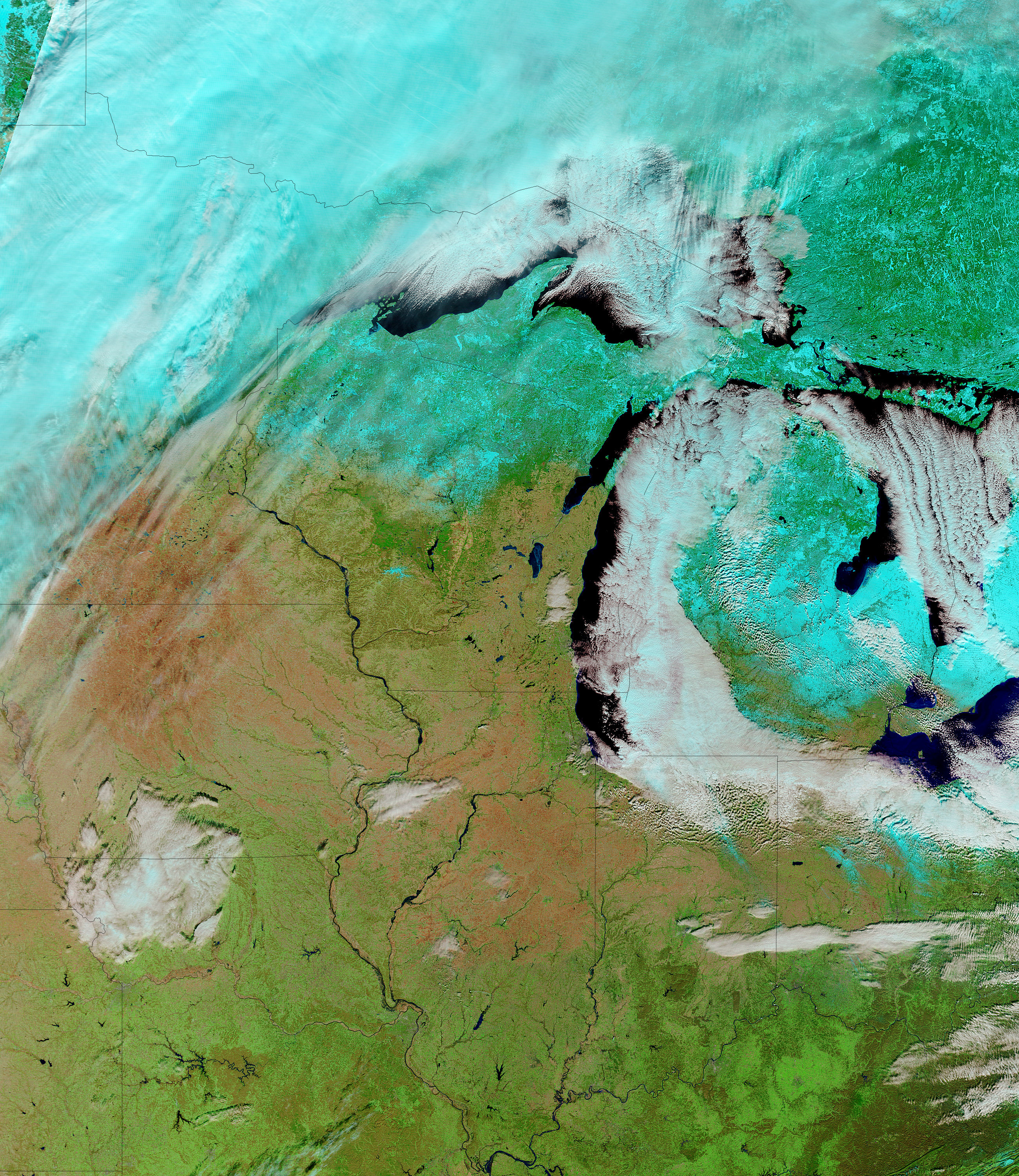
- January 9, 2005 (1.93 Mb)
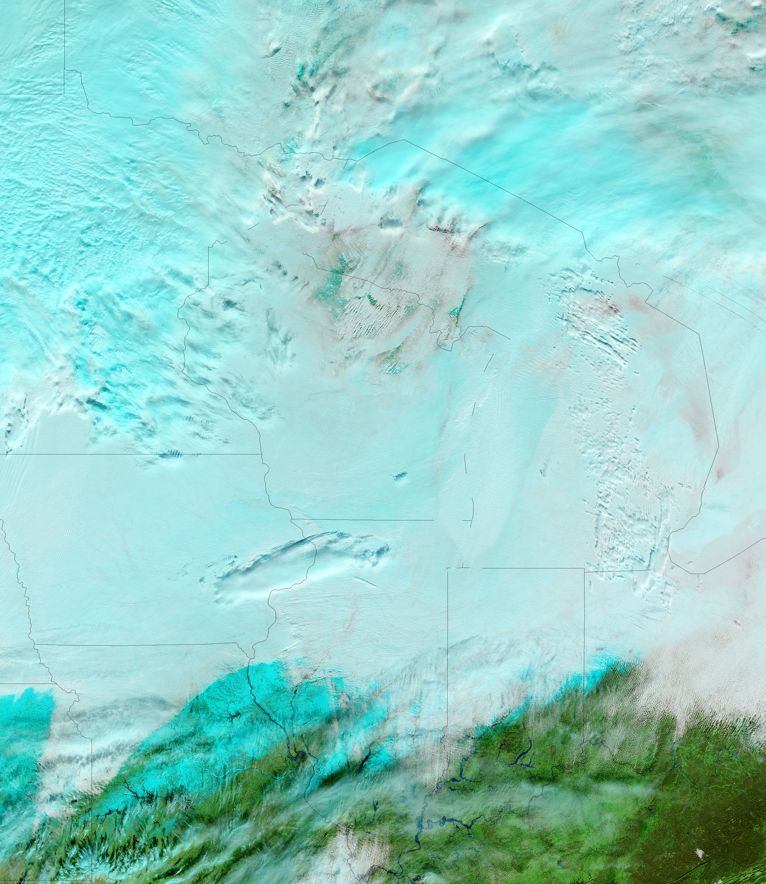
- December 17, 2004 (3.35 Mb)
A small break in the clouds on January 9, 2005, provided the Moderate Resolution Imaging Spectroradiometer (MODIS) flying aboard NASAâs Terra satellite a peek at the swollen rivers of the Ohio River Valley in the Central Lowlands of the United States. Winter weather has pushed the Ohio River and many of its tributaries past flood stage. In the above MODIS image, the Ohio River, Wabash River, White River and the East Branch White River are all swollen compared to conditions on December 17, 2004, shown in the lower image. A false-color band combination has been used to make the flood waters more apparent. In both images, water is dark blue and black, clouds are light blue and white, vegetation is bright green, and bare earth is pink.
References & Resources
NASA images courtesy the MODIS Rapid Response Team at NASA GSFC.


