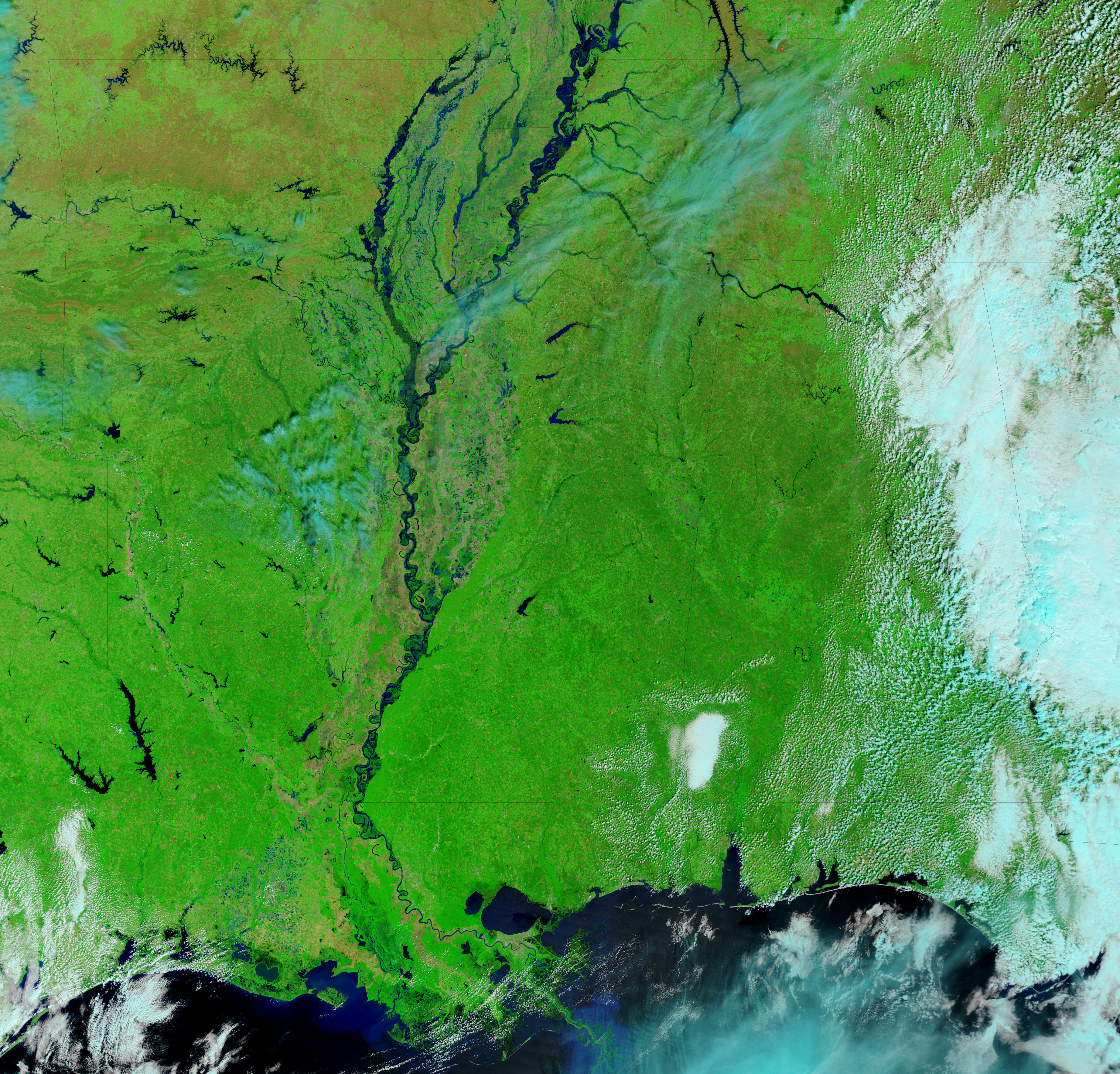
- April 7, 2008 (4.04 MB jpg)
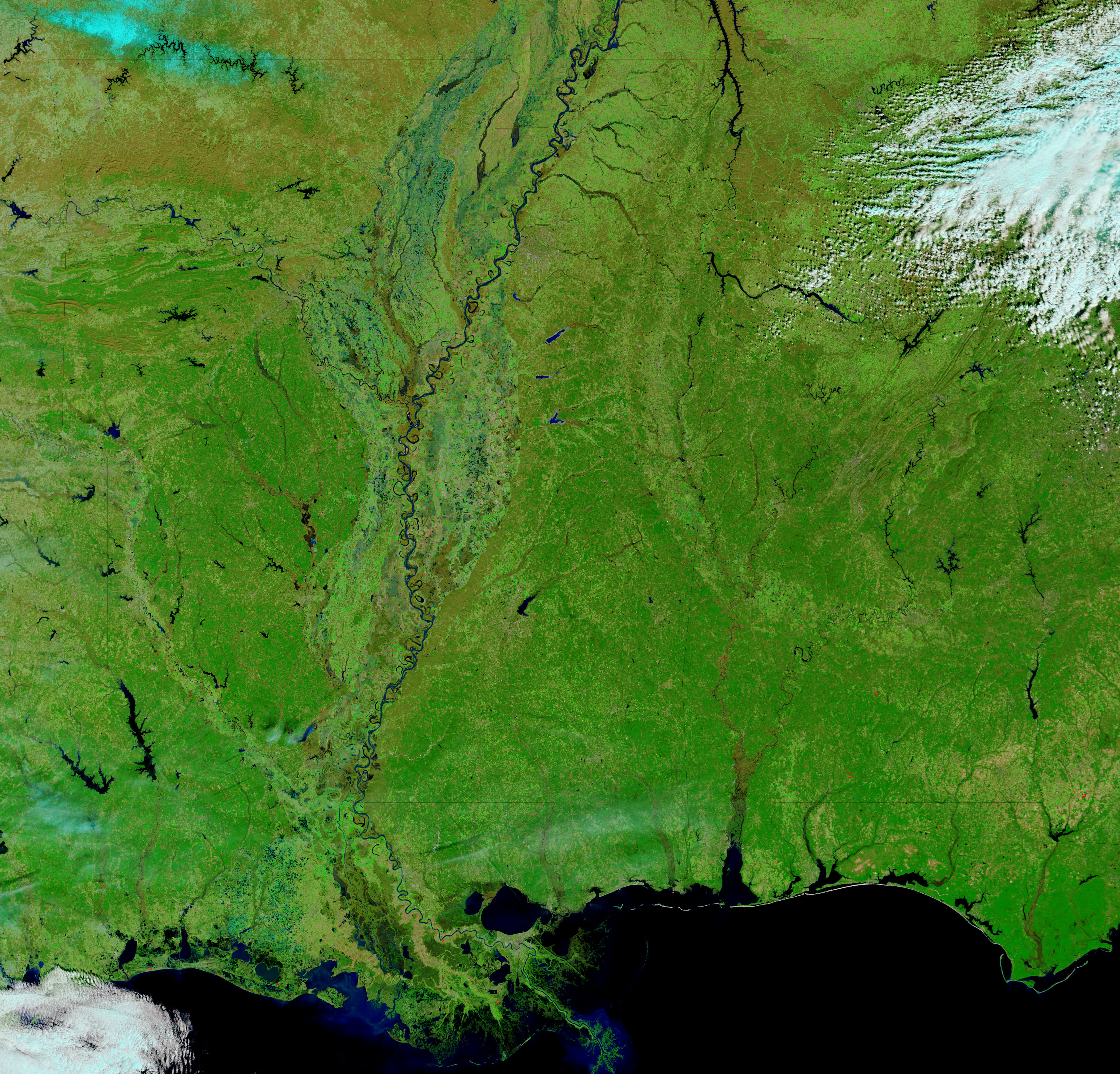
- February 19, 2008 (3.79 MB jpg)
Water levels on the Mississippi River were still high when the Moderate Resolution Imaging Spectroradiometer (MODIS) on NASA’s Terra satellite captured this image on April 7, 2008. Meandering across relatively flat land, the Mississippi has a wide flood plain. The bulges and swells in the river seen in this image represent moderate or minor flooding, according to gauge measurements reported by the National Weather Service. The lower image shows the Mississippi before spring rains caused widespread flooding in March. A comparison of the lower image, which Terra MODIS took on February 19, 2008, reveals that many of the rivers and creeks that flow into the Mississippi were running high.
Regular floods on the Mississippi River throughout history have deposited fertile soil across the flood plain. Bright flecks of green line the river where the deep, rich soil of the flood plain now supports extensive agriculture. The crops are a brighter shade of green than the native vegetation, and land that has little vegetation growing on it is tan. Clouds are pale blue in the combination of infrared and visible light used to make these images.
References & Resources
- References
- National Weather Service. (2008, April 9). Advanced Hydrologic Prediction Service. National Oceanic and Atmospheric Administration. Accessed April 9, 2008.
NASA images courtesy the MODIS Rapid Response Team at NASA GSFC, which provides daily images of the United States. Caption by Holli Riebeek.