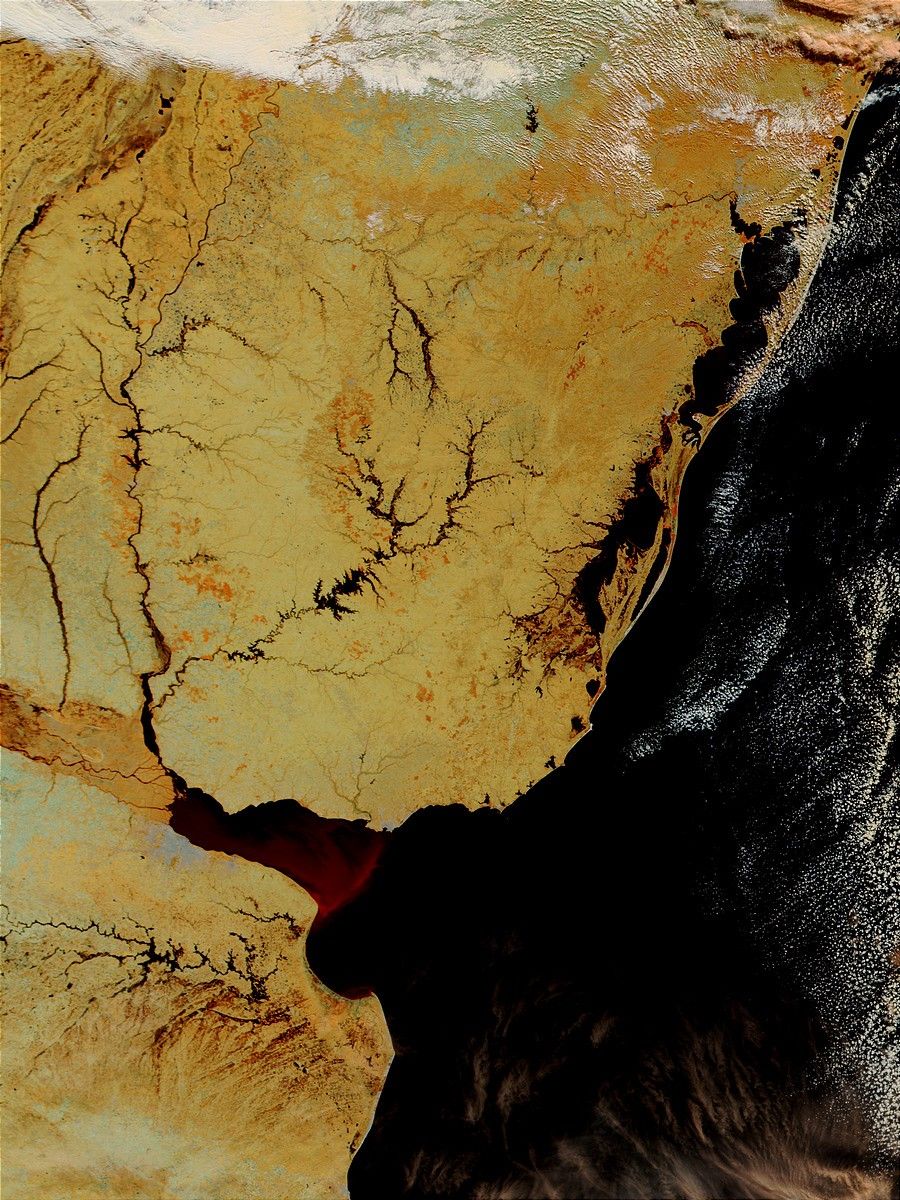
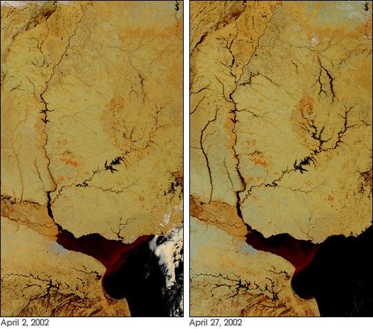
Above average rains over the past two months have given rise to floods throughout Uruguay. The false-color image of the flood (right) was acquired on April 27, 2002, by the Moderate-resolution Imaging Spectroradiometer (MODIS), flying aboard NASA’s Terra spacecraft. Over 3600 hundred people have been evacuated from their homes in Uruguay, and many highways have been shut down. The large river running down the border between Uruguay and Argentina is the Uruguay River, and the spidery lake in the center of Uruguay is Lake Rincon del Bonete. Normally, the lake and its tributaries cover a much smaller area (left image, acquired on April 2, 2002).
In these false-color images, land surfaces are tan and beige and water is black. The pinkish-white patches are clouds.
To obtain a high-resolution copies of the scene acquired on April 2 (shown above, left), visit the MODIS Rapid Response Image Gallery.
References & Resources
Image courtesy Jacques Descloitres, MODIS Land Rapid Response Team at NASA GSFC