Suggested Searches

1 min read

Global Data

Global Data

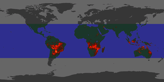
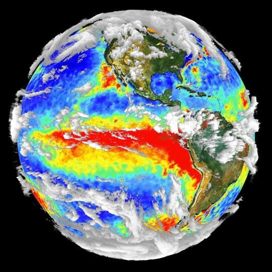
This globe shows data collected from multiple satellite sensors and integrated into one image. It represents the capabilities of NASA's EOS Terra satellite, currently being prepared for launch, which will view the Earth with a series of interrelated instruments.

For more information, see About Terra.

References & Resources

Image by R.B. Husar, Washington U.; the land layer from the SeaWiFS Project; fire maps from the European Space Agency; the sea surface temperature from the Naval Oceanographic Office's Visualization Laboratory; and cloud layer from SSEC, U. of Wisconsin

You may also be interested in:

Stay up-to-date with the latest content from NASA as we explore the universe and discover more about our home planet.

The Galaxy Next Door
3 min read

The Large Magellanic Cloud—one of our closest neighboring galaxies—is a hotbed of star formation that is visible to both astronauts…

Article
Five Minutes in Orbit
3 min read

An astronaut captured a moonrise—and much more—in a series of photos taken from the International Space Station.

Article
A Subtle Return of La Niña 
3 min read

A weak La Niña emerged in the equatorial Pacific in late 2025, and scientists are watching how it may help…

Article