![Request for Information – Potential [Placeholder for Prize]](https://assets.science.nasa.gov/dynamicimage/assets/science/psd/solar/2023/09/s/solarsystem_0.jpg?w=1024)


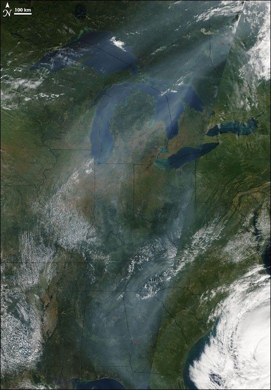
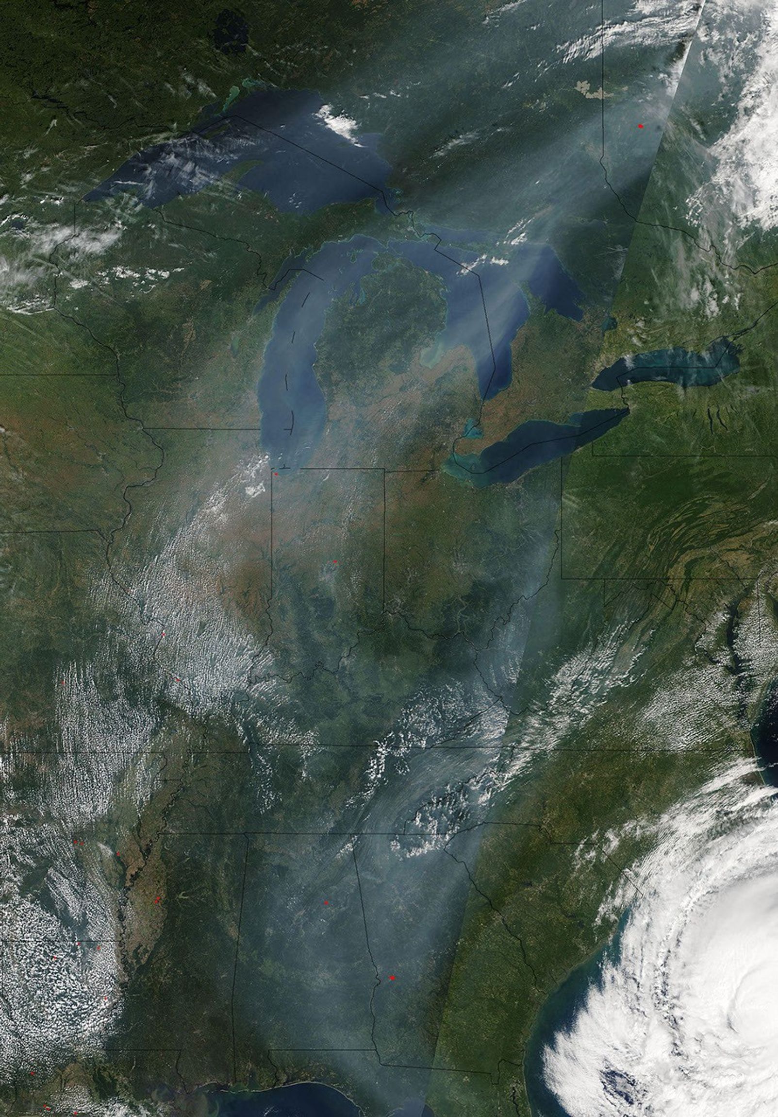
An atmospheric high-pressure system transported moisture and pollutants over the Great Lakes and the region to the south, affecting air quality indexes, as forecasted by AirNow. For individuals sensitive to air quality, some indexes could reach unhealthy levels. Hurricane Ophelia, a portion of which appears in the lower right, was expected to impact some local weather and air quality conditions.
The Moderate Resolution Imaging Spectroradiometer (MODIS) flying onboard the Terra satellite captured this image on September 11, 2005. In this image, haze stretches southwards from Canada, over the Great Lakes, and into the Midwest. This picture is actually a mosaic of satellite images acquired by different passes of the Terra satellite. The sharp line running diagonally through the image shows where those different pictures were stitched together.
References & Resources
NASA image courtesy the MODIS Rapid Response Team at NASA GSFC.