

























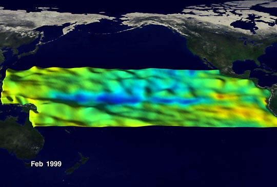
Recent (early June, 1999) record high temperatures along the United State’s east coast are being linked to La Niña by scientists at the National Center for Atmospheric Research and NOAA’s Climate Prediction Center. During La Niña unusually cold water pools along the tropical Pacific Ocean. This sea surface temperature anomaly causes strange summer weather around the world, such as drought in the Mid-Atlantic states, cool temperatures in California, and rain in Indonesia.
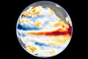
The above image shows the La Niña as seen by TOPEX-Poseidon and NOAA's polar orbiting environmental satellites. Above average sea surface heights are raised, while those lower than normal are lowered. Warm water is orangeand red and cooler than normal water is blue. When the data for this image was collected, in February of 1999, La Niña was expected to diminish, but it is currently predicted to increase in strength through the end of theyear.
To learn more about La Niña, see the Earth Observatory'sLa Niña fact sheet.
References & Resources
Image courtesy Greg Shirah, NASA Goddard Scientific Visualization Studio
None