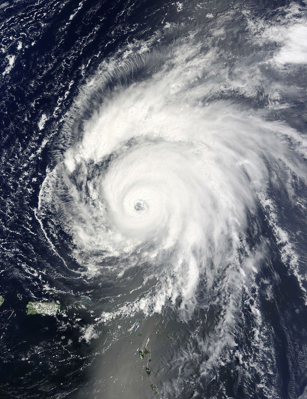
The Moderate Resolution Imaging Spectroradiometer (MODIS) on NASA’s Terra satellite captured this photo-like image of Hurricane Bill northeast of Puerto Rico at 10:55 a.m. local time (14:55 UTC) on August 20, 2009. The storm had sustained winds of 195 kilometers per hour (120 miles per hour or 105 knots) and was expected to strengthen, said the National Hurricane Center.
The image reveals that Bill was large, sprawling across hundreds of kilometers from end to end. The storm also had a clear eye. The National Hurricane Center expected Hurricane Bill to track northwest between the United States’s East Coast and Bermuda, possibly crossing over Nova Scotia and Newfoundland on August 23.
The high-resolution image provided above is at MODIS’ full spatial resolution (level of detail) of 250 meters per pixel. The MODIS Rapid Response System provides this image at additional resolutions.
References & Resources
- National Hurricane Center. (2009, August 17). Hurricane Bill Advisory Archive. National Oceanic and Atmospheric Administration, National Weather Service. Accessed August 20, 2009.
NASA image by Jeff Schmaltz, MODIS Rapid Response Team, Goddard Space Flight Center. Caption by Holli Riebeek.