






















Suggested Searches

1 min read

Hurricane Isabel

Instruments:
2003-09-14 00:00:00
September 14, 2003

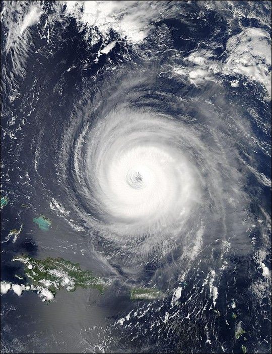
The MODIS instrument onboard NASA's Aqua satellite captured this true-color image of Hurricane Isabel on September 14, 2003 at 17:55 UTC. In this image Isabel is located about 400 miles north of Puerto Rico and is packing maximum sustained winds near 155 mph.

References & Resources

Image courtesy Jacques Descloitres, MODIS Land Rapid Response Team at NASA GSFC.

You may also be interested in:

Stay up-to-date with the latest content from NASA as we explore the universe and discover more about our home planet.

Tropical Storm Arthur
2 min read

The first named storm of the 2026 Atlantic hurricane season brought intense rainfall and the threat of flash flooding to…

Article
Snow in the Shadow of the Andes
2 min read

An early autumn storm left higher elevations in southern Argentina with a fresh and fleeting coat of white.

Article
Nebraska’s Wide, Rolling Domain
3 min read

The Nebraska Sandhills—the largest system of sand dunes in the Western Hemisphere—stretch across about one-quarter of the state.

Article





